Contents
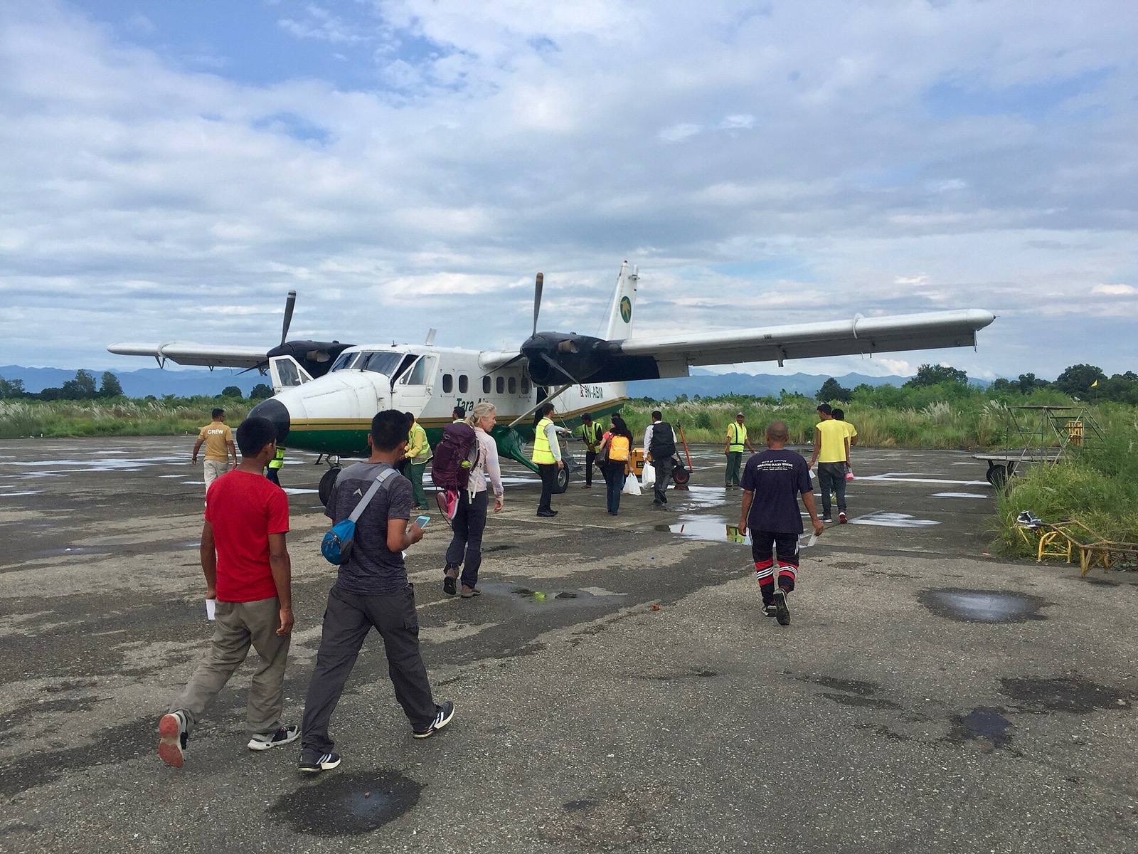
Nepalgunj sits on the Terai plains near the southern border with Bahraich district in Uttar Pradesh, India, and its airport has operated flights to the western hill districts1. Below are the city and its airport; the flights beyond are in the getting-there hub.
Where it is
Nepalgunj is a sub-metropolitan city in Banke district, Lumbini Province2,1. It stands at 150 m above sea level, and the 2021 census gave it 166,258 people1. Ghorahi lies 153 km to the north-east side of it and Kohalpur is 16 km north1.
The airport is 6 km north of the city centre1. It was named Mahendra Airport after King Mahendra, but it is commonly called Ranjha Airport1.
Nepalgunj Airport
The airport’s IATA code is KEP and its ICAO code is VNNG3. It has been in service since 1961 and sits at 540 feet (165 m) above mean sea level5. It has one asphalt runway, designated 08/26, measuring 1,700 m by 30 m5. In land area it is the fourth largest airport in Nepal, and it has the second greatest number of aircraft and passenger movements of all domestic airports5. The Civil Aviation Authority of Nepal’s list of airports in operation places Nepalgunj in the domestic hub category8.
In 2005 Flying Dragon Airlines set up its operating base at the airport, and the airline ceased to operate one year later5. An upgrade to serve as an international airport began in 20185.
Flights from Kathmandu
Two operators describe the Kathmandu route on their own pages. In October 2026 Yeti Airlines listed Kathmandu to Nepalgunj and back every day2. In October 2026 Buddha Air listed 6 daily flights, with night flights among them, and a flight time of 50 minutes over about 366 km3.
| Operator | Listing seen October 2026 | Note |
|---|---|---|
| Yeti Airlines | Kathmandu to Nepalgunj and back every day | Page seen October 20262 |
| Buddha Air | 6 daily flights, 50 minutes | Listing seen October 2026; about 366 km by air3 |
Onward flights to the hills
Nepalgunj is the main entry point for flights onward to remote districts such as Humla, Jumla, Dolpa and Mugu2. Its airport has operated flights to Kathmandu and to Humla, Dolpa, Jumla, Mugu and Rukum1. Each route has its own page: flights to Jumla, flights to Simikot, flights to Talcha for Rara Lake and flights to Juphal for Dolpo.
Since the 2015 earthquake the Simikot to Hilsa route in Humla has become the dominant route for Kailash pilgrimage through Nepal, and Nepalgunj airport is the gateway for pilgrims on it1.
The new terminal
In October 2025 the new terminal building at Ranjha Airport was complete, two months ahead of schedule4. Work started in January 2023 under a three-year deadline4. The project cost Rs 2.74 billion excluding VAT4. The new terminal was built after the old one was unable to meet the increasing number of passengers and future air demand6. Kantipur’s November 2025 figure for the margin is one and a half months ahead of schedule7.
| Feature | Figure | Source |
|---|---|---|
| Passenger capacity | Up to 628 passengers per hour | Khabarhub, October 20254 |
| Floor area | 5,750 square metres over three storeys, including a semi-basement | Khabarhub, October 20254 |
| Check-in counters | 14, plus three VIP lounges | Khabarhub, October 20254 |
| Apron | Three ATR-72 and five Twin Otter aircraft at a time | Khabarhub, October 20254 |
Climate and when to pass through
Nepalgunj has a sub-tropical climate, and temperatures sometimes exceed 40 °C from April to June1. The rainy season arrives in June and lasts into September, when it is less hot but sometimes very humid1. Winter is usually pleasant while the sun is out, but it can be foggy and overcast, with temperatures below 10 °C and no frost1.
By road and around Nepalgunj
The Mahendra Highway, the country’s longest, runs through Kohalpur1. Surkhet, an Inner Terai valley, lies north of Nepalgunj1; the road up to Jumla and beyond is described on the Karnali Highway page.
Bardia National Park is an hour’s drive west, and the Karnali River is a 90-minute drive west1. Buddha Air also names Bageshwori Temple as a famous Hindu temple in Nepalgunj, and Lucknow in Uttar Pradesh as a 5-hour drive away3.
Services and people
Hotel and restaurant industries in Nepalgunj have grown significantly1. The city has hospitals including Bheri Zonal Hospital and Nepalgunj Medical College Teaching Hospital1.
At the 2011 census, 33.7% of residents spoke Nepali as a first language, 30.7% Awadhi and 27.2% Urdu1. The 2011 population was 141,2411.
Read next
Flights to Jumla: Nepalgunj and Surkhet schedules and airport facts
Flights to Jumla from Nepalgunj and Surkhet: the Nepal Airlines October 2026 timetable, other operators, Jumla Airport facts and past incidents.
Getting thereFlights to Simikot: Nepalgunj and Surkhet schedules for Humla
Flights to Simikot, Humla: the Nepal Airlines October 2026 timetable from Nepalgunj and Surkhet, other operators, airport facts and the way on to Hilsa.
Getting thereFlights to Talcha: the airstrip for Rara Lake from Nepalgunj and Surkhet
Flights to Talcha airport for Rara Lake: Nepal Airlines October 2026 timetable from Nepalgunj and Surkhet, flight times, the walk to the lake, incidents.
Questions travellers ask
How long is the flight from Kathmandu to Nepalgunj?
In October 2026 Buddha Air gave the flight time as 50 minutes and the distance as about 366 km, with 6 daily flights3. Yeti Airlines listed flights in both directions every day2.
Which airport serves Nepalgunj?
Nepalgunj Airport lies 6 km north of the city centre1. It was named Mahendra Airport but is commonly called Ranjha Airport1. Its IATA code is KEP and its ICAO code is VNNG3.
Sources
- Nepalgunj - Wikipedia · Wikipedia · en.wikipedia.org · checked 19 October 2026
- Nepalgunj - Yeti Airlines destination · Yeti Airlines · yetiairlines.com · checked 19 October 2026
- Flights from Kathmandu to Nepalgunj - Buddha Air · Buddha Air · buddhaair.com · checked 19 October 2026
- Ranjha Airport's new terminal building completed ahead of schedule · Khabarhub · english.khabarhub.com · checked 19 October 2026
- Nepalgunj Airport · Wikipedia · en.wikipedia.org · checked 20 October 2026
- Nepalgunj Airport's state-of-the-art terminal building to be put into operation this month · Kantipur (ekantipur.com) · ekantipur.com · checked 20 October 2026
- Nepalgunj Airport's new terminal building ready · Kantipur (ekantipur.com) · ekantipur.com · checked 20 October 2026
- CAAN airport profiles (airports in operation, domestic hub) · Civil Aviation Authority of Nepal · caanepal.gov.np · checked 20 October 2026
Image credits (1)
- Bruno Rijsman / Wikimedia Commons · CC BY 2.0 · source

Fees, fares and road conditions change: each note shows the date it was checked. How we check facts · Report an error.