Contents
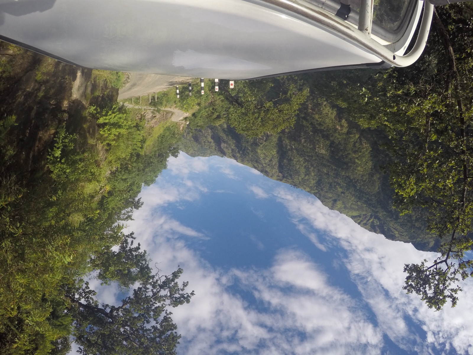
The Karnali Highway runs from the Indian border at Banke to the Chinese border at Humla1. Below are the route, how it was built and what was reported on which day. For the quicker alternative see flights to Jumla; the rest of the cluster is in the getting-there hub.
The route
The Karnali Corridor stretches from Jamunaha in Banke District, near the Indian border, to Hilsa in Humla District, near the Chinese border, a total of 505 km1. Its major intersections are Nepalgunj, Kohalpur, Chhinchu, Birendranagar, Baddichaur, Tallo Dungeshwar, Rakam, Manma and Okhartola1. The highway links Jumla with Birendranagar, the Karnali capital, and with the rest of Surkhet district1. A banner on the Department of Roads home page points “straight to Kalikot and Jumla” along the Karnali Corridor5.
The southern section from Jamunaha to Birendranagar used to be a separate national highway, known as Ratna Highway or National Highway 121. The 107 km section from Hilsa to Simikot was completed in 20191, and a Bailey bridge over the Chuwakhola river was inaugurated on 6 July 2025, connecting Simikot to the national road network1.
How it was built
The then prime minister Girija Prasad Koirala laid the foundation in 1992, but the passage was opened only in 20071. Of the 232 km between Birendranagar and Jumla, 17 km were blacktopped in 20101. Construction of the corridor began in the late 1990s, and progress was slowed by difficult terrain, administrative delays and inconsistent state attention1.
A study in the Nepal Sociological Journal dates it differently: construction began in 2000 and was completed in 2015, with a basic earthen road open in 2000 to 2002 and nearly 14 years needed to finish the graveled and blacktopped highway10. It puts the Surkhet to Jumla length at 233 km10. The highway has tremendously reduced travel time to nearby towns10.
In 2010 heavy monsoon rains closed the highway with landslides, and it reopened on 3 October, three months later1.
Paving and contracts
As of March 2026 the Karnali Corridor spanned 123 kilometres from Khulalu in Kalikot to Hilsa in Humla via Bajura and was the only road access to Humla9. The Army handed over 112 kilometres of the track to the Department of Roads in January 2024, while work was still going on the remaining 11 kilometres9. Contracts for blacktopping and upgrading were awarded in 2025, and work had started on a 50-kilometre stretch from Pilichaur in Bajura to Tumcha in Sarkegad Rural Municipality of Humla9. In March 2026 the works were being carried out under the North-South Trade Route Expansion Project of the Department of Roads9.
Contracts worth more than 1 billion were awarded in the year before February 2025 to build concrete bridges on the rivers and streams of the corridor7. In June 2026 the Road Division Office in Jumla cancelled 16 contract agreements for the Karnali Highway after the road work was not completed on time8.
Dated reports of closures
| Date | Where | Report |
|---|---|---|
| 17 August 2025 | Gaganekhola and Bihani (Kalikot), Khidki Jyula (Dailekh), near Nagma on the Kalikot-Jumla border | Landslides after continuous rainfall blocked the highway2 |
| 17 August 2025 | Phugad river, along the Karnali Corridor | Flooding obstructed traffic2 |
| 27 August 2025 | Kalikhola, Kalikot | Road collapse brought the Surkhet to Jumla section to a standstill3 |
On 17 August 2025 the road to Dailekh had been cut off since the previous evening, and vehicles heading to Surkhet via Kalikot were stranded at several locations2. On 27 August 2025 equipment and manpower had been deployed for repair after the previous night’s collapse, and the road division chief cautioned that it would take some time before traffic resumed smoothly; travellers were advised to use alternative routes until repairs were finished3.
Safety record
As of 9 July 2026 the highway had remained the deadliest road in Karnali Province despite years of repairs4. Police figures reported that day:
| Measure | Figure | Source |
|---|---|---|
| Share of Karnali road accidents on the highway | Nearly 56 percent | Police data, reported 9 July 20264 |
| Deaths since fiscal year 2014-15 | 917 | Karnali Province Police Office, reported 9 July 20264 |
| Last three years | 111 deaths and 309 injuries | Reported 9 July 20264 |
| Province, past decade | 4,002 accidents, 1,637 deaths | Police, reported 9 July 20264 |
Police figures give 34 deaths in 113 accidents on the highway in the fiscal year then current, against 31 deaths in the previous fiscal year and 46 in 2023-244. Authorities attributed the rising number of accidents to narrow roads and overcrowded vehicles4. In the week before 9 July 2026 a passenger minibus from Surkhet to Raskot plunged into the Karnali river from the highway at Sangetada in Dailekh4. Earlier major crashes include 42 deaths at Kitu in Dailekh on 18 March 2010 and 28 deaths at Bittamod in Kalikot on 7 December 20114.
Crash barriers
The World Bank results story on mountain road safety records that 73,000 metres of crash barriers were installed on eight Strategic Road Network roads, totalling 700 km, between early 2016 and mid-201711. Kalyan in Surkhet and Gadgadeni in Jumla were among the high-risk sections that received them11. A US$7.47 million grant was approved on 8 April 2015 to fund the barriers, and the Department of Roads implemented the project11. The World Bank estimates the barriers may save 3,456 lives over 20 years, on GRSF projections11. A Surkhet to Jumla bus driver quoted in January 2020 said drivers feel at ease on roads with barriers11.
The current situation of transportation in Nepal, autumn 2026
On 25 September 2026 the Kathmandu Post reported that heavy rain had disrupted transport and raised the risk of floods and landslides across several parts of Nepal12. The Mechi Highway in Taplejung had reopened after a landslide, but vehicles were barred from it at night during the forecast heavy rain12. Night traffic was suspended on the Sandhikharka-Gorusinge road in Arghakhanchi, and the Ramechhap administration urged caution over floods, landslides and road blockages12.
On 10 October 2026 the Kathmandu Post reported traffic halted on the Lokaha bridge on the Narayangadh-Kawasoti section of the Mahendra Highway13. At Galaundi on the Prithvi Highway nearly 100 metres of road cracked and vehicle movement halted13. The collapse stemmed from erosion by the Trishuli river after the Bhotekoshi floods of 26 August13. More on the monsoon pattern is in monsoon road closures.
A May 2018 itinerary
In May 2018 a Buddha Air itinerary described the Karnali highway as graveled and easy to drive in, with road construction ongoing in some areas6. It starts with a 20 km jeep ride from Surkhet to Guranshe, then about 7 hours from Guranshe to the Kalikot headquarters6. For the route on towards Rara see the Mugu page.
Read next
Jumla: Chandannath, the airport and the Karnali Highway
Jumla district guide: Chandannath, Jumla Airport, the Karnali Highway from Surkhet, the history of the Khas kingdom and dated road reports for travellers.
Getting thereFlights to Jumla: Nepalgunj and Surkhet schedules and airport facts
Flights to Jumla from Nepalgunj and Surkhet: the Nepal Airlines October 2026 timetable, other operators, Jumla Airport facts and past incidents.
District guidesSurkhet: Birendranagar, gateway to Karnali
Surkhet district guide: Birendranagar, Bulbule Lake, Kankrebihar, the airport, the Ratna and Karnali highways and dated road reports for onward travel.
Questions travellers ask
How long is the Karnali Highway?
The full highway (NH58) runs 505 km from Jamunaha in Banke to Hilsa in Humla1. The Birendranagar (Surkhet) to Jumla stretch is 232 km, of which 17 km were blacktopped in 20101.
What closures were reported in August 2025?
On 17 August 2025 landslides blocked the highway at Gaganekhola and Bihani in Kalikot, Khidki Jyula in Dailekh and near Nagma on the Kalikot-Jumla border2. On 27 August 2025 the Surkhet to Jumla section stood still after a road collapse at Kalikhola in Kalikot3.
How dangerous is the Karnali Highway?
As of 9 July 2026 the highway accounted for nearly 56 percent of road accidents in Karnali Province4. The Karnali Province Police Office counted 917 deaths on it since the 2014-15 fiscal year, and 111 deaths in the three years to July 20264.
When did the Karnali Highway open?
The foundation was laid in 1992, but the passage was opened only in 20071. In 2010 monsoon landslides closed it, and it reopened on 3 October, three months later1.
What is the current road status in Nepal?
On 25 September 2026 the Kathmandu Post reported heavy rain had disrupted transport across several parts of Nepal, with night-time vehicle traffic barred on the Mechi Highway in Taplejung12. On 10 October 2026 traffic was halted on the Lokaha bridge on the Mahendra Highway and at Galaundi on the Prithvi Highway13.
What is the current road condition from Kathmandu to Mugling?
On 10 October 2026 nearly 100 metres of the Prithvi Highway at Galaundi developed cracks, and a section collapsed after Trishuli river erosion following the Bhotekoshi floods of 26 August13. Small vehicles were rerouted via the Kanti Highway and Tribhuvan Rajpath after 6 pm that Saturday13.
Sources
- Karnali Highway - Wikipedia · Wikipedia · en.wikipedia.org · checked 19 October 2026
- Landslides block Karnali Highway · The Kathmandu Post · kathmandupost.com · checked 19 October 2026
- Karnali Highway blocked after road collapse in Kalikot · The Himalayan Times · thehimalayantimes.com · checked 19 October 2026
- Karnali Highway remains province's deadliest road despite millions spent on repairs · The Kathmandu Post · kathmandupost.com · checked 19 October 2026
- Department of Roads (home page) · Department of Roads, Nepal · dor.gov.np · checked 19 October 2026
- RARA Calling - Natural & Pristine Perfection · Buddha Air · buddhaair.com · checked 19 October 2026
- 4 billion contract to pave the Karnali Corridor · Kantipur (ekantipur.com) · ekantipur.com · checked 20 October 2026
- Karnali Highway work has been stalled for years, 16 contracts were terminated at once · Kantipur (ekantipur.com) · ekantipur.com · checked 20 October 2026
- Blacktopping begins on Karnali Corridor road section · The Himalayan Times · thehimalayantimes.com · checked 20 October 2026
- Roads to change: The Karnali highway and occupational shift among Dalits in Dahikhola-Chhati · Nepal Sociological Journal, Vol. 1, 2025 · nepjol.info · checked 20 October 2026
- Enhancing the Safety of Nepal's Mountain Roads (World Bank results story, 10 Nov 2020) · World Bank · worldbank.org · checked 20 October 2026
- Heavy rain disrupts travel, raises flood and landslide risks across Nepal (25 Sep 2026) · Kathmandu Post · kathmandupost.com · checked 20 October 2026
- Damaged highways disrupt Dashain travel, airlines prepare late-night flights · Kathmandu Post · kathmandupost.com · checked 20 October 2026
Photos (1)
- Prabinkhadka, CC BY-SA 4.0

Fees, fares and road conditions change: each note shows the date it was checked. How we check facts · Report an error.