Contents
Kanchanpur is accessible by road from Mahendranagar, Dhangadhi and other western towns9. Buddha Air measures the road distance to Mahendranagar from Dhangadhi Airport in neighbouring Kailali3. Shuklaphanta National Park is the district’s best-known draw1. The map point marks the district centre as given on Wikipedia, not the town of Mahendranagar. Other districts are in the districts hub.
Where it is
Kanchanpur is part of Sudurpashchim Province in the Terai plain, one of Nepal’s seventy-seven districts1. It covers 1,610 square kilometres, with Bhimdatta as the district headquarters1. Geographically it is on the Terai, but the northern part has some higher altitudes1. The highest point is 1,528 m and the lowest 176 m1.
The first headquarters was Belauri Municipality, and Mahendranagar was declared the current headquarters in 2019 BS1. The majority of the population is ethnic Tharu1. Its culture includes Tharu, Chhetri and Brahmin communities9. Dashain, Tihar and Maghi are widely celebrated9.
Municipalities
The District Coordination Committee lists seven municipalities: Krishnapur, Punarbas, Bedkot, Belauri, Bhimdatta, Dodhara Chandani and Shuklaphanta7. The two rural municipalities are Beldandi and Laljhadi7.
Getting there
Kanchanpur is accessible by road from Mahendranagar, Dhangadhi and other western towns9. Dhangadhi Airport provides domestic flights to Kathmandu and other major cities9. It is owned by the Government of Nepal and operated by the Civil Aviation Authority of Nepal, and stands 210 m above sea level5. See flights to Dhangadhi.
| Leg | Distance | Time |
|---|---|---|
| Kathmandu to Mahendranagar | 750 km | About 16 hours by bus (Buddha Air, seen 2026)3 |
| Dhangadhi Airport to Mahendranagar | 55 km | About 1 hour by bus (seen 2026)3 |
| Mahendranagar to Shuklaphanta | 5 km | About 15 minutes by car (seen 2026)3 |
Long road journeys and high travel costs limit foreign tourist arrivals to Shuklaphanta3. The long overland route is covered in Kathmandu to the far west by road. Mahendranagar Bazaar offers hotels, lodges and restaurants with tourist-friendly facilities3.
When to go
March to June is the best time for Shuklaphanta, when wildlife sightings are most frequent3. For the district as a whole, October to April is the best time, with mild temperatures and dry weather9. The two ranges overlap in March and April. Visitors must enter the park before 3 PM and leave before sunset3.
Shuklaphanta National Park
Shuklaphanta covers 305 km2 of open grasslands, forests, riverbeds and wetlands at 174 to 1,386 m4. It is bounded by the Mahakali river to the west, the Mahendra Highway to the north and the Syali river to the east4. One-third of the park is grassland3. The Shukla Phanta grassland is the largest continuous grassland patch in Nepal, and the park takes its name from it4.
The park’s status has changed over time. The area was gazetted as Royal Shukla Phanta Wildlife Reserve in 19734, and the same page gives 19764. King Mahendra designated it a hunting reserve in 1969, and it became a national park in 20173.
Wildlife includes barasingha, Royal Bengal tigers, rhinoceroses, wild elephants and birds3. Deer are commonly seen on the grasslands, and tigers and rhinoceroses can often be spotted resting near ponds3. The park has 120 ponds, natural and man-made, that suit migratory birds3. Tigers rose from eight in 2015 to 17 by March 20214. Buddha Air’s undated “latest statistics” give 44 tigers, 23 rhinoceroses, 2,323 barasingha and 465 bird species3; the tiger counts differ and the dates do not match. The blackbuck count in Hirapurphanta has reached 3093. Twenty nature guides operate within the park3.
The park headquarters is in Majhagaon, near Mahendranagar Bazaar3.
Other places to see
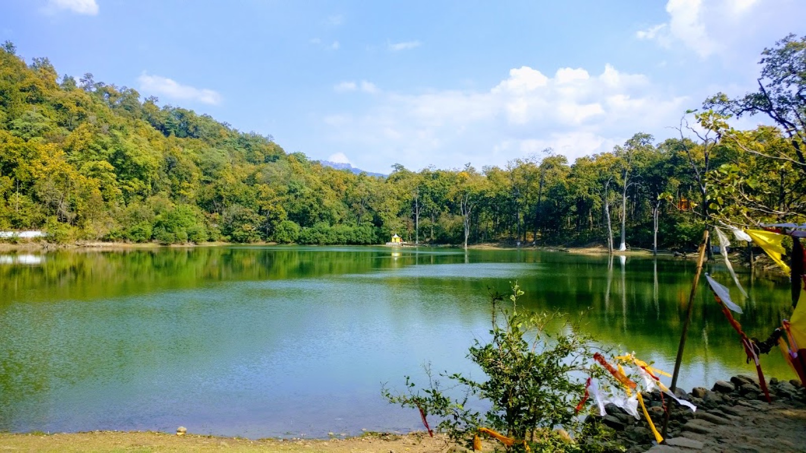
The district’s 1,456.97 metre multi-span suspension bridge crosses the Mahakali River1. Jhilmila Lake, Bedkot Lake, Bandatal, Shovatal, Ranital and the Vishnu Temple are other attractions1. Rafting is available on the Mahakali River, which forms the border between Nepal and India3.
Permits and park fees
Shuklaphanta charges an entry fee per person per entry; in October 2026 the Nepal Tourism Board’s park entry-fee page listed it as follows8:
| Visitor | Shuklaphanta National Park entry | Seen |
|---|---|---|
| Nepali | NPR 100 per person per entry | October 20268 |
| SAARC national | NPR 750 per person per entry | October 20268 |
| Foreigner | NPR 1,500 per person per entry | October 20268 |
A park entry permit must be obtained to enter protected areas, and entrance fees must be paid8.
Fees for other parks are in national park fees.
Population
Kanchanpur held 513,757 residents in 2021, 240,686 male and 273,071 female2. That makes it the second most populous district of Sudurpaschim Province, with the highest density, 319 per km22. The 2021 census report and Wikipedia agree on the total2,1. The 2011 national report recorded 451,248 people, a density of 280 per km26.
Khas people make up 67% of the population1. Tharus and Rana Tharus are the largest minority, at 26%1, and hill Janjatis, mainly Magars and Tamangs, are 3%1.
Read next
Kailali: Dhangadhi, Ghodaghodi Lake and the road from Kathmandu
Kailali district guide: Dhangadhi airport, distance from Kathmandu, Ghodaghodi Lake, Godawari, Tharu villages, municipalities, climate and population.
Getting thereFlights to Dhangadhi: Kathmandu schedules, flight time and airport facts
Kathmandu to Dhangadhi flights: Buddha Air and Shree Airlines schedules as seen October 2026, flight time, fares on record, and Dhangadhi Airport facts.
Getting thereKathmandu to the far west by road: Mahendra Highway buses to Mahendra Nagar
Kathmandu to Mahendra Nagar and Dhangadhi by road: the Mahendra Highway stages, a deluxe bus timetable seen October 2026, and Dashain 2026 disruption.
Questions travellers ask
In which district is Shuklaphanta National Park located?
Shuklaphanta National Park is in Kanchanpur, Sudurpashchim Province3. The park headquarters is in Majhagaon, near Mahendranagar Bazaar3. The district is renowned for the park1.
In which district is Mahendranagar located?
Mahendranagar is in Kanchanpur District3. The district's first headquarters was Belauri Municipality, and Mahendranagar was declared the current headquarters in 2019 BS1.
What is Kanchanpur District known for?
Kanchanpur is renowned for Shuklaphanta National Park and for the 1,456.97 metre suspension bridge over the Mahakali River1. It is also known for open plains and border routes9.
Which municipalities are located in Kanchanpur District?
Kanchanpur has seven municipalities: Krishnapur, Punarbas, Bedkot, Belauri, Bhimdatta, Dodhara Chandani and Shuklaphanta7. Its two rural municipalities are Beldandi and Laljhadi7.
How much is the Shuklaphanta National Park entry fee?
In October 2026 the Nepal Tourism Board listed NPR 100 for Nepali visitors, NPR 750 for SAARC nationals and NPR 1,500 for foreigners, per person per entry8.
Sources
- Kanchanpur District - Wikipedia · Wikipedia · en.wikipedia.org · checked 20 October 2026
- Sudurpaschim Province census report, National Population and Housing Census 2021 · Central Bureau of Statistics, Nepal · censusnepal.cbs.gov.np · checked 20 October 2026
- Shuklaphanta: a sanctuary of silence, survival and spectacle · Buddha Air · buddhaair.com · checked 20 October 2026
- Shuklaphanta National Park - Wikipedia · Wikipedia · en.wikipedia.org · checked 20 October 2026
- Dhangadhi Airport - Wikipedia · Wikipedia · en.wikipedia.org · checked 20 October 2026
- National Report, Population Census 2011 (Wayback) · Central Bureau of Statistics, Nepal · cbs.gov.np · checked 20 October 2026
- District Coordination Committee Kanchanpur (Wayback) · DCC Kanchanpur, Sudurpashchim Province · ddckanchanpur.gov.np · checked 20 October 2026
- Park Entry Fees in Nepal · Nepal Tourism Board · ntb.gov.np · checked 20 October 2026
- Kanchanpur Travel Guide · visitNepal77 · visitnepal77.com · checked 20 October 2026
Image credits (1)
- Shambhujii / Wikimedia Commons · CC BY-SA 4.0 · source

Fees, fares and road conditions change: each note shows the date it was checked. How we check facts · Report an error.