Contents
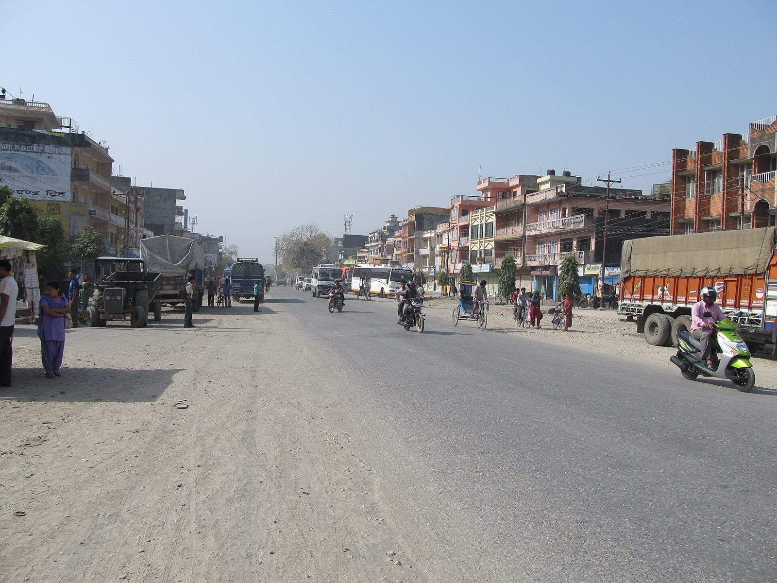
The far west is reached from Kathmandu by road across the Terai, on the Mahendra Highway. This page gives the distance, one operator’s bus listing, the stages of the road and the disruption reported on it before Dashain. For the hill roads that branch off it, see Nepalgunj and the Karnali Highway; everything else is in the getting there hub.
Distance and the main road
Kathmandu to Mahendra Nagar is around 710 km by road1. Most of the westward run is the Mahendra Highway, which crosses the Terai from east to west for over 1,030 km, between Kakarbhitta and Mahendra Nagar2. It is mostly a single-lane road in each direction and spans over 500 bridges2. It runs through every province of Nepal except Karnali Province2.
The stages that matter for a far-west journey, in order from Hetauda westwards2:
| Place | Note |
|---|---|
| Hetauda | The Mahendra and Tribhuvan highways join to cross the Siwalik Range to Hetauda in Chitwan Valley2 |
| Bardibas | Meets the BP Highway, the shortest route linking Kathmandu with the Terai2 |
| Butwal | Junction of the highway with the Siddhartha Highway2 |
| Kohalpur | 428 km west of Hetauda; junction for the road 13 km south to Nepalgunj and the border2 |
| Chisapani | The highway crosses the Karnali River here and continues west to Bhim Datta2 |
| Bhim Datta | Indian border on the Mahakali River, crossed on a barrage2 |
Wikipedia’s entry, seen in October 2026, says the section between Chisapani and Bhim Datta is in poor repair2.
Buses and fares
In October 2026 Yatra Nepal listed a daily air-conditioned deluxe bus with wifi from Kathmandu to Mahendra Nagar1. The timetable it showed:
| Direction | Times listed | Duration | Seats | Fare |
|---|---|---|---|---|
| Kathmandu to Mahendra Nagar | 02:00 PM and 08:00 AM | 18 hours | 35 | NRs 3,200, seen October 20261 |
| Mahendra Nagar to Kathmandu | 12:00 PM and 06:00 AM | 18 hours | 35 | NRs 3,200, seen October 20261 |
The same page offers online booking for the run in both directions1. BusSewa, an online ticketing platform, listed 400+ bus routes linking over 65 districts in October 20265, with Surkhet to Kathmandu among its popular routes5. For the Surkhet and Jumla end of the journey see buses and jeeps.
Dashain 2026 disruption
The Kathmandu Post reported on 10 October 2026 that with over one million travellers expected to leave the Kathmandu Valley by road, damage to highways had thrown festival travel into turmoil3. The Prithvi Highway typically handles over 15,000 vehicles a day, and its traffic triples during Dashain3. On the Friday traffic halted when nearly 100 metres of road at Galaundi on the Prithvi Highway cracked and a 20-metre section collapsed3. The Department of Roads director general said the collapse stemmed from erosion by the Trishuli river after the Bhotekoshi floods of 26 August3.
Advance booking counters were temporarily suspended on the Saturday and several long-distance night buses were halted, while small vehicles were rerouted via the Kanti Highway and Tribhuvan Rajpath after 6:00 pm that day and fares were refunded to affected travellers3. The same report records traffic halted across the Lokaha bridge on the Narayangadh-Kawasoti section of the Mahendra Highway after part of the structure sagged on the Saturday evening3.
The monsoon pattern behind them is in monsoon road closures.
How the Mahendra Highway was built
The Department of Roads’ strategic road network statistics for 2017/18 list the Mahendra Rajmarga (H01) at 1,027.67 km6. The same table breaks it into sections, each built in its own period6.
| Section | Length | Built | Source |
|---|---|---|---|
| Kakarbhitta-Dhalkebar | 258.21 km | 1967 to 1974, India cooperating | 6 |
| Hetauda-Narayangadh | 77.00 km | 1973 to 1982 | 6 |
| Narayangadh-Butwal | 114.00 km | 1969 to 1972, UK cooperating | 6 |
| Butwal-Kohalpur | 237.00 km | 1973 to 1985, India cooperating | 6 |
| Kohalpur-Banbasa | 203.39 km | 1973 to 1978 | 6 |
The hill leg: Naubise to Mugling and Narayanghat
A World Bank environmental and social assessment describes the 2-lane Nagdhunga-Naubise-Mugling road as 94.7 km long, on the north-south trade corridor between Kathmandu and Birgunj7. It found no passing lanes on the Prithvi Highway section, no traffic signage even at major intersections such as Naubise, Galchi and Malekhu, and speed limits not applied on most of the section7. Mugling has a junction with the Mugling-Narayanghat section, which connects the Prithvi Highway to the Mahendra Highway7.
The World Bank project also plans to upgrade the Kamala-Dhalkebar-Pathlaiya section of the Mahendra Highway from 2-lane to 4-lane7.
The Narayanghat-Mugling road runs between steep hills on one side and the Trishuli River on the other, and was highly prone to landslides each year8. In a February 2025 World Bank feature, over a hundred slopes on it were reported fortified with bioengineering and drainage8. Slope hazards on other hill roads are in landslides and road safety.
Safety and checks
A bus from Kathmandu to Dhangadhi on the East-West Highway went out of control and overturned at Daunne’s S bend on Monday 12 October 2026, with five people injured4. In the Dashain measures reported on 10 October 2026, long-distance buses were mandated to employ two drivers, and fare lists were to be displayed at departure points3. Joint inspection teams were deployed at departure points including New Bus Park in Gongabu, Kalanki, Koteshwar and Balkhu3.
The calmer months for travel are in best time to visit west Nepal.
Read next
Nepalgunj: the airport hub for flights into west Nepal
Nepalgunj guide for west Nepal: Ranjha Airport, flights from Kathmandu, onward flights to Jumla, Simikot, Dolpa and Mugu, climate and the new terminal.
Getting thereKarnali Highway: route, dated closure reports and safety record
Karnali Highway (NH58) from Banke to Hilsa: the route, how it opened, dated landslide and collapse reports from 2025 and the July 2026 accident figures.
Getting thereMonsoon road closures in west Nepal: dated landslide and highway reports
Dated record of monsoon landslides and closures on the Karnali Highway and the roads from Kathmandu, 2025 to 2026, with what authorities told travellers.
Questions travellers ask
How far is Kathmandu from Mahendra Nagar by road?
Yatra Nepal's bus page, seen in October 2026, gave around 710 km by road1. The Mahendra Highway, which crosses the Terai for over 1,030 km from Kakarbhitta to Mahendra Nagar, carries the westward part2.
How much does a bus from Kathmandu to Mahendra Nagar cost?
In October 2026 Yatra Nepal listed an air-conditioned deluxe bus with wifi at NRs 3,200, with 35 seats1. The return from Mahendra Nagar listed the same fare1.
What time does the Kathmandu to Mahendra Nagar bus depart?
In October 2026 Yatra Nepal listed Kathmandu to Mahendra Nagar with times of 02:00 PM and 08:00 AM over 18 hours, and Mahendra Nagar to Kathmandu with times of 12:00 PM and 06:00 AM over 18 hours1.
Which roads do buses use between Kathmandu and Dhangadhi?
A Sudurpaschim Transport bus from Kathmandu to Dhangadhi was reported on 12 October 2026 travelling along the East-West Highway when it overturned at Daunne's S bend4.
Sources
- Kathmandu - Mahendra Nagar Daily Bus · Yatra Nepal · yatranepal.com · checked 19 October 2026
- Mahendra Highway - Wikipedia · Wikipedia · en.wikipedia.org · checked 19 October 2026
- Damaged highways disrupt Dashain travel, airlines prepare late-night flights · The Kathmandu Post · kathmandupost.com · checked 19 October 2026
- Five Injured as Passenger Bus Overturns at Daunne's S Bend · Kantipur · ekantipur.com · checked 19 October 2026
- BusSewa: Nepal's Trusted Online Ticketing & Travel Platform · BusSewa · bussewa.com · checked 19 October 2026
- Statistics of Strategic Road Network 2017/18, Table 9: List of important roads · Department of Roads · dor.gov.np · checked 20 October 2026
- Environmental and Social Impact Assessment, Strategic Road Connectivity and Trade Improvement Project (SRCTIP) · World Bank · documents1.worldbank.org · checked 20 October 2026
- Protecting Slopes to Build Resilient Roads in Nepal (World Bank feature, 10 Feb 2025) · World Bank · worldbank.org · checked 20 October 2026
Photos (1)
- Sundar1, CC BY-SA 3.0

Fees, fares and road conditions change: each note shows the date it was checked. How we check facts · Report an error.