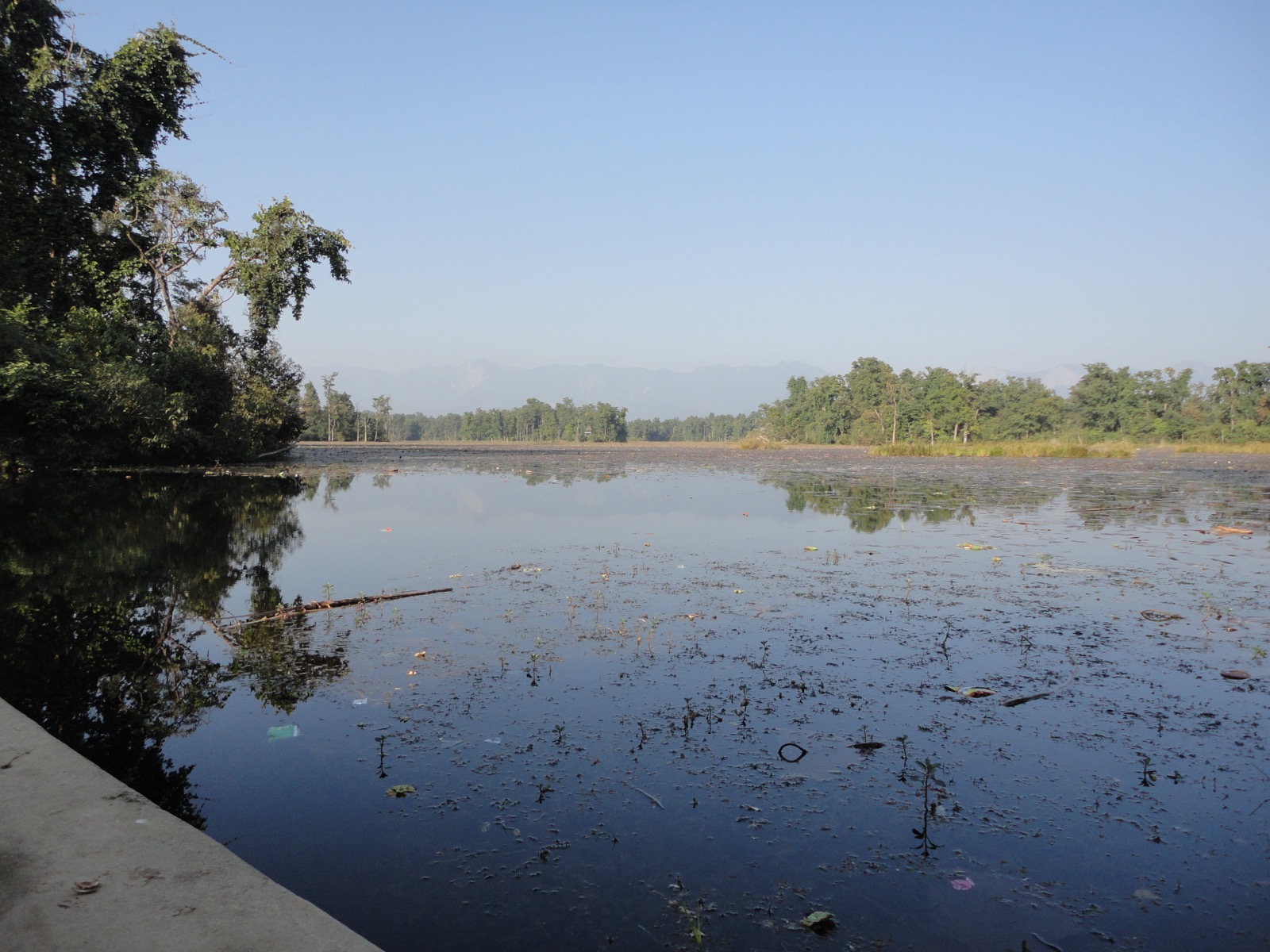
Kailali is the most populous district of Sudurpashchim and the home of Dhangadhi Airport3,4,6. Its geography runs from Terai plain to hill country2. This page covers the whole district; the other districts are in the districts hub, and the neighbour to the west is Kanchanpur.
Where it is
Kailali is part of Sudurpashchim Province in the Terai plain1. The district covers 3,235 square kilometres, with Dhangadhi as its headquarters1. It is a mix of plains and hilly terrain, with 40.35% of the land mountainous2. Nepal News gives 688 km west of Kathmandu for the district and 750 km for Dhangadhi itself2.
Ghodaghodi Municipality sits in the central part of Kailali and borders Bardagoriya Rural Municipality to the east2. Bhajani Municipality lies in the central south2. Mohanyal Rural Municipality is in the hills, at 1,100 to 1,700 m above sea level2. Gauriganga Municipality ranges from 165 m to 944 m2. Kailali was part of the Kalabanjar Kingdom in ancient times2.
Local units
Kailali has 13 local levels: six rural municipalities, six urban municipalities and one sub-metropolitan city2. The District Coordination Committee lists municipalities Godawari, Gauriganga, Ghodaghodi, Tikapur, Bhajani and Lamkichuha9. Its rural municipalities include Kailari, Chure, Janaki, Joshipur, Bardagoriya and Mohanyal9.
Getting there
Dhangadhi Airport is a public airport owned by the Government of Nepal and operated by the Civil Aviation Authority of Nepal4. It stands at 210 m above sea level4. For Ghodaghodi Lake, a flight to Dhangadhi followed by a short drive is a convenient option8. See flights to Dhangadhi for the air side, and Kathmandu to the far west by road for the long bus route.
By road, Lamkichuha Municipality is connected to the East-West Mahendra Highway2. Janaki Rural Municipality is about 10 km south of Lamki Chowk on the East-West Highway2. Kailari Rural Municipality is 27 km east of Dhangadhi2. Bardagoriya Rural Municipality is 50 km east of Atariya2. Godawari lies 7 km north of Attariya2.
The bridge over the Karnali River is a vital link between the far west and the rest of the country2.
The Mahakali Highway then runs north towards the hills, as covered under Baitadi; for the next hill district see Dadeldhura.
When to go
Kailali averages 1,840 mm of rain a year2. In winter, temperatures run from a minimum of 5°C to 19°C, and in summer from 19°C to 46°C2. Dhangadhi’s average maximum is 45°C and its minimum 7°C2.
Festivals mark the calendar. Every year in Magh, Kailari holds a Maghi fair at the Ban Devi Temple and the Aparampara Temple2.
What to see
Dhangadhi
Dhangadhi is a sub-metropolitan city and the district headquarters, divided into 19 wards6. It was established in 1976 as a municipality6. It is the biggest city in western Nepal and the largest sub-metropolitan city in the country6. It lies at 109 m above sea level2. Dhangadhi had 198,792 people in the 2021 census6. It is one of the major cities of Sudurpashchim, with Mahendranagar, Dadeldhura and Patan6. It is known as the City of Cricket6. Bhada Village in Dhangadhi is famous for its Tharu lifestyle and culture2.
Ghodaghodi Lake
Ghodaghodi Tal is a Ramsar site in western Nepal5. It lies in Kailali at 205 m in the Siwalik Hills, and was designated on 13 August 20035. It is a natural freshwater oxbow lake, with thirteen associated lakes and ponds7. The area is a wildlife corridor between the lowland and the Siwaliks7. Animals include the Eurasian otter, Bengal tiger and red-crowned roofed turtle5. The lake is a crucial habitat for migratory birds, and visitors can go birdwatching8.
The distance from Dhangadhi is reported two ways. Nepal News gives 60 km east of Dhangadhi and 37 km west of Karnali Chisapani2; Tourism Info Nepal gives about 40 km, with regular buses8.
Temples and other sites
Kailali’s religious sites include Shivpuridham, Godawari Dham, Shree Kartikeya (Mohanyal) and Behadababa2. The Godawari temple is home to the tallest Bajrangbali Hanuman statue in Nepal, 52 feet high2. The sacred Godawari River irrigates Godawari Municipality2.
Garva Durbar is the only Rana-era palace in Nepal’s far west, reached after a 6-hour walk from Choumal2. Khanidanda in Chure Rural Municipality offers views of the surrounding hills, plains and the Api Himal2. Tikapur Park covers 5 hectares and is famous for its 80 varieties of roses2. The Mohana River in Bhajani is home to the endangered dolphin2.
Population and history
Kailali held 904,666 residents in 2021, 433,456 male and 471,210 female, the highest of Sudurpaschim’s nine districts3. The 2021 census report and Wikipedia agree on the total3,1. For 2011, the CBS national report records 775,709 people at 240 per km210.
Tharus and Rana Tharus are the largest single community, at 38%1. Khas people make up 55% and hill Janjatis, mainly Magars, 5%1.
The Sugauli Treaty forced Nepal to cede large tracts of the western Terai, including Kailali6. In 1860 the British returned Kailali, Kanchanpur, Banke and Bardiya to Nepal under Jung Bahadur Rana6. Dhangadhi began as a small border settlement and customs post for trade with India6.
Permits and park fees
One national rule covers every protected area in Nepal.
A park entry permit must be obtained to enter protected areas, and entrance fees must be paid11.
The rule is on the Nepal Tourism Board’s park entry-fee page11. It also lists the lake on its Ghodaghodi Lake Area page7. Fees by park are in national park fees, and Shuklaphanta National Park is covered under Kanchanpur.
Read next
Kanchanpur: Mahendranagar, Shuklaphanta National Park and how to get there
Kanchanpur district guide: Mahendranagar, Shuklaphanta National Park fees, the road from Dhangadhi airport, best months, municipalities and population.
Getting thereFlights to Dhangadhi: Kathmandu schedules, flight time and airport facts
Kathmandu to Dhangadhi flights: Buddha Air and Shree Airlines schedules as seen October 2026, flight time, fares on record, and Dhangadhi Airport facts.
Getting thereKathmandu to the far west by road: Mahendra Highway buses to Mahendra Nagar
Kathmandu to Mahendra Nagar and Dhangadhi by road: the Mahendra Highway stages, a deluxe bus timetable seen October 2026, and Dashain 2026 disruption.
Questions travellers ask
In which province is Kailali District located?
Kailali is part of Sudurpashchim Province, in the Terai plain, and is one of Nepal's seventy-seven districts1. Dhangadhi is its district headquarters1.
In which district is Dhangadhi located?
Dhangadhi is in Kailali District, in Sudurpashchim Province6. It is a sub-metropolitan city of 19 wards and the largest sub-metropolitan city in Nepal6. It had 198,792 people in the 2021 census6.
In which district is Ghodaghodi Lake located?
Ghodaghodi Lake is in Kailali District, at 205 m in the Siwalik Hills5. It is a natural freshwater oxbow lake7, 60 km east of Dhangadhi by one account2 and about 40 km by another8.
How far is Kailali from Kathmandu?
Kailali is 688 km west of Kathmandu, and Dhangadhi 750 km2. Tourism Info Nepal calls a flight from Kathmandu to Dhangadhi followed by a short drive a convenient option for Ghodaghodi Lake8.
How many local levels does Kailali have?
Kailali has 13 local levels: six rural municipalities, six urban municipalities and one sub-metropolitan city2.
Sources
- Kailali District - Wikipedia · Wikipedia · en.wikipedia.org · checked 20 October 2026
- Kailali district (Nepal News) · Nepal News · english.nepalnews.com · checked 20 October 2026
- Sudurpaschim Province census report, National Population and Housing Census 2021 · Central Bureau of Statistics, Nepal · censusnepal.cbs.gov.np · checked 20 October 2026
- Dhangadhi Airport - Wikipedia · Wikipedia · en.wikipedia.org · checked 20 October 2026
- Ghodaghodi Tal - Wikipedia · Wikipedia · en.wikipedia.org · checked 20 October 2026
- Dhangadhi - Wikipedia · Wikipedia · en.wikipedia.org · checked 20 October 2026
- Ghodaghodi Lake Area · Nepal Tourism Board · ntb.gov.np · checked 20 October 2026
- Ghodaghodi Lake (Tourism Info Nepal) · Tourism Info Nepal · tourisminfonepal.com · checked 20 October 2026
- District Coordination Committee Kailali (Wayback) · DCC Kailali, Sudurpashchim Province · ddckailali.gov.np · checked 20 October 2026
- National Report, Population Census 2011 (Wayback) · Central Bureau of Statistics, Nepal · cbs.gov.np · checked 20 October 2026
- Park Entry Fees in Nepal · Nepal Tourism Board · ntb.gov.np · checked 20 October 2026
Image credits (1)
- Ganesh Paudel / Wikimedia Commons · CC BY-SA 3.0 · source

Fees, fares and road conditions change: each note shows the date it was checked. How we check facts · Report an error.