Contents
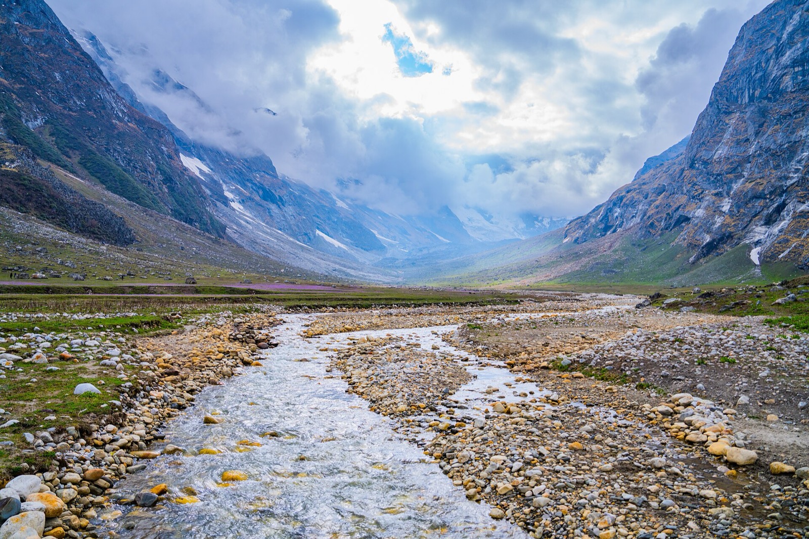
Darchula is the north-western corner of Nepal, where the Mahakali River forms the border with India and the Api and Nampa massifs rise above the country’s westernmost protected area1,2,4. This page covers the whole district; its neighbours are in the districts hub, including Bajhang.
Where it is
Darchula is one of the nine districts of Sudurpashchim Province and one of Nepal’s 77 districts1. With Khalanga (Mahakali Municipality) as its capital it covers 2,782.28 km21. The 2011 census gave 133,274 people and the 2021 census 133,3101. The main languages are Dotiyali and Nepali1.
The district consists of nine municipalities, two urban (Mahakali and Shailyasikhar) and seven rural1. Darchula is also known for its traditional Thapla system, a cultural practice preserved for generations1.
Byans and the Tinkar Valley
The northern part of the district contains the Nepali portion of the historical Byans region1. The principal villages in the Tinkar Valley are Chhangru (100 households) and Tinkar (80 households), populated by the Byansi people, who speak Byansi1. Byangsi is a West Himalayish language of India and Nepal8. In Nepal its villages are in the Byans municipality of Darchula District, bounded to the east and south-east by the snowy range of Tinkar, Nampa and Api8. A figure of 3,300 native speakers is cited from the 2000 to 2011 census8.
Khalanga and the border
Khalanga is a town and the district headquarters of Darchula, in Sudurpashchim Province2. It lies on the bank of the Mahakali River, on the border with Dharchula District of Uttarakhand, India2. The Mahakali River is the border between Nepal and India, with a suspension bridge connecting the towns on the two sides2. In October 2026 the border was listed as closed at night for security reasons2. The Mahakali Highway is listed as the district’s major highway1.
The Mahakali River originates in the northern Uttarakhand state of India, in the Great Himalayas on the eastern slopes of the Nanda Devi massif9. Its basin is one of the five major river basins of Nepal shared with India, with a basin size of 14,871 km29. The Mahakali Treaty, signed on 12 February 1996, set a framework for the integrated development and management of the river’s water resources9.
Getting around: the highway and the trails
The Mahakali Highway is National Highway 66, in Sudur Province, and its total length is 364.93 km10. It formerly was a 325 km road with the old number H14 that connected Dhangadhi in Kailali District to Mahakali Municipality in Darchula District, passing through Doti, Dadeldhura and Baitadi districts10. The road from Syaule in Dadeldhura to Satbanj in Darchula was built with US assistance between 1967 and 198510.
In 2019 an alternative route, Gokuleshwor to Khalanga, lay incomplete at 44 km, with construction started around three decades earlier12. The Decentralised Rural Infrastructure and Livelihood Project had opened the track of the incomplete stretch about five years before 2019, and the 72 km stretch of the Mahakali Highway from Khalanga to Gokuleshwor was in operation12.
Reaching Chhangru and Tinkar from Khalanga meant passing through Indian territory, as there were no roads or foot trails on the Nepali side10. For more than two decades Khalanga residents had been compelled to use Indian territory to reach them11. In October 2020 the Nepal Army handed over a newly built trail linking Khalanga with Changru of Byas Municipality and Tikar village11.
Api Nampa Conservation Area
Api Nampa Conservation Area was established in 2010 in Darchula district and covers 1,903 km2, and it is Nepal’s westernmost protected area4. It ranges in elevation from 518 m to 7,132 m at the Himalayan peak Api3. It is named after the two peaks Api and Nampa3, and encompasses Api (7,132 m) and Nampa (6,755 m)4. For route detail see the Api base camp trek page and the Api Nampa Conservation Area page.
Trekking conditions
In June 2019 the conservation area covered 21 VDCs and lay under the shadow of Mounts Api and Nampa, the two highest peaks in western Nepal7. Hiking trails ran directly up the Mahakali, along the Indian border, to the base of the Api and Nampa massifs, while other trails ran deep into the interior7. In June 2019 tourism in Darchula was nascent, and obtaining trekking gear and organising treks was considerably harder than in more established areas7. Information on Api Nampa was scarce, and most trekking agencies in Thamel knew little about it7.
When to go
October to March gives clear weather in most regions, and March to May suits high-altitude treks4.
Permits and fees
In October 2026 the Department of Immigration’s trekking route and permit fee table listed Darchula at USD 90 per person per week, with USD 15 per day beyond 1 week5. The area it names is Vyas Rural Municipality, ward 15.
| District | Permit | After the first week | Area | Seen |
|---|---|---|---|---|
| Darchula | USD 90 per person per week | USD 15 per day beyond 1 week | Vyas RM, ward 1 | October 20265 |
Api Nampa Conservation Area charges an entry fee per person per entry; in October 2026 the Nepal Tourism Board’s park entry-fee table listed it as follows, with children under 10 free6:
| Visitor | Api Nampa entry | Seen |
|---|---|---|
| Nepali | NPR 100 per person per entry | October 20266 |
| SAARC national | NPR 500 per person per entry | October 20266 |
| Foreigner | NPR 2,000 per person per entry | October 20266 |
Rules for each area are collected in restricted-area permits.
Read next
Api Nampa Conservation Area: entry fee, permits and how to reach it
Api Nampa Conservation Area in Darchula: entry fee for Nepalis, SAARC nationals and foreigners, the Darchula permit row, access from Dhangadhi, best months.
TreksApi base camp trek: route, days, season and costs from Darchula
Api Himal base camp trek in Darchula: 9, 12 and 16-day operator itineraries, base camp altitude, best months, the Darchula permit row, park entry, prices.
District guidesBajhang: Chainpur, Saipal and Surma Sarobar
Bajhang district guide: Chainpur headquarters, the Saipal permit, flights and roads in, Surma Sarobar, Saipal Himal and climate by elevation.
Questions travellers ask
In which district is Api mountain located?
Api is in Darchula district, within Api Nampa Conservation Area, which was established in 20103. The area ranges in elevation from 518 m to 7,132 m at the peak Api3.
What language is spoken in Darchula?
The main languages are Dotiyali and Nepali1. In the Tinkar Valley the principal villages are populated by the Byansi people, who speak Byansi, a West Himalayish language1.
How much does it cost to trek to Api Base Camp?
In October 2026 the Nepal Tourism Board listed Api Nampa Conservation Area at NPR 100 for Nepalis, NPR 500 for SAARC nationals and NPR 2,000 for foreigners per entry6. The Department of Immigration listed a Darchula permit at USD 90 per person per week for Vyas RM ward 15.
Sources
- Darchula District - Wikipedia · Wikipedia · en.wikipedia.org · checked 19 October 2026
- Khalanga, Darchula - Wikipedia · Wikipedia · en.wikipedia.org · checked 19 October 2026
- Api Nampa Conservation Area - Wikipedia · Wikipedia · en.wikipedia.org · checked 19 October 2026
- Api Nampa Conservation Area - Nepal Climbing Adventures · Nepal Climbing Adventures · nepalclimbing.com · checked 19 October 2026
- Trekking Route and Permit Fee · Department of Immigration, Nepal · immigration.gov.np · checked 19 October 2026
- Park Entry Fees in Nepal · Nepal Tourism Board · ntb.gov.np · checked 19 October 2026
- Api Nampa Conservation Area has been a colossal failure · Record Nepal · recordnepal.com · checked 19 October 2026
- Byangsi language - Wikipedia · Wikipedia · en.wikipedia.org · checked 20 October 2026
- Mahakali River - Wikipedia · Wikipedia · en.wikipedia.org · checked 20 October 2026
- Mahakali Highway - Wikipedia · Wikipedia · en.wikipedia.org · checked 20 October 2026
- Nepali Army hands over Khalanga-Changru-Tikar trail in Darchula · The Himalayan Times · thehimalayantimes.com · checked 20 October 2026
- Gokuleshwor-Khalanga road still remains neglected · Kathmandu Post · kathmandupost.com · checked 20 October 2026
Image credits (1)
- Bibekkunwar7 / Wikimedia Commons · CC BY-SA 4.0 · source

Fees, fares and road conditions change: each note shows the date it was checked. How we check facts · Report an error.