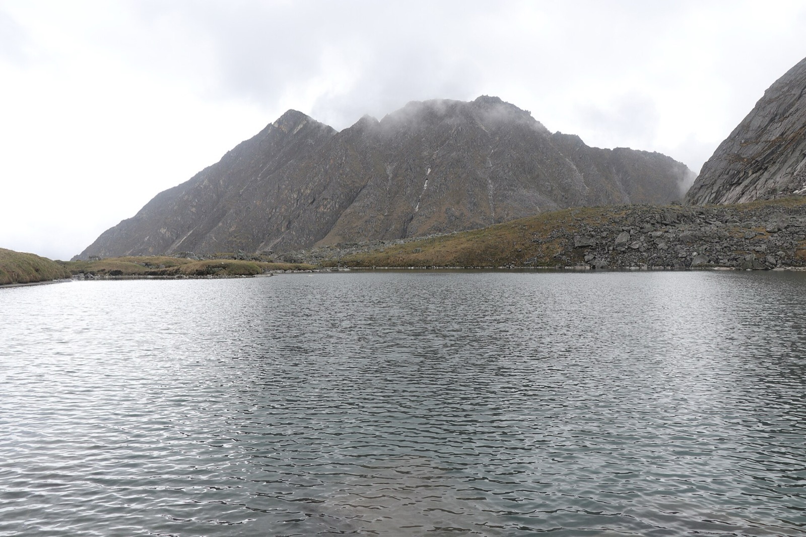
Bajhang is the Sudurpashchim district that holds Saipal3. Chainpur, the headquarters, sits on the bank of the Seti River and the Bauli Khola1. This page covers the whole district; its neighbours are in the districts hub, including Darchula and Bajura.
Where it is
Bajhang is a part of Sudurpashchim Province and one of Nepal’s 77 districts1. It covers 3,422 km21. The 2011 census gave 195,159 people and the 2021 census 189,0851. It has a literacy rate of 70.54%1, and in 2021 29.48% of residents lived in municipalities1.
The district is surrounded by Bajura and Humla in the east, Baitadi and Darchula in the west, Humla in the north and Doti and Achham in the south1. Its elevation runs from 900 m to 7,035 m1.
| Zone | Elevation | Share of area |
|---|---|---|
| Subtropical | 1,000 to 2,000 m | 18.0%1 |
| Temperate | 2,000 to 3,000 m | 26.5%1 |
| Subalpine | 3,000 to 4,000 m | 16.6%1 |
| Alpine | 4,000 to 5,000 m | 8.4%1 |
| Nival | above 5,000 m | 30.0%1 |
Chainpur and Jaya Prithvi
Jayaprithvi is a municipality and the district headquarters of Bajhang District, in Sudurpashchim Province8. It was established on 18 May 2014 by merging former Village Development Committees, and it lies on the bank of the Seti River8. At the 2011 census it had 22,553 people; 75.7% spoke Nepali and 23.7% Bajhangi as their first language8. In that census 41.6% were Chhetri, 22.4% Hill Brahmin and 15.1% Thakuri8.
Chainpur is an ancient town in Jaya Prithvi Municipality, in the Seti Zone of north-western Nepal2. At the 1991 census it had 4,143 people and 759 houses2. The Peace Corps operated in Chainpur from 1990 to 20022. In Sydney Wignall’s Prisoner in Red Tibet and Spy on the Roof of the World, the story starts and finishes in Chainpur2. The town has two community radio stations, Jayaprithvi FM at 96.3 MHz and Bajhang FM2.
Getting there
By air
In October 2026 Chainpur was listed with a grass runway in town and limited flights2. The Nepal Tourism Board’s Khaptad page gave, in October 2026, the route as a flight from Kathmandu to Nepalgunj (60 minutes), then to Chainpur (20 minutes), followed by a three-day walk to Khaptad4. Bajhang Airport lies in Old-Rithapata8.
By road
In October 2026 buses were listed from Kathmandu to Dhangadhi and from Dhangadhi to Bajhang5. The Khopde-Bajhang Road, also called the Jaya Prithivi Bahadur Singh Road, connects Khopde and Bajhang over 109 km5. Road conditions change with the monsoon; see monsoon road closures for the regional picture.
What to see
Saipal is a mountain in the Himalayas of north-west Bajhang district, 7,031 m high, and was first climbed in 1960 by Sangay Thinlay3. It is the second-highest mountain in the Far Western Himalayas5. Other snow peaks include Ramkot Peak, Sankhamala Himal and Lama Peak5. Api, Nampa and Saipal are a trio of high mountains in north-western Nepal that together form a small range of sharp, icy peaks3. The walking route is on the Saipal base camp trek page.
Surma Sarowar lake, at 4,300 m, lies south-west of the Saipal range5. Every year at the end of July a large festival called Birijaat is held there, when thousands of pilgrims take a ceremonial bath5.
Khaptad National Park
Khaptad National Park, in the Far-Western Region, was established in 1984 on the advice of Khaptad Baba, and a buffer zone of 216 km2 was declared in 20069. It stretches over Bajhang, Bajura, Achham and Doti districts, covers 225 km2 and ranges in elevation from 1,400 to 3,300 m9. Sahashra Linga, at 3,200 m, is the highest point of the park4.
The park consists of moorland, steep slopes and streams, with 567 floral species9. It harbours 23 mammals, including Indian leopard, Himalayan black bear, dhole and Alpine musk deer9. Its 287 bird species include the Impeyan pheasant, peregrine falcon and white-rumped vulture9. The Nepal Tourism Board lists March to May and October to November as the best season, at 10 to 20 degrees Celsius, with June to September rainy4. The route is on the Khaptad trek page.
Permits
In October 2026 the Department of Immigration’s trekking route and permit fee table listed Bajhang at USD 90 per week, with USD 15 per day beyond 1 week6. The area it names is Saipal Rural Municipality, wards 1 to 56.
| District | Permit | After the first week | Area | Seen |
|---|---|---|---|---|
| Bajhang | USD 90 per week | USD 15 per day beyond 1 week | Saipal RM, wards 1 to 5 | October 20266 |
Khaptad National Park, reached through Chainpur on the Nepal Tourism Board’s route, charges an entry fee per person per entry. In October 2026 the Nepal Tourism Board’s park entry-fee table listed it as follows, with children under 10 free7:
| Visitor | Khaptad National Park entry | Seen |
|---|---|---|
| Nepali | NPR 100 per person per entry | October 20267 |
| SAARC national | NPR 1,500 per person per entry | October 20267 |
| Foreigner | NPR 3,000 per person per entry | October 20267 |
Rules for each area are collected in restricted-area permits and Khaptad National Park.
Read next
Darchula: Khalanga, Api Nampa and the Mahakali border
Darchula district guide: Khalanga on the Mahakali, Api Nampa Conservation Area fees, the Darchula permit, Byans villages and when to go.
District guidesBajura: Martadi, Badimalika and the Saipal range
Bajura district guide: Martadi headquarters, Badimalika municipality, the Safebagar-Martadi road, the Saipal range and seasonal landslide risk.
District guidesDoti: Dipayal Silgadhi, the Seti Highway and the road to Khaptad
Doti district guide: Dipayal Silgadhi headquarters, the Seti Highway from Amargadhi, Doti Airport, Khaptad park fees and the Doti Kingdom's history.
Questions travellers ask
In which district does Saipal Himal lie?
Saipal is a mountain in the Himalayas of north-west Bajhang district3. Its elevation is 7,031 m, and it was first climbed in 1960 by Sangay Thinlay3.
What is the area of the Bajhang district?
Bajhang covers 3,422 km21. The 2011 census gave 195,159 people and the 2021 census gave 189,0851.
What is Bajhang famous for?
Saipal at 7,031 m is the second-highest mountain in the Far Western Himalayas5. Surma Sarowar lake lies at 4,300 m south-west of the Saipal range, and a festival called Birijaat is held there at the end of July5.
How do I get to Chainpur, Bajhang?
In October 2026 the Nepal Tourism Board's Khaptad page gave a flight Kathmandu to Nepalgunj (60 minutes) and then to Chainpur (20 minutes)4. In October 2026 Chainpur was listed with a grass runway and limited flights2, and buses ran from Kathmandu to Dhangadhi and on to Bajhang5.
Sources
- Bajhang District - Wikipedia · Wikipedia · en.wikipedia.org · checked 19 October 2026
- Chainpur, Bajhang - Wikipedia · Wikipedia · en.wikipedia.org · checked 19 October 2026
- Saipal - Wikipedia · Wikipedia · en.wikipedia.org · checked 19 October 2026
- Khaptad National Park - Nepal Tourism Board · Nepal Tourism Board · ntb.gov.np · checked 19 October 2026
- Bajhang District Sudurpaschim's Hidden Treasure - Hop Nepal · Hop Nepal · hopnepal.com · checked 19 October 2026
- Trekking Route and Permit Fee · Department of Immigration, Nepal · immigration.gov.np · checked 19 October 2026
- Park Entry Fees in Nepal · Nepal Tourism Board · ntb.gov.np · checked 19 October 2026
- Jayaprithvi - Wikipedia · Wikipedia · en.wikipedia.org · checked 20 October 2026
- Khaptad National Park - Wikipedia · Wikipedia · en.wikipedia.org · checked 20 October 2026
Image credits (1)
- Cultural beauty of Bajhang / Wikimedia Commons · CC BY-SA 4.0 · source

Fees, fares and road conditions change: each note shows the date it was checked. How we check facts · Report an error.