Contents
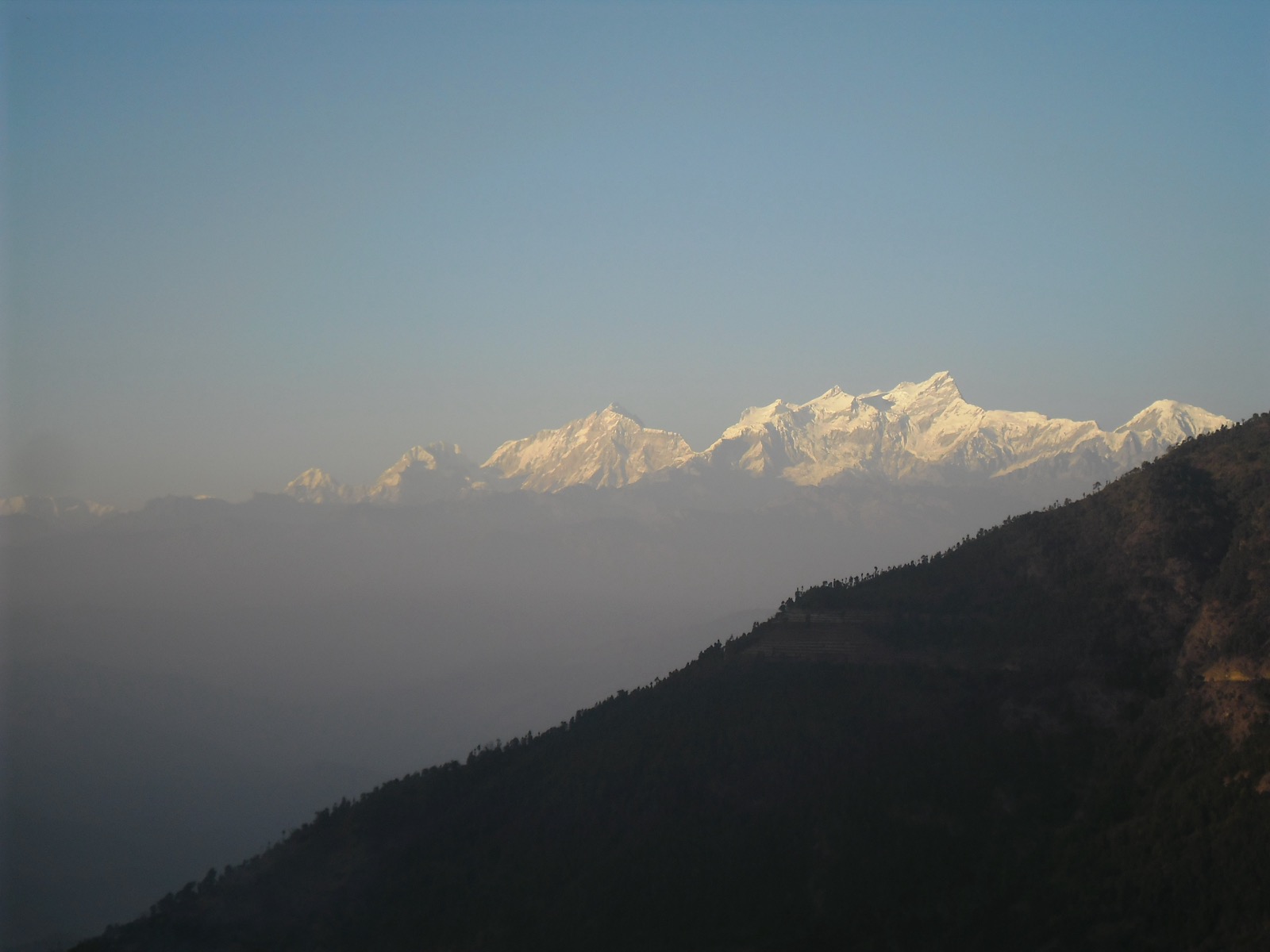
Khalanga, the district headquarters, sits at the top of a spur road that climbs from the Rapti Highway6,4. Salyan has not been explored to its fullest, because of its hard terrain4. This page covers the whole district; other districts are in the districts hub, and the nearby regional capital is under Surkhet.
Where it is
Salyan is one of Nepal’s seventy-seven districts, in Karnali Province1. Rolpa lies to its east, with Surkhet and Bardiya to the west2. The district covers 1,462 km21. Its altitude runs from 300 m in the Babai River basin to 2,000 m in the highlands2; a hilltop north of Salyan, at 2,537 m, is given as its highest point2. The district is called hilly, yet its south-west reaches the lower Siwalik Hills, an extension of the Terai1. The Babai River flows through that south-western section after draining Dang Valley1. The Bheri drains the western half of the hill region, and the Sharad Khola drains the eastern half, including the district centre1. The Sarda river cuts through the lower part of the district and keeps the land fertile3.
The name comes from the Nepali word sallo, pine tree or conifer1. Salyan was one of the Baise Rajya, a confederation of 22 petty kingdoms in the Karnali region, annexed by the Shah dynasty around 1760 during the unification of Nepal1.
Khalanga is the administrative centre, and today it is part of Shaarada Municipality1,6. The District Coordination Committee lists three municipalities, Bagchaur, Banagad Kupinde and Sharada8. Its rural municipalities are Kapurkot, Kalimati, Kumakh, Chhatreshwari, Siddha Kumakh, Triveni and Darma8. Nearby bazaars include Chande, Kapurkot, Darma, Mokhala and Kalimati4.
Getting there
By air
Salyan has no airport, and the closest is Tulsipur Airport4. Nepalgunj is reached by a domestic flight from Kathmandu2. Nepalgunj is highly accessible by road and air from most parts of the country3. See Nepalgunj for the gateway city.
By road
Hop Nepal puts Salyan 518 km west of Kathmandu and says there is no direct bus, so you change vehicles on the way2. Nepal Traveller gives 500 km and lists buses and minibuses to Salyan from Dang, Kathmandu and Nepalgunj4. The two sources disagree on both points.
| Route | Distance or time | Note |
|---|---|---|
| Nepalgunj to Khalanga | 235 km; seven hours by bus (2016 report) | District headquarters3 |
| Tulsipur to Kapurkot | By the Rapti highway | Kapurkot is the gateway to the district3 |
| Surkhet to Salli Bazaar | Follows the Bheri river | Salli Bazaar is in western Salyan3 |
| Khalanga onward | Buses to Tulsipur, Ghorahi and the Mahendra Highway | Spur road climbs from the main highway6 |
A spur road from the Rapti Highway leads to the district headquarters4. Salyan lies 235 km north-east of Nepalgunj, and Kapurkot, the gateway to the district, is also reachable by the Rapti highway from Dang’s Tulsipur3. For long-distance bus detail see buses and jeeps.
When to go
June to August are the finest months for visiting Salyan2. The district’s average temperature ranges from 3.9 to 28.2 degrees Celsius2. Devotees visit the Barahdev shrine by Kupinde Lake twice a year, in February and April3. The Bhawani Bhuwaneswari temple hosts thousands of devotees twice every year3.
Locals say Kupinde Lake changes its hue three times a year3. Greenery of all hues surrounds the villages and hills3.
What to see
Kupinde Lake lies around 24 km west of Khalanga3. Hills surround it on all sides, and it has stayed free from tampering3. It is one of the most beautiful lakes in the Rapti Zone2.
Chattreswori Devi Temple lies 19 km from Khalanga3. It is the only Shaktipith in Nepal where animals are not sacrificed3. The temple complex spreads over more than 50 ropanis of land3. A massive fossil north of the temple is believed to hold the remains of Satidevi3. In local tale, Lord Shiva laid the body of Satidevi at this temple2.
The Kumakh hilltop is a walk of around 2 hours and gives views of Dhaulagiri, Sisne, Chakhure and other peaks2. The Bhawani Bhuwaneswari temple can be reached from Khalanga by road3.
Muplani Botanical Garden was founded in 1990 and covered 5.5 hectares2. It protects more than 30 orchid species2.
Salyan is famous across Nepal for its oranges and ginger3. It also produces Sirupate khukuri knives2.
Population and people
The 2021 census counted 238,515 people in Salyan, the third most populous district of Karnali Province5. The Central Bureau of Statistics report gives that figure; Wikipedia has the same number5,1.
For 2011, the Central Bureau of Statistics national report gives 242,444 people over 1,462 km2, at 166 people per km27. Wikipedia gives 241,716 for the same census and 213,500 for 20011. The CBS figure is the one to use for 2011.
Khas people make up 84% of the population, Chhetris 59% and Magars 15%1. In 2021, 98.26% spoke Nepali as their first language1; the 2011 share was 99.4%1. Literacy stands at 77.30%1. In total, 42.61% of residents live in municipalities1, and 9.68% are under 5 years of age1.
Permits and park fees
One national rule covers every protected area in Nepal.
A park entry permit must be obtained to enter protected areas of Nepal, and entrance fees must be paid9.
The Nepal Tourism Board’s park entry-fee page states that rule9. Fees by park are in national park fees.
Where to stay
Food and accommodation are hard to come by in the district, so make Khalanga your base3. As the headquarters, it has most of the facilities, such as schools, health services and police4. Backpackers should stock up on toiletries and clean clothes before heading out3.
Read next
Surkhet: Birendranagar, gateway to Karnali
Surkhet district guide: Birendranagar, Bulbule Lake, Kankrebihar, the airport, the Ratna and Karnali highways and dated road reports for onward travel.
Getting thereNepalgunj: the airport hub for flights into west Nepal
Nepalgunj guide for west Nepal: Ranjha Airport, flights from Kathmandu, onward flights to Jumla, Simikot, Dolpa and Mugu, climate and the new terminal.
Getting thereBuses and jeeps to Jumla and Mugu: the Karnali Highway road
Road transport to Jumla and Mugu: the Karnali Highway, direct buses, fares, journey times, night driving ban and the accident and landslide record.
Questions travellers ask
What is Salyan District famous for?
Salyan is known for oranges and ginger3, and for Sirupate khukuri knives2. Chattreswori Devi Temple, 19 km from Khalanga, is the only Shaktipith in Nepal where animals are not sacrificed3.
How far is Salyan from Kathmandu by road?
Salyan lies 518 km west of Kathmandu2. No direct bus runs, so travellers change vehicles2. Nepalgunj to Khalanga is 235 km, and a 2016 report gave seven hours by bus3. Nepal Traveller puts Salyan 500 km from Kathmandu4.
Which zone is Salyan?
Salyan sits in Karnali Province1. Under the old zone system, Kupinde Lake in Salyan was placed in the Rapti Zone2.
Sources
- Salyan District, Nepal - Wikipedia · Wikipedia · en.wikipedia.org · checked 20 October 2026
- Salyan District Nepal: Discovering Karnali's Hidden Treasures · Hop Nepal · hopnepal.com · checked 20 October 2026
- Salyan: The district less travelled by · OnlineKhabar English · english.onlinekhabar.com · checked 20 October 2026
- Salyan - Nepal Traveller · Nepal Traveller · nepaltraveller.com · checked 20 October 2026
- Karnali Province census report, National Population and Housing Census 2021 · Central Bureau of Statistics, Nepal · censusnepal.cbs.gov.np · checked 20 October 2026
- Salyan Khalanga - Wikipedia · Wikipedia · en.wikipedia.org · checked 20 October 2026
- National Report, Population Census 2011 (Wayback) · Central Bureau of Statistics, Nepal · cbs.gov.np · checked 20 October 2026
- District Coordination Committee Salyan (Wayback) · DCC Salyan, Karnali Province · ddcsalyan.gov.np · checked 20 October 2026
- Park Entry Fees in Nepal · Nepal Tourism Board · ntb.gov.np · checked 20 October 2026
Image credits (1)
- Balkrishna / Wikimedia Commons · CC BY-SA 3.0 · source

Fees, fares and road conditions change: each note shows the date it was checked. How we check facts · Report an error.