Contents
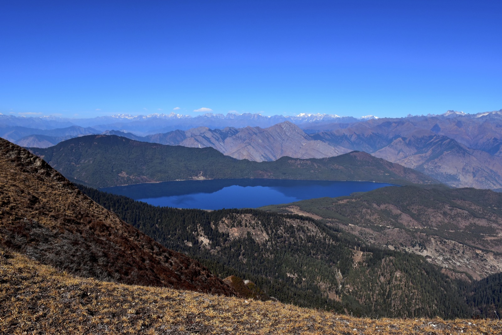
Almost every road journey into Jumla and Mugu runs on one road, the Karnali Highway. It carries the buses, the trucks and the private vehicles. This page covers road transport on that corridor: buses, fares, journey times, crashes and closures. The road itself is in the Karnali Highway guide, and the rest of the access routes are in the getting there hub.
The road the buses use
The Karnali Highway directly connects Surkhet, Dailekh, Kalikot, Jumla and Mugu1. It runs 505 km from Jamunaha to Hilsa8 and links Jumla with Birendranagar, the Karnali capital8. A banner on the Department of Roads home page points “straight to Kalikot and Jumla” along the Karnali Corridor13. A public bus also runs from Surkhet to Gamgadhi, the Mugu district headquarters3.
The surface has a history. The highway was blacktopped with Otta Seal technology in fiscal year 2019-20, with World Bank funding, and the sections break down like this1:
| Section | Length | Note |
|---|---|---|
| Surkhet to Khidkijhyula | 126 km | Blacktopped in fiscal year 2019-201 |
| Khidkijhyula to Jumla | 107 km | Blacktopped in fiscal year 2019-201 |
| Jumla to Kathmandu (direct bus) | about 830 km | Distance of the direct bus run, reported at its April 2015 launch2 |
In a report of 9 July 2026 around 80 percent of that blacktopping had peeled away1.
Direct buses from Jumla and Humla
A direct bus service from Jumla to Kathmandu was launched on Friday 24 April 2015 to mark Loktantra Day, with a first bus carrying eight passengers2. The launch report said it would reach Kathmandu after 36 hours over a distance of about 830 km2.
Humla also has a direct bus to the capital. In January 2026 Kantipur reported on the Humla to Kathmandu direct bus and what it meant for passengers5. A Humla traveller quoted there said the fare alone used to cost more than 7,000 rupees to reach Surkhet5. In January 2025 Kantipur reported that Humla riders paid 6,500 for a 334 km trip9.
In November 2012 the Karnali Transport Operators’ Association Jumla set the long-route bus fares and had raised them more than once, and the increase hit the general public hard4.
How long it takes
An engineer quoted in the Kathmandu Post on 9 July 2026 said that under engineering standards the 232 km journey from Jumla should take about six hours, but that travellers are often forced to spend up to 24 hours on the road1. The same report names narrow roads as one of the reasons the highway is difficult1.
The direct Kathmandu bus was reported at 36 hours at its April 2015 launch2.
Rara Lake is the end of the road on this side. It has no connection to the national road network and is reached on foot from Jumla3; the nearest airports are Talcha in Mugu and Jumla Airport3.
In its report of 9 July 2026 the Kathmandu Post said police had banned vehicles from operating on the highway at night1.
Accident record
Police data in the 9 July 2026 report show the highway accounts for nearly 56 percent of all road accidents recorded across Karnali Province1. The Karnali Province Police Office counted 917 people dead in accidents on the highway since fiscal year 2014-151. Police recorded 4,002 road accidents in Karnali Province over the past decade, with 1,637 deaths, and 34 people were killed in 113 accidents on the highway in the fiscal year then current1. Authorities attribute the rising number of accidents to a combination of factors, including narrow roads and overcrowded vehicles1.
Police identify the stretch between Dahikhola in Dailekh and Galjebazaar in Kalikot as the most dangerous section of the highway, with 98 accidents over three years that killed 35 people1. Two crashes are named in that report:
| Date | Event | Result |
|---|---|---|
| 25 May 2022 | Mugu to Nepalgunj bus crashed at Sisnedanda, Dailekh | Three people died at the scene and 33 were injured1 |
| Early July 2026 | Surkhet to Raskot minibus plunged into the Karnali river at Sangetada, Dailekh | Reported 9 July 2026, with the bus still not found six days later1 |
Kathmandu to Nepalgunj by road
The road from Kathmandu to Nepalgunj follows the Mahendra Highway, and the Department of Roads’ 2017/18 strategic road network statistics list the sections below10.
| Section | Length | Built |
|---|---|---|
| Hetauda-Narayangadh | 77.00 km | 1973 to 198210 |
| Narayangadh-Butwal | 114.00 km | 1969 to 197210 |
| Butwal-Kohalpur | 237.00 km | 1973 to 198510 |
Kohalpur is 428 km west of Hetauda, and a branch runs 13 km south from there to Nepalgunj11. The full run west is in Kathmandu to the far west by road, and the town itself is in the Nepalgunj guide.
Safety measures on the highway
A World Bank results story records that 73,000 metres of crash barriers were installed on eight Strategic Road Network roads, totalling 700 km, between early 2016 and mid-201712. Kalyan in Surkhet and Gadgadeni in Jumla were among the high-risk sections that received them12. The World Bank estimates the barriers may save 3,456 lives over 20 years, on GRSF projections12. A Surkhet-Jumla bus driver quoted in January 2020 said drivers feel at ease on roads with barriers12.
Landslides and closures
In the 9 July 2026 report a Jumla Road Division officer said there is a constant risk of landslides throughout the highway, and that most of the maintenance budget is spent dealing with them1. Nearly Rs670 million had been spent on maintenance over the three fiscal years to the July 2026 report1. The Jumla Road Division Office terminated 16 long-delayed highway contracts1.
Two closures show how it plays out in the rains. On 17 August 2025 landslides blocked the highway at Gaganekhola and Bihani in Kalikot, at Khidki Jyula in Dailekh and near Nagma on the road to Mugu, and vehicles heading to Surkhet via Kalikot were stranded at several locations6. On 27 August 2025 the Surkhet to Jumla section was brought to a standstill after a road collapse at Kalikhola in Kalikot, and authorities urged travellers, including tourists heading to Jumla, to use alternative routes until repairs were completed7.
Both closures were reported in August 20256,7. The wider pattern across the western highways is in monsoon road closures, and the best months to avoid the rains are in best time to visit west Nepal. For the district at the end of the road, see Mugu.
Read next
Karnali Highway: route, dated closure reports and safety record
Karnali Highway (NH58) from Banke to Hilsa: the route, how it opened, dated landslide and collapse reports from 2025 and the July 2026 accident figures.
District guidesJumla: Chandannath, the airport and the Karnali Highway
Jumla district guide: Chandannath, Jumla Airport, the Karnali Highway from Surkhet, the history of the Khas kingdom and dated road reports for travellers.
District guidesMugu: Rara Lake, Talcha airport and the roads in
Mugu district guide for Rara Lake: Gamgadhi, Talcha airport, getting in from Surkhet and Jumla, the best months, the permit and where to stay.
Questions travellers ask
How can I get to Rara Lake from Nepalgunj?
The Karnali Highway links Surkhet, Dailekh, Kalikot, Jumla and Mugu1, and a public bus runs from Surkhet to Gamgadhi, the Mugu headquarters3. The lake has no connection to the national road network and is reached on foot from Jumla3.
How long does the road to Jumla take?
An engineer quoted in a report of 9 July 2026 said the 232 km from Jumla should take about six hours under engineering standards, yet travellers are often forced to spend up to 24 hours on the road1. At its April 2015 launch the Jumla to Kathmandu direct bus was reported at 36 hours over about 830 km2.
Is it safe to travel by bus on the Karnali Highway?
Police data in a report of 9 July 2026 put nearly 56 percent of Karnali Province's road accidents on the highway, and 917 people had died on it since fiscal year 2014-151. Authorities cite narrow roads and overcrowded vehicles, and the report said police had banned night operation1.
How much does the bus cost?
In a report of January 2026 a Humla traveller said the fare alone to reach Surkhet used to cost more than 7,000 rupees, in a report on the Humla to Kathmandu direct bus5. A November 2012 report said the Karnali Transport Operators' Association Jumla fixed long-route fares and had raised them more than once4.
How to reach Rara Lake by road?
The Karnali Highway links Surkhet, Dailekh, Kalikot, Jumla and Mugu1, and a public bus runs from Surkhet to Gamgadhi, the Mugu headquarters3. Rara Lake has no connection to the national road network, so the last leg from Jumla is on foot3.
How do you travel from Kathmandu to Nepalgunj by road?
Take the Mahendra Highway west: Kohalpur is 428 km west of Hetauda, and a branch runs 13 km south from there to Nepalgunj11. The Department of Roads lists Hetauda-Narayangadh at 77 km, Narayangadh-Butwal at 114 km and Butwal-Kohalpur at 237 km10.
Sources
- Karnali Highway remains province's deadliest road despite millions spent on repairs · The Kathmandu Post · kathmandupost.com · checked 19 October 2026
- Direct bus service from Karnali to Kathmandu marks Loktantra Day (24 April 2015) · myRepublica (RSS) · myrepublica.nagariknetwork.com · checked 19 October 2026
- Rara Lake - Wikipedia · Wikipedia · en.wikipedia.org · checked 19 October 2026
- Karnali bus fare goes up, general public hit hard (10 November 2012) · myRepublica · myrepublica.nagariknetwork.com · checked 19 October 2026
- Humla-Kathmandu direct bus service, convenience for passengers · Kantipur · ekantipur.com · checked 19 October 2026
- Landslides block Karnali Highway · The Kathmandu Post · kathmandupost.com · checked 19 October 2026
- Karnali Highway blocked after road collapse in Kalikot · The Himalayan Times · thehimalayantimes.com · checked 19 October 2026
- Karnali Highway - Wikipedia · Wikipedia · en.wikipedia.org · checked 19 October 2026
- Humli on the price of frequent fares: 6,500 is paid for traveling 334 km (Kantipur, AI-translated, 14 Jan 2025) · Kantipur (ekantipur) · ekantipur.com · checked 20 October 2026
- Statistics of Strategic Road Network 2017/18, Table 9: List of important SRN and status (Part 10) · Department of Roads, Government of Nepal · dor.gov.np · checked 20 October 2026
- Mahendra Highway - Wikipedia · Wikipedia · en.wikipedia.org · checked 20 October 2026
- Enhancing the Safety of Nepal's Mountain Roads (World Bank results story, 10 Nov 2020) · World Bank · worldbank.org · checked 20 October 2026
- Department of Roads (home page) · Department of Roads, Nepal · dor.gov.np · checked 20 October 2026
Photos (1)
- Prabeshsdev, with additional fixes by W.carter, CC BY-SA 4.0

Fees, fares and road conditions change: each note shows the date it was checked. How we check facts · Report an error.