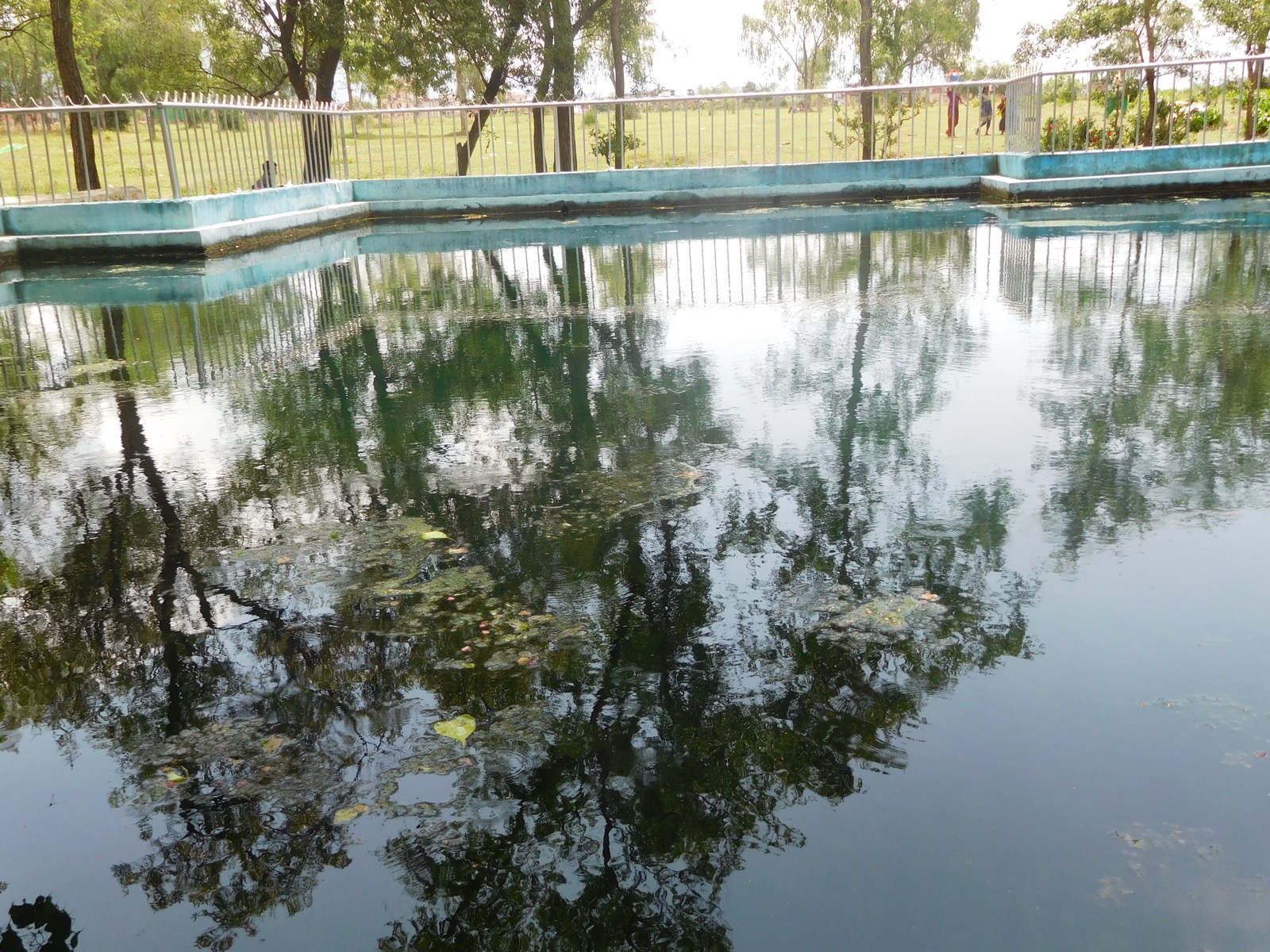
Surkhet is a hub for the remoter districts of Kalikot, Jumla, Mugu, Jajarkot and Salyan1. Birendranagar, the district headquarters, is the provincial capital1. This page covers the district and the town; the other far-west districts are in the districts hub, and the road north is on the Karnali Highway page.
Where it is
Surkhet is a district in Karnali Province, about 600 km west of Kathmandu1. Birendranagar is its district headquarters and the capital of Karnali Province1. Surkhet is a hub for the remoter districts of Kalikot, Jumla, Mugu, Jajarkot and Salyan1. Surkhet Valley is one of the Inner Terai Valleys of Nepal1. Wikipedia’s text gives the district 415,126 people at the 2021 census, while its infobox gives 417,7761.
Birendranagar municipality stands at about 665 m above sea level, in a valley, and had 153,863 residents in 20212. Its climate is moderate, being neither too cold nor too hot2. Wikipedia gives winter lows of about 5 °C and summer highs of 38 °C1. The city was named after King Birendra in 1972; it was previously called Chauhanchaur2. It is one of Nepal’s few cities built under a master plan1. The valley is bowl-shaped, with the Mahabharat range’s Ranimatta and Ratanangla to the north and the Chure range’s Harre and Deurali to the south, and the Bheri River flanks the city to the east and the Karnali to the west2.
The municipality’s guide gives the first settlement as 19662. Before that the district headquarters was at Gadhi, because malaria infected the lowland valley, which was mostly inhabited by Tharu and Raji communities2. After malaria was eradicated, people from the hills of Surkhet and Dailekh and other parts of Karnali moved into the valley, and the government offices followed2.
Getting there
By air
In October 2026 Surkhet Airport in Birendranagar was listed with regular flights to Kathmandu, Nepalgunj and Jumla and other districts1. The airport was established in 19652. For the flights into the hills see flights to Jumla.
By road
The Ratna Highway links Surkhet to the rest of Nepal1; the municipality’s guide dates its completion to 1981 and calls the city a vital gateway to the districts of Karnali since then2. The Karnali Highway directly connects Surkhet, Dailekh, Kalikot, Jumla and Mugu3. It is 232 km long6. The passage was opened in 20076, and 17 km were blacktopped in 20106. The road was blacktopped using Otta Seal technology in fiscal year 2019-203. With Rs1 billion from the World Bank, the government blacktopped 126 km from Surkhet to Khidkijhyula and a further 107 km from Khidkijhyula to Jumla3.
In July 2026 around 80 percent of that blacktopping had peeled away, and the 232 km journey that should take about six hours often took up to 243. The Kathmandu Post called the Karnali Highway the deadliest road in Karnali Province despite years of repairs, and police data attributed nearly 56 percent of all road accidents in the province to it3.
| Date | Report | Place |
|---|---|---|
| 2010 | Monsoon landslides closed the highway; it reopened on 3 October6 | Karnali Highway6 |
| 17 August 2025 | Landslides blocked sections; vehicles heading to Surkhet via Kalikot were stranded4 | Kalikot, Dailekh and Jumla4 |
| 27 August 2025 | A road collapse brought the Surkhet-Jumla section to a standstill5 | Kalikhola, Kalikot5 |
The sections beyond Surkhet are covered in Dailekh, Kalikot and Jumla. The rains are discussed in monsoon road closures.
What to see
The main sites are Kankrebihar, Bulbule, Deuti Bazzai, Ghantaghar, Shahid Park, Patalganga, Gadhi and Jarbuta2.
Bulbule Lake
Bulbule Lake covers 31.5 bighas and is one of the main tourist attractions in Karnali Province, at about 657 m above sea level2. Its park has picnic areas, boat rides, gardens and a children’s park2. The lake is named after bubbling water emerging from the ground, and its main attraction is a set of ten taps built to gather that water2. Conservation began in 1972, after King Birendra’s visit to Surkhet2. The Surkhet Valley Urban Development Committee manages the park, whose popularity has grown since motorboat services began2. It is open every day2. It is about 1.6 km from Mangalgadhi Chowk, a 3-minute drive on a paved road2.
Kakre Bihar
Kakre Bihar, spelt Kankrebihar in the Birendranagar Municipality guide, is the remains of an old Buddhist monastery and is on the list of national heritage sites in Nepal1. It takes about 40 minutes on foot from Surkhet Bus Park, or around 13 minutes by vehicle on the paved road2. The surrounding forest is the first forest protection area of Nepal2. A 2021 butterfly study published in a Surkhet journal on NepJOL found butterfly diversity in the protected forest highest after the monsoon and lowest in winter7.
Historians cited in the municipality’s guide say Ashok Challa, then king of Sinja, built the 60-foot Shikhar-style temple in 1325 BS2. The Department of Archaeology has rebuilt the steps around it in two phases2. The site stands 4 km south of Mangalgadhi Chowk, on Latikoili Hill in Ward 92.
Other sights
Ghantaghar was established in 1988 with the assistance of the Chinese Government, with large clocks imported from Japan on all four sides of the tower2. It is a 3-minute drive from Mangalgadhi2. Shahid Park, in Ward 4, covers three hectares of Bhairav Community Forest and was built in memory of the martyrs of the Karnali Province Movement2. It is about 2.5 km from Mangalgadhi Chowk, around 10 minutes by vehicle2. Deuti Bazzai Temple, in Ward 10, is linked with the Raji community and stands about 1 km south of the Ratna Highway2. The Province Museum is open every day except Tuesday and public holidays2. Bayalkanda Gadhi Fort is about 13 km north on the paved road towards Dailekh, around 30 minutes by vehicle, and the whole Surkhet Valley can be seen from it2. There are no records of who built it; local elders and historians believe the Gorkhali army built it during Bahadur Shah’s reign2. A Batuk Bhairav temple stands about 50 m west of the fort2. The municipality’s guide notes comparisons with Sarangkot in Pokhara because of paragliding landings in the valley2.
The Bheri river is a common destination for rafting1; Ranighat serves as the landing site for rafting that starts from the Bheri Bridge2. Paragliding has started in the valley1.
Where to stay and permits
Wikipedia’s Surkhet page lists thousands of hotels, inns and lodges at Birendranagar1. Community-operated homestays have contributed to the town’s tourism2. The first stop on the road north, in neighbouring Dailekh, is covered under Dailekh.
Restricted-area trekking in Nepal needs a permit from the Department of Immigration in Kathmandu, and the holder must show it to immigration staff or police on request, as set out on the Nepal Tourism Board permit page8. Restricted-area fees are in restricted-area permits.
Read next
Dailekh: Panchakoshi, Dullu and the road from Surkhet
Dailekh district guide: Pancha Koshi shrines, the Bhurti temple complex, Dullu, Mahabu, how to reach it from Surkhet and dated reports on the Karnali Highway.
District guidesJumla: Chandannath, the airport and the Karnali Highway
Jumla district guide: Chandannath, Jumla Airport, the Karnali Highway from Surkhet, the history of the Khas kingdom and dated road reports for travellers.
Getting thereKarnali Highway: route, dated closure reports and safety record
Karnali Highway (NH58) from Banke to Hilsa: the route, how it opened, dated landslide and collapse reports from 2025 and the July 2026 accident figures.
Questions travellers ask
In which province does Surkhet lie?
Surkhet is a district in Karnali Province, one of the 77 districts of Nepal1. Its headquarters, Birendranagar, is the capital of Karnali Province1.
In which province is Birendranagar located?
Birendranagar is in Surkhet District, Karnali Province, and is the provincial capital1. It stands at about 665 m above sea level and about 600 km from Kathmandu2.
What are the most famous places to visit in Surkhet district?
The main sites are Kankrebihar, Bulbule Lake, Deuti Bazzai, Ghantaghar, Shahid Park, Patalganga, Gadhi and Jarbuta2. Bulbule Lake is one of the main tourist attractions in Karnali Province2.
How do I visit Kakre Bihar from Surkhet?
From Surkhet Bus Park it takes about 40 minutes on foot to Kakre Bihar, or around 13 minutes by vehicle on the paved road2. The site is the remains of an old Buddhist monastery and is on Nepal's list of national heritage sites1.
How long is the road from Surkhet to Jumla?
The Karnali Highway runs 232 km, and by engineering standards the journey should take about six hours; in July 2026 travellers were often spending up to 24 hours on the road3.
Sources
- Surkhet District · Wikipedia · en.wikipedia.org · checked 19 October 2026
- Destination Birendranagar (photo guide) · Birendranagar Municipality · birendranagarmun.gov.np · checked 19 October 2026
- Karnali Highway remains province's deadliest road despite millions spent on repairs · The Kathmandu Post · kathmandupost.com · checked 19 October 2026
- Landslides block Karnali Highway · The Kathmandu Post · kathmandupost.com · checked 19 October 2026
- Karnali Highway blocked after road collapse in Kalikot · The Himalayan Times · thehimalayantimes.com · checked 19 October 2026
- Karnali Highway · Wikipedia · en.wikipedia.org · checked 19 October 2026
- Kakrebihar protected forest butterfly diversity study · Surkhet Journal (NepJOL) · nepjol.info · checked 19 October 2026
- Trekking Permit in Nepal · Nepal Tourism Board · ntb.gov.np · checked 19 October 2026
Photos (1)
- Janak Poudel, CC BY-SA 4.0

Fees, fares and road conditions change: each note shows the date it was checked. How we check facts · Report an error.