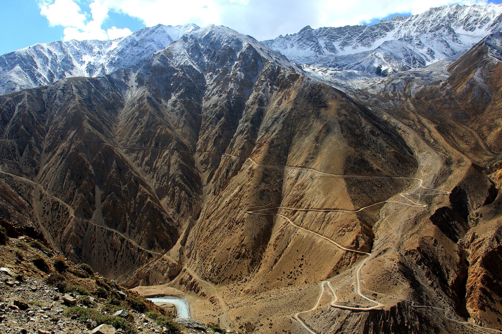
Humla is the Nepal end of the pilgrimage to Mount Kailash: the route runs from Simikot up the Humla Karnali to Hilsa on the Tibet border, and the Nepal section of the Great Himalaya Trail ends at Hilsa1. The route has historically been an ancient foot trail along the mountain slopes on the left side of the Humla Karnali1. This page sets out the walk, an operator’s full itinerary, the high points, the season, permits and costs. The district is covered in Humla, and the other long routes are in the treks hub.
Route and days
On foot, the Simikot to Hilsa walk takes 4 to 5 days with overnight stops at a few villages on the way1. Travel companies offer helicopter flights over the same distance, which take about 20 minutes1. The distance is about 92 km by the jeep road in ABC Adventures’ itinerary2. A detour at the confluence of the Humla Karnali and Salli Khola leads to Hilsa by the Nyalu La pass and the Limi valley1; that variant is on the Limi Valley trek page.
In October 2026 ABC Adventures’ 2027 jeep itinerary from Lucknow ran 11 days and drove Simikot to Hilsa instead of walking2. Its stages, with the operator’s elevations:
| Day | Stage | Elevation and distance |
|---|---|---|
| 1 | Lucknow to Nepalgunj by road | 150 m2 |
| 2 | Fly Nepalgunj to Simikot | 2,910 m, about 50 minutes2 |
| 3 | Jeep Simikot to Hilsa | 3,640 m, about 92 km, 5 to 6 hours2 |
| 4 | Walk across the Karnali bridge at Hilsa, road to Purang | 3,900 m2 |
| 5 | Purang to Lake Mansarovar | 4,590 m, about 110 km, 2 to 3 hours2 |
| 6 | Lake Mansarovar to Darchen | 4,670 m2 |
| 7 | Darchen to Diraphuk, parikrama day 1 | 4,900 m, about 13 km, 7 to 8 hours on foot2 |
| 8 | Diraphuk to Zuthulphuk, parikrama day 2 | 4,790 m, about 22 km, 9 to 10 hours2 |
| 9 | Zuthulphuk to Purang, parikrama day 3 | About 8 km, 3 hours on foot2 |
| 10 | Purang to Simikot | Drive to Sher, 20-minute walk to Hilsa, jeep Hilsa to Simikot about 92 km, 5 to 6 hours2 |
| 11 | Fly Simikot to Nepalgunj | Return flight2 |
Highest point
On ABC Adventures’ itinerary the highest point is Dolma La at 5,630 m, crossed on day 8 of the circuit, the 22 km parikrama day2. The operator’s header lists the same 5,630 m as the highest altitude, with a difficulty of moderate to strenuous2.
On the Nepal side the high point of the walk is the Nara La pass on the Simikot to Hilsa route, which Wikipedia gives as 4,530 m in its text and 4,535 m in a photo caption1. Hilsa itself is at 3,640 m on the operator’s figure2. Simikot is at 2,910 m on the same itinerary2.
Humla at a glance
Humla is a district in Karnali Province in north-western Nepal, and it is the second-largest district in the country by area1. Simikot is its administrative headquarters1. The 2011 census recorded 50,858 people1.
On the page seen in October 2026, Wikipedia gave Humla as reachable only by air or on foot, with a motorable road from Hilsa to Simikot still being built1. That conflicts with ABC Adventures, which runs a jeep between Simikot and Hilsa on days 3 and 10 of its 2027 itinerary2. Humla has grown in significance as a preferred route for the Kailash pilgrimage1. The road from Tibet ends in Humla at Hilsa, on the border1, and the trekking route to Tibet starts from Simikot1.
The wider Kailash Sacred Landscape spreads across remote parts of the Tibet Autonomous Region of China and contiguous areas of Nepal and India5. The nonprofit ICIMOD’s feasibility assessment report is the source for that description.
Season
ABC Adventures gives May to September as the best season, and its 2027 fixed departures run from 10 May 2027 to 30 September 20272.
The Embassy of India’s page, last updated 19 October 2026, advises avoiding travel during or near full moon days: the pilgrimage then sees a high density of travellers and overbooking, with incidents of pilgrims being stranded in Simikot and Hilsa4. The same page gives the Simikot and Hilsa route as connected only through air, which needs fair weather and visibility to remain open, so delays of days are possible at all points4. ABC Adventures’ jeep stage on the same stretch conflicts with that2. Flight options are covered in flights to Simikot.
Permits
In October 2026 the Department of Immigration’s trekking route and permit fee table priced Humla at USD 50 per person per week, with USD 10 per day beyond 1 week3. The areas named are Simikot Rural Municipality wards 1, 6 and 7, Namkha Rural Municipality wards 1 to 6 and Changkheli Rural Municipality wards 3 to 53.
| Area | Permit | After the first week | Seen |
|---|---|---|---|
| Humla | USD 50 per person per week | USD 10 per day | October 20263 |
For Indian pilgrims, the Embassy of India’s guidance sets out these steps: a Chinese visa and a travel permit for the Tibetan Autonomous Region before the journey starts, the Chinese visa from the Chinese embassy in New Delhi and not Kathmandu, and a Nepal restricted-area permit for Simikot and Hilsa obtained by the travel agent4. ABC Adventures’ package includes all Xizang Autonomous Region permits2. See Kailash via Humla and restricted-area permits.
Costs
ABC Adventures’ package for the 11-day jeep trip includes the Nepalgunj to Simikot and back airfare and the Simikot to Hilsa jeep round trip2.
The extras are in yuan. In October 2026 the page priced a horse and horseman at Yuan 3,000 for 3 days and a personal porter at Yuan 1,500 for 3 days for the Kailash parikrama, and advised carrying Yuan 5,000 per person for additional expenses2.
The Embassy of India’s page lists no ATM facilities in Simikot or Hilsa and advises carrying adequate cash for emergencies4.
Getting to the trailhead
The trailhead is Simikot. ABC Adventures flies Nepalgunj to Simikot in about 50 minutes on day 2 of its itinerary2. Simikot is the starting point for trekking and mountaineering in Humla, reached through Simikot Airport, and the trekking route to Tibet starts there1.
The Embassy of India’s page puts medical facilities in Simikot and Hilsa as minimal or absent4. For the transit city, see Nepalgunj.
Read next
Humla: Simikot, the Kailash route and the permit
Humla district guide: Simikot, how to reach it by air and on foot, the route to Hilsa and Kailash, the restricted-area permit fee and who can issue it.
Getting thereFlights to Simikot: Nepalgunj and Surkhet schedules for Humla
Flights to Simikot, Humla: the Nepal Airlines October 2026 timetable from Nepalgunj and Surkhet, other operators, airport facts and the way on to Hilsa.
TreksLimi Valley trek: route, days, season, permits and cost
Limi Valley trek in Humla: a day-by-day stage table from Simikot, the passes, the best months, the Humla permit fee and what an operator charges.
Questions travellers ask
How long is the walk from Simikot to Hilsa?
A 4 to 5 day walk from Simikot to Hilsa, with overnight stops at a few villages, crossing the 4,530 m Nara La pass1. ABC Adventures drives the same stretch by jeep, about 92 km in 5 to 6 hours2.
What is the distance between Simikot and Hilsa?
About 92 km by jeep, which takes 5 to 6 hours on ABC Adventures' day 32. On foot the same stretch is a 4 to 5 day walk over the 4,530 m Nara La pass1, and a helicopter covers it in about 20 minutes1.
When is the best time to go to Kailash via Humla?
May to September is the season on ABC Adventures' plan, and its 2027 fixed departures run from 10 May to 30 September 20272. The Embassy of India advises avoiding full moon days, when overbooking has left pilgrims stranded in Simikot and Hilsa4.
What permit do I need to walk from Humla to Kailash?
In October 2026 the Department of Immigration's table priced Humla at USD 50 per person per week, with USD 10 per day beyond 1 week3. The Embassy of India's pilgrim guidance adds a Nepal restricted-area permit for Simikot and Hilsa, a Chinese visa from New Delhi and a travel permit for the Tibetan Autonomous Region4.
Sources
- Humla District - Wikipedia · Wikipedia · en.wikipedia.org · checked 19 October 2026
- Kailash Mansarovar Yatra 2027 - LKJ - Jeep via Humla, ex-Lucknow · ABC Adventures · abcadventures.com.np · checked 19 October 2026
- Trekking Route and Permit Fee · Department of Immigration, Nepal · immigration.gov.np · checked 19 October 2026
- Kailash Mansrovar yatra Via Nepal · Embassy of India, Kathmandu · indembkathmandu.gov.in · checked 19 October 2026
- Kailash Sacred Landscape Conservation Initiative: Feasibility Assessment Report · ICIMOD · lib.icimod.org · checked 20 October 2026
Photos (1)
- Sherparinji, CC BY-SA 3.0

Fees, fares and road conditions change: each note shows the date it was checked. How we check facts · Report an error.