Contents
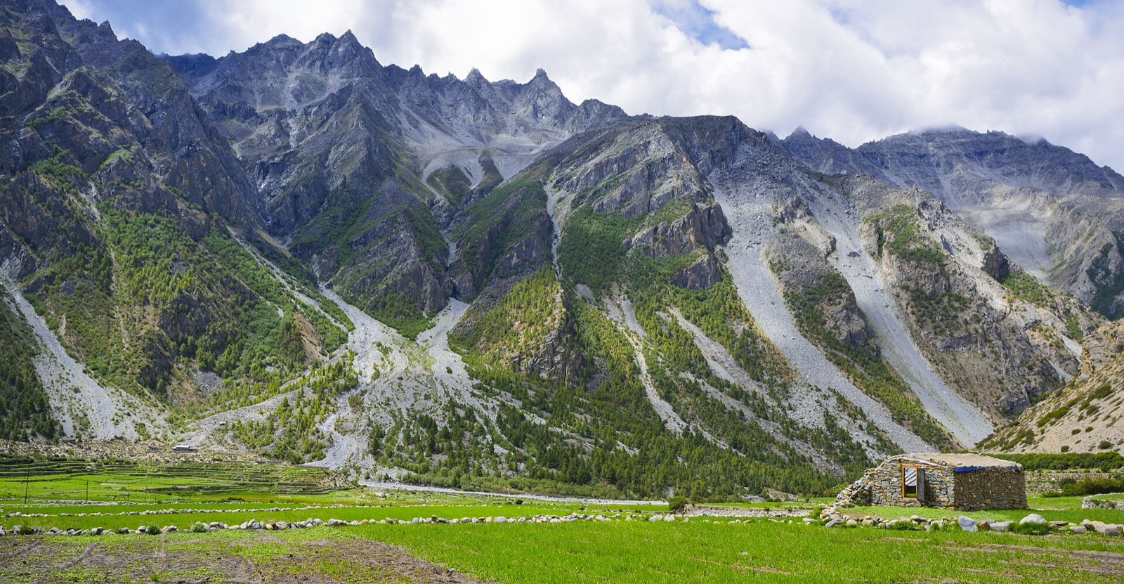
The Limi Valley is the northernmost part of Humla and borders Tibet3. The trek follows an ancient trading and pilgrim route over high passes, and it opened to foreigners only in 20024. Humla itself is covered in Humla, and the other long routes are in the treks hub.
Route and days
Himalayan Exploration gives two day counts: a header of 12 days starting and ending at Simikot, and an itinerary that runs to 21 days from arrival in Kathmandu to final departure1. The page carries two versions of that itinerary, an outline and a day-by-day detail, and they differ: the outline gives Kermi at 2,650 m and 5.5 hours, Yari at 4 hours 45 minutes, Jang at 3,960 m, Talung at 7 hours and the second Kermi stage at 6 hours1. The stage table below follows the day-by-day detail, which gives Kermi (day 6) 4 hours, Yari 5 hours, Jang 3,930 m, Talung 8 hours and the second Kermi stage 7 hours1. The header rates the trek moderate, with camping as the accommodation1. Its stages:
| Day | Stage | Elevation and walk time |
|---|---|---|
| 1 | Arrive in Kathmandu | 1,350 m1 |
| 4 | Fly Nepalgunj to Simikot | 2,950 m1 |
| 5 | Trek to Dharapuri | 2,300 m, 5 hours1 |
| 6 | Trek to Kermi | 4 hours1 |
| 7 | Trek to Yalbang | 3,010 m, 6 hours1 |
| 8 | Trek to Tumkot | 3,380 m, 6 hours1 |
| 9 | Trek to Yari | 3,690 m, 5 hours1 |
| 10 | Trek to Hilsa via Nara La | 3,720 m at Hilsa, pass at 4,620 m1 |
| 11 | Trek to Manepema | 3,990 m, 6 hours1 |
| 12 | Trek to Til | 4,000 m, 6 hours1 |
| 13 | Trek to Halji | 3,670 m, 4 hours1 |
| 14 | Trek to Jang | 3,930 m, 4 hours1 |
| 15 | Trek to Talung | 4,370 m, 8 hours1 |
| 16 | Trek to Shingjuma via Nyalu La | 3,620 m at Shingjuma, pass at 4,950 m, 8 hours1 |
| 17 | Trek to Kermi | 2,670 m, 7 hours1 |
| 18 | Trek to Simikot | 2,950 m, 7 hours1 |
| 19 | Fly Simikot to Kathmandu with a stop at Nepalgunj | Return flight1 |
| 21 | Final departure | 1 |
The valley itself has only three settlements, Dzang, Halji and Til3. Wikipedia gives their elevations as 3,920 m, 3,700 m and 4,100 m3; the operator’s table gives 4,000 m for Til, 3,670 m for Halji and 3,930 m for Jang1. Magical Nepal names Halji, Jang and Til as the three villages instead, so the village list differs by source4. Where the elevations differ, this page uses the operator’s table.
How long is the trek, and which way in
From Simikot there are two walking routes into the valley. The first follows the Humla Karnali upstream to Hilsa, crosses the river there and climbs east to enter the valley near Til; the walk takes 5 to 7 days3. The second turns north at the confluence of the Salli Khola and the Humla Karnali, crosses the Nyalu pass, enters the Talung valley and reaches the Limi valley near Takche in 4 to 5 days3. The operator’s table passes through both Hilsa and Nyalu La1.
Great Himalaya Trail lists the Salli Khad pass at 3,144 m, 35 minutes of climbing, and a minor pass above Simikot that takes 3 hours5. Much of the circuit follows ancient trade routes linking Tibet, Nepal and India5.
Passes and highest point
The two high points on Himalayan Exploration’s table are Nara La at 4,620 m, crossed on day 10, and Nyalu La at 4,950 m, crossed on day 161. Wikipedia and ICIMOD both give the Nyalu pass as 4,995 m, and it is the major entry point into the Limi Valley3,6. This page uses the operator’s 4,950 m only when quoting its table. Nara La differs too: 4,620 m in the operator’s table, 4,580 m on Magical Nepal’s page and 4,560 m on Great Himalaya Trail’s1,4,5. The header of the same page lists a maximum altitude of 4,200 m, which is below both passes in its own table1.
Magical Nepal names the Nyala Pass as the highest elevation of its trek, with the Lamka La Pass at 4,300 m and Limi Lapcha, also called Lapcha Syar, at 4,900 m4. Talung, the camp before Nyalu La, sits at 4,370 m on the Himalayan Exploration table1. Great Himalaya Trail puts Simikot at 2,985 m in its flight note, against 2,950 m on the Himalayan Exploration table5,1.
Season
April to the end of November is the good-weather window on Himalayan Exploration’s page, and Great Himalaya Trail gives the same months1,5. Most trekkers visit Humla and Limi in the monsoon as part of a pilgrimage to Mount Kailash1. Outside the warm summer months of June to September there are few trekkers on the trail1,5. Logistics can be problematic in summer, and local porters demand high pay rates1.
The area has a harsh climate and a lot of snow, and a study of Limi settlement relocations by Kropacek and Hovden lists a snow disaster in October 2014 among its natural hazards7. The Humla road and flight links to the trailhead are in flights to Simikot.
Permits
Humla is a Department of Immigration trekking-permit area. In October 2026 the trekking route and permit fee table listed Humla at USD 50 per person per week, with USD 10 per day beyond 1 week, for Simikot Rural Municipality wards 1, 6 and 7, Namkha Rural Municipality wards 1 to 6 and Changkheli Rural Municipality wards 3 to 52. Limi is a ward of Namkha Rural Municipality3.
| Area | Permit | After the first week | Seen |
|---|---|---|---|
| Humla | USD 50 per person per week | USD 10 per day | October 20262 |
Himalayan Exploration’s inclusions list all necessary documentation and permits1. The Department of Immigration’s USD 50 per week2 differs from the US$90 per person for ten days in Himalayan Exploration’s own text1. Magical Nepal adds that only limited permits are issued each year to protect the Limi Valley ecosystem4. How the system works is in restricted-area permits.
Costs
In October 2026 Himalayan Exploration listed the trek at USD 2,860 per person1. The package includes domestic flights, airport and hotel transfers, Kathmandu accommodation with breakfast, tent accommodation and all meals on the trek1.
There are few lodges on the Limi Valley circuit, so camping is the only alternative1. The package excludes international airfare, the Nepal visa fee, meals in Kathmandu other than breakfast and personal expenses1. Rations and fuel can be costly at Simikot, so more valuable goods are better brought from Nepalgunj1. Great Himalaya Trail’s page gives the same warning and, as seen in October 2026, lists daily morning flights to Simikot5.
The villages and what you see
Til is the smallest of the three villages and is surrounded by fields of barley4. Rizing Ling Gompa, a Drukpa Kagyu monastery, stands nearby4. ICIMOD names the Limi Valley, Lapcha La Pass and Rinchenling Monastery as attractions in Namkha’s five-year tourism plan6.
Halji has an ancient Buddhist monastery7. Local people told the Kropacek and Hovden study that Halji was moved many generations ago, seeking refuge around the monastery, and that Til was moved over water availability and irrigation problems7. The largest communities of the area call themselves Bhotia, people from Tibet5. Losar, the New Year festival, runs for 15 days in the Limi villages, and the Rimche festival, with lama dancing, falls on the February to March full moon for 3 days5.
The Limi river drains the valley into the Humla Karnali3. Wild yaks, once thought extinct, were rediscovered here in 2014, and the valley is home to snow leopards and Himalayan blue sheep4. Namkha is also a gateway to the Kailash-Mansarovar area in Pulan, where thousands make a pilgrimage every year6.
Getting to the trailhead
The trailhead is Simikot, the Humla headquarters3. On Wikipedia’s account Simikot is reached by bus on the Karnali highway or by flight from Nepalgunj3. Himalayan Exploration’s table flies Kathmandu to Nepalgunj on day 3 and Nepalgunj to Simikot on day 41. Read Nepalgunj for the transit city.
On the way back the table flies Simikot to Kathmandu on day 19 with a stop at Nepalgunj1. For the pilgrim route along the same river to the border, see Humla to Kailash.
Read next
Humla: Simikot, the Kailash route and the permit
Humla district guide: Simikot, how to reach it by air and on foot, the route to Hilsa and Kailash, the restricted-area permit fee and who can issue it.
Getting thereFlights to Simikot: Nepalgunj and Surkhet schedules for Humla
Flights to Simikot, Humla: the Nepal Airlines October 2026 timetable from Nepalgunj and Surkhet, other operators, airport facts and the way on to Hilsa.
TreksHumla to Kailash: Simikot to Hilsa route, days, season and permits
Simikot to Hilsa on the Humla route to Kailash: the 4 to 5 day walk, a jeep itinerary stage table, Dolma La, the season, permits and extra costs.
Questions travellers ask
How many days is the Limi Valley trek?
Himalayan Exploration's page shows 12 days in its header and a 21-day itinerary table from Kathmandu arrival to departure1. From Simikot, Wikipedia gives 5 to 7 days on foot by the Hilsa route and 4 to 5 days by the Nyalu La route3.
When is the best time to trek the Limi Valley?
Himalayan Exploration gives April to the end of November1. Most trekkers on Humla and Limi routes go in the monsoon as part of a pilgrimage to Mount Kailash, and logistics can be problematic in summer, with local porters demanding high pay rates1.
What permit does the Limi Valley trek need?
In October 2026 the Department of Immigration listed Humla at USD 50 per person per week, with USD 10 per day beyond 1 week, for Simikot, Namkha and Changkheli rural municipalities2. Limi is a ward of Namkha Rural Municipality3.
How much does the Limi Valley trek cost?
In October 2026 Himalayan Exploration listed USD 2,860 per person, covering domestic flights, tent accommodation and all meals on the trek1. International airfare and meals in Kathmandu other than breakfast are excluded1.
Sources
- Limi Valley Trek · Himalayan Exploration Travel · himalayanexploration.com · checked 19 October 2026
- Trekking Route and Permit Fee · Department of Immigration, Nepal · immigration.gov.np · checked 19 October 2026
- Limi - Wikipedia · Wikipedia · en.wikipedia.org · checked 19 October 2026
- Humla Limi Valley Trek · Magical Nepal · magicalnepal.com · checked 20 October 2026
- Limi Valley Circuit · Great Himalaya Trail · greathimalayatrail.com · checked 20 October 2026
- From a gateway to a destination: Developing Namkha as a transboundary tourism hub · ICIMOD · icimod.org · checked 20 October 2026
- Relocations of settlements in Limi Valley in Humla driven by natural hazards (slides) · Jan Kropacek and Astrid Hovden, hosted by ICIMOD · icimod.org · checked 20 October 2026
Photos (1)
- Sabin Adhikari, CC BY-SA 4.0

Fees, fares and road conditions change: each note shows the date it was checked. How we check facts · Report an error.