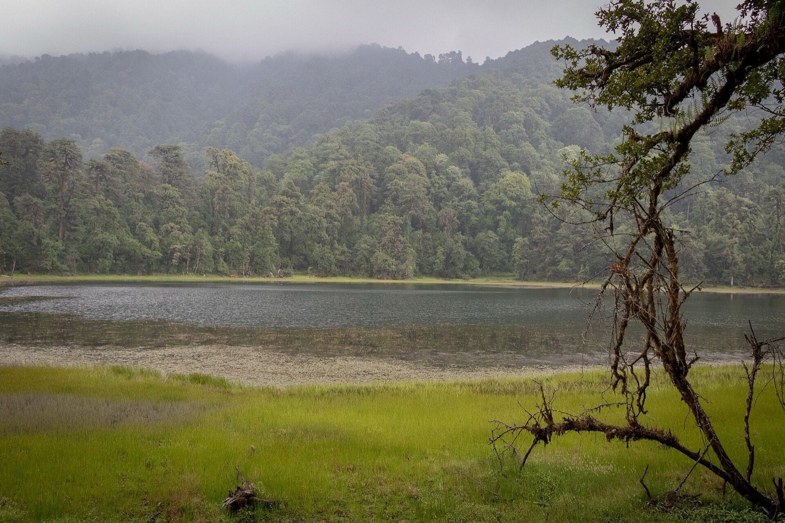
Achham is a mid-hill district of the far west and one of the remotest in the country1. Its headquarters, Mangalsen, is reached by a paved road from Dhangadhi or by the unpaved Mid-Hill Highway through Dailekh1. This page covers the whole district; its neighbours are in the districts hub, starting with Bajura and Doti.
Where it is
Achham is a district in Sudurpashchim Province and one of Nepal’s 77 districts1. It covers 1,692 km2, with Mangalsen as its district headquarters1. Elevation runs from 540 m to a maximum of 3,820 m, and about 90% of the area is mid-hill and 10% high-hill1.
Achham was part of the Doti Kingdom in the medieval era, and was carved out of Doti District on 13 April 19611. The 2021 census recorded 228,852 people1, with a literacy rate of 72.64% and a sex ratio of 1173 females per 1000 males1. Achham is one of the remotest districts of Nepal1. Four urban municipalities (Mangalsen, Kamalbazar, Sanfebagar and Panchadewal Binayak) and six rural ones (Ramaroshan, Chaurpati, Turmakhand, Mellekh, Dhakari and Bannigadi Jayagad) are listed for the district1. The district is served by two hospitals: the government district hospital in Mangalsen and one at Bayalpata1.
Mangalsen
Mangalsen is a municipality and the capital of Achham District in Sudurpashchim Province4. It was established on 18 May 2014 by merging the former village development committees of Janalibandali, Kuntibandali, Oligaun, Jupu and Kalagaun4. The population of the municipality declined to 26,557 at the 2021 census4. In 2021 around 99.9% of residents were Nepali citizens and 72.9% were literate, and 97.5% spoke Nepali and 0.5% Achhami4.
Mangalsen was a major scene of conflict between Maoist rebels and government forces during the Nepalese Civil War4.
Getting there
By road
In October 2026 Achham was listed as accessible by automobile from Kathmandu and Nepalgunj via a paved road that runs along the western border of Nepal from Dhangadhi1. Mangalsen is a 2.5-hour drive and an eight-hour walk from Sanphebagar1. A paved road connecting Sanphebagar to Mangalsen was built during 2009/20101.
A second route comes from the east: in October 2026 the unpaved road of the Mid-Hill Highway through Dailekh district was listed as also reaching Mangalsen, crossing the Karnali at Rakam1. See Dailekh for that side.
| Approach | What it is | Seen |
|---|---|---|
| Kathmandu or Nepalgunj via Dhangadhi | Paved road along the western border | October 20261 |
| Sanphebagar to Mangalsen | 2.5 hours by road | October 20261 |
| Mid-Hill Highway via Dailekh | Unpaved, crosses the Karnali at Rakam | October 20261 |
In September 2026 the Mid-Hill Highway had gradually connected Achham’s hill settlements to the road network, while feeder roads made it easier to transport produce2. The road-by-road picture for the whole region is in monsoon road closures.
By air
Sanphebagar has a domestic airport that was listed as non-functional in October 20261.
What to see
The places to visit in the district include Khaptad, Achham Naini, Ramaroshan, Baidhanath, Binayak Panchadewol, Sanfebagar and Mangalsen Durbar1.
Ramaroshan
Ramaroshan is a rural municipality (gaupalika) in Achham District in Sudurpashchim Province5. It was formed by merging the Malatiko, Chafamandu, Shantada, Batulasain, Samroshan, Bhatakatiya and Sutar VDCs5. Its population is 99.4% Hindu and 0.6% Christian5.
Khaptad National Park
Khaptad National Park, in the Far-Western Region of Nepal, was established in 1984 on the advice of Khaptad Baba6. It ranges in elevation from 1,400 to 3,300 m6. The park consists of moorland, steep slopes and streams, with 567 floral species6. Its 287 bird species include the Impeyan pheasant, peregrine falcon and white-rumped vulture6.
For trip planning, the park has its own pages: the Khaptad National Park entry rules and the Khaptad trek.
Permits and park fees
Khaptad National Park charges an entry fee per person per entry. In October 2026 the Nepal Tourism Board’s park entry-fee table listed it as follows, with children under 10 free3:
| Visitor | Khaptad National Park entry | Seen |
|---|---|---|
| Nepali | NPR 100 per person per entry | October 20263 |
| SAARC national | NPR 1,500 per person per entry | October 20263 |
| Foreigner | NPR 3,000 per person per entry | October 20263 |
Rules for the park are collected in Khaptad National Park.
Farming and local markets
In Toli, a village in Panchadewal Binayak Municipality-6, traders collect ginger, timur, allo and maize every year, and the produce is sent to markets outside Achham, including in Kailali, Surkhet and Banke2. About 55,000 kg of ginger was collected from Toli in 2026, and farmers were paid Rs55 per kg2.
Read next
Bajura: Martadi, Badimalika and the Saipal range
Bajura district guide: Martadi headquarters, Badimalika municipality, the Safebagar-Martadi road, the Saipal range and seasonal landslide risk.
District guidesDoti: Dipayal Silgadhi, the Seti Highway and the road to Khaptad
Doti district guide: Dipayal Silgadhi headquarters, the Seti Highway from Amargadhi, Doti Airport, Khaptad park fees and the Doti Kingdom's history.
Permits and feesKhaptad National Park: entry fee, how to reach it and when to go
Khaptad National Park guide: the entry fee for Nepalis, SAARC nationals and foreigners, Silgadhi access, the Triveni and Sahasra Linga sites, season and safety.
Questions travellers ask
In which province is Achham district located?
Achham is in Sudurpashchim Province and is one of Nepal's 77 districts1. Mangalsen is its district headquarters, and the district covers 1,692 km21.
How many municipalities are in Achham district?
Four urban municipalities (Mangalsen, Kamalbazar, Sanfebagar and Panchadewal Binayak) and six rural ones (Ramaroshan, Chaurpati, Turmakhand, Mellekh, Dhakari and Bannigadi Jayagad) are listed1. In 2021, 43.51% of residents lived in municipalities1.
What is Achham famous for?
Places to visit in the district include Khaptad, Achham Naini, Ramaroshan, Baidhanath, Binayak Panchadewol, Sanfebagar and Mangalsen Durbar1. Ginger, timur, allo and maize are collected from farmers in villages such as Toli2.
How do I get to Achham by road?
In October 2026 the district was listed as accessible by automobile from Kathmandu and Nepalgunj via a paved road running along the western border from Dhangadhi1. In October 2026 an unpaved Mid-Hill Highway route through Dailekh was listed as also reaching Mangalsen, crossing the Karnali at Rakam1.
Sources
- Achham District - Wikipedia · Wikipedia · en.wikipedia.org · checked 19 October 2026
- Achham farmers no longer chase markets as traders reach remote villages · Kathmandu Post · kathmandupost.com · checked 19 October 2026
- Park Entry Fees in Nepal · Nepal Tourism Board · ntb.gov.np · checked 19 October 2026
- Mangalsen - Wikipedia · Wikipedia · en.wikipedia.org · checked 20 October 2026
- Ramaroshan - Wikipedia · Wikipedia · en.wikipedia.org · checked 20 October 2026
- Khaptad National Park - Wikipedia · Wikipedia · en.wikipedia.org · checked 20 October 2026
Image credits (1)
- Aditya Pal / Wikimedia Commons · CC BY-SA 4.0 · source

Fees, fares and road conditions change: each note shows the date it was checked. How we check facts · Report an error.