Contents
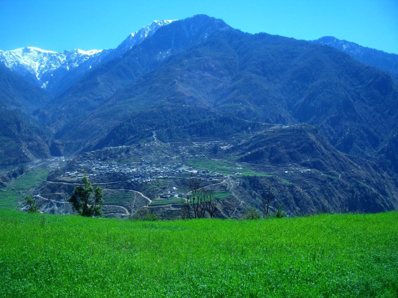
Bajura is a district of the far west that climbs from 300 m to 6,400 m1. Martadi, the district seat, is part of Badimalika Municipality1,2, and the Safebagar-Martadi road serves it3. This page covers the whole district; its neighbours are in the districts hub, including Achham and Bajhang.
Where it is
Bajura is a part of Sudurpashchim Province and one of Nepal’s 77 districts1. It covers 2,188 km2, with Martadi (today part of Badimalika municipality) as its district headquarters1. The district runs from 300 m to 6,400 m in height1. Its Higher Himalayan region comprises the Saipal Himalayan range1.
The 2021 census recorded 138,523 people1, and 55.20% of them lived in municipalities1. The average population density is around 62 people per km21. The district has a literacy rate of 71.24% and a sex ratio of 1065 females per 1000 males1.
Terrain and climate
The district splits into three regions from north to south: a Higher Himalayan region, a high mountain region and the mid-mountains1. The high mountain region comprises Doha Lekh and Ghori Lekh, and the Badimalika Temple sits among the mid-mountain ranges1.
Climate zones by share of the district’s area:
| Zone | Elevation | Share of area |
|---|---|---|
| Subtropical | 1,000 to 2,000 m | 19.7%1 |
| Temperate | 2,000 to 3,000 m | 36.4%1 |
| Subalpine | 3,000 to 4,000 m | 25.2%1 |
| Alpine | 4,000 to 5,000 m | 11.2%1 |
| Nival | above 5,000 m | 6.4%1 |
Temperatures vary from 0 °C to 40 °C1.
Martadi
Martadi is a town and the seat of the Bajura District Coordination Committee, and the headquarters of Badimalika Municipality2. It stands at 2,030 m and had 8,807 people at the 2011 census2. Bajura Multiple Campus, which offers bachelor-level programmes of Tribhuwan University, is in the town2. The town and the area around it fall under the Martadi District Police2.
Badimalika Temple
Badimalika Temple is a Hindu temple in Bajura district, dedicated to Bhagwati, and one of the major temples in Nepal4. It is listed in Triveni Municipality4. Malika Chaturdashi is its major festival4. Two priests serve it, one representing Kalikot district and the other Bajura district4.
The temple’s story ties it to the mountain: the goddess’s left shoulder fell on the Mallagiri mountain, which was then referred to as Malika4. King Dipraj Chhatyal of the Chhatyal dynasty ruled over this sacred land4.
The Nepali Army has completed a new temple at the site, replacing the old dilapidated structure5. The site lies at an altitude of 4,220 metres, and the temple was completed in just over two months despite extreme weather and difficult terrain5. Construction began on 10 April (Chaitra 28, 2081) and concluded on 7 July (Asar 23, 2082)5. The project cost around Rs 20 million (seen October 2026), funded from the Army’s internal resources5.
It was built in accordance with the Ancient Monument Preservation Act, 2013 B.S., from traditional materials including sal wood, stone and mud5. Materials were airlifted from Martadi, the district headquarters, while some were carried on foot from Mana in Badimalika Municipality-55. A homa kunda (ritual fire pit) and a helipad were also built5.
Getting there
The Safebagar-Martadi road serves the district headquarters3. A 33-kV national transmission line from Achham to Martadi supplies electricity to the district3.
By 8 September 2026 rain had triggered landslides at several locations, blocking the road3. Landslides had blocked the road at Karagar Mod, Binod Smriti Pratikshalaya, Selagad and Subakandha in Badimalika Municipality-9 and other locations, and it had been impassable since Saturday night3. Martadi was left cut off from the road network and without electricity for three days3. Patients referred outside Bajura had to be carried on stretchers3.
| Date | Event | Detail |
|---|---|---|
| Reported 8 September 2026 | Safebagar-Martadi road blocked | Landslides at Karagar Mod, Selagad, Subakandha and other points3 |
| Reported 8 September 2026 | Power cut | Around 32 poles of the national transmission line brought down, power out since about 9pm Saturday3 |
The wider picture for the rainy months is in monsoon road closures.
Farming and living conditions
The livelihood of more than 80% of the district population depends on agriculture, mainly small-scale livestock1. Because of low agricultural output, the majority of households face acute food shortages for a large part of the year1.
Read next
Achham: Mangalsen, Sanfebagar and the roads into the district
Achham district guide: Mangalsen headquarters, the paved road from Dhangadhi, the Mid-Hill Highway, Khaptad and what to know before you go.
District guidesBajhang: Chainpur, Saipal and Surma Sarobar
Bajhang district guide: Chainpur headquarters, the Saipal permit, flights and roads in, Surma Sarobar, Saipal Himal and climate by elevation.
District guidesDoti: Dipayal Silgadhi, the Seti Highway and the road to Khaptad
Doti district guide: Dipayal Silgadhi headquarters, the Seti Highway from Amargadhi, Doti Airport, Khaptad park fees and the Doti Kingdom's history.
Questions travellers ask
Is Bajura in Karnali?
No. Bajura is part of Sudurpashchim Province and is one of the 77 districts of Nepal1. Its headquarters, Martadi, is now part of Badimalika municipality1.
In which district does Badimalika lie?
Badimalika Municipality lies in Bajura, and Martadi is its headquarters2. The Badimalika Temple is named among the mid-mountain ranges of the district1.
What is Bajura district famous for?
The Higher Himalayan region of the district comprises the Saipal Himalayan range, and the Badimalika Temple is among its mid-mountain features1. More than 80% of the population depends on agriculture, mainly small-scale livestock1.
How is Bajura reached by road?
Martadi is linked to the road network by the Safebagar-Martadi road3. In September 2026 rain triggered landslides that blocked it at Karagar Mod, Selagad, Subakandha and other points3.
Who built the new Badimalika temple?
The Nepali Army completed a new temple at Badimalika, replacing the old dilapidated structure5. It stands at an altitude of 4,220 metres and was built in just over two months at a cost of around Rs 20 million (cost seen October 2026), funded from the Army's own resources5.
Sources
- Bajura District - Wikipedia · Wikipedia · en.wikipedia.org · checked 19 October 2026
- Martadi - Wikipedia · Wikipedia · en.wikipedia.org · checked 19 October 2026
- Three days without road, power leave Bajura's Martadi cut off · The Himalayan Times · thehimalayantimes.com · checked 19 October 2026
- Badimalika Temple - Wikipedia · Wikipedia · en.wikipedia.org · checked 20 October 2026
- Nepali Army constructs temple at Badimalika pilgrimage site in Bajura · The Himalayan Times · thehimalayantimes.com · checked 20 October 2026
Image credits (1)
- Prabinaidi / Wikimedia Commons · CC BY-SA 4.0 · source

Fees, fares and road conditions change: each note shows the date it was checked. How we check facts · Report an error.