Contents
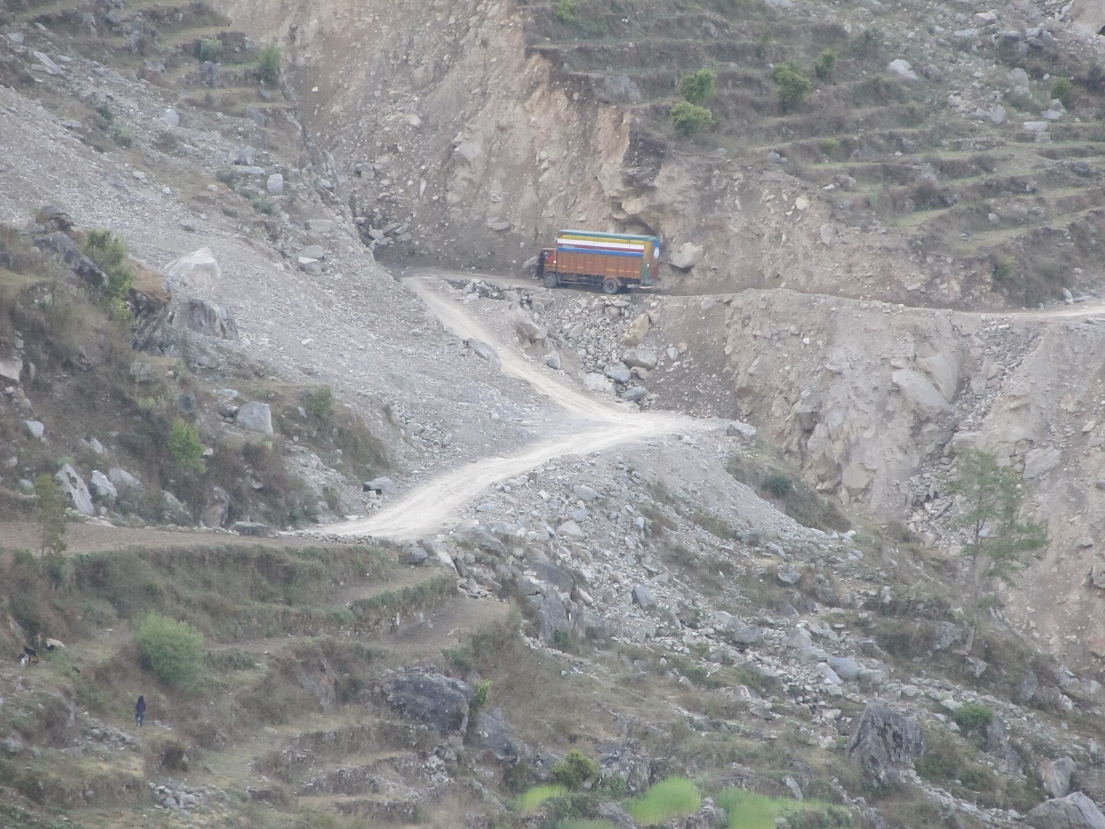
Road closures in west Nepal come in two layers: landslides on the hill road itself, and washouts on the long highways from Kathmandu that feed it. This page keeps a dated record of both. Every closure below carries the date it was reported. The roads are described in Karnali Highway, and the buses that use them in buses and jeeps. The other planning pages are in the getting there hub.
The Nepal Tourism Board’s climate page gives the monsoon as June to September, with 80 percent of all the rain in Nepal falling in it1. The dated reports below fall mostly inside that window.
Karnali Highway: reported closures
The Surkhet to Jumla road passes through Dailekh and Kalikot, and the press reported these closures on it2,5:
| Reported | Where | What the report said |
|---|---|---|
| 17 August 2025 | Gaganekhola and Bihani (Kalikot), Khidki Jyula (Dailekh), near Nagma on the road to Mugu | Landslides blocked the highway; vehicles heading to Surkhet via Kalikot were stranded2 |
| 17 August 2025 | Between Raskot and Pachhal Jharana | Flood left motorcycles and small vehicles unable to cross2 |
| 27 August 2025 | Kalikhola, Kalikot | Surkhet to Jumla section at a standstill after a road collapse5 |
| 1 September 2025 | Gaganekhola, Kalikot | Blocked for a third day; controlled blasting may be required to reopen the road3 |
| July 2026 | Gagane Khola, then Pili and S-Mode (Kalikot) | Highway completely blocked from 7 pm on a Saturday; further landslide and rockfall damage on the Sunday6 |
What authorities told travellers
On 27 August 2025 authorities urged travellers, including tourists heading toward Jumla, to use alternative routes until repairs were completed5. In July 2026 the Jumla Road Division asked passengers and the public not to travel along the blocked section until a notice was issued, and its chief said the risk of landslides, floods and road erosion remained high during the monsoon6.
The July 2026 closure also stranded vehicles loaded with apples for three days on the Jumla-Kalikot-Dailekh section6. The same report quotes an apple trader who lost around Rs 1 million the year before to rain, floods and landslides6.
Long-distance services suspended
In its report of 26 September 2026 the Kathmandu Post said long-distance vehicles in Karnali had been suspended because of the risk of floods, landslides and road blockages4. Provincial police said services to Surkhet, Nepalgunj, Jumla, Humla, Kalikot, Dolpa, Salyan and Rukum had been stopped, while short-distance local services ran depending on road conditions4.
The roads from Kathmandu
The same rains cut the long highways from Kathmandu that feed the far west. On 26 September 2026 the Kathmandu Post reported that the Prithvi Highway, a major road connecting Kathmandu with western Nepal, was affected at several locations4. Other dated reports from September and October 2026:
| Reported | Road | What the report said |
|---|---|---|
| 2 September 2026 | Prithvi Highway, Pataleban | Traffic halted after a three-metre-wide section sank; small vehicles were diverted through the Nagdhunga tunnel12 |
| 18 September 2026 | Prithvi Highway, Jyamire (Dhading) | Obstructed by a landslide13 |
| 25 September 2026 | Prithvi Highway and Narayanghat-Muglin road, Chitwan | Closed until further notice because of landslides and the risk of further incidents7 |
| 25 September 2026 | Prithvi Highway, Dhading | Two sections at Krishnabhir and Tigraang Khola completely blocked7 |
| 26 September 2026 | Mahendra and Prithvi highways, Chitwan | Chitwan administration stopped travel indefinitely4 |
| 29 September 2026 | BP, Prithvi, Kanti, Tribhuvan and Arniko highways | Department of Roads update: reopened, with some sections one-way8 |
| 30 September 2026 | Prithvi Highway, Chambas (Dhading) | A section blocked for five days reopened on the Tuesday evening, then was blocked again by another landslide on the Wednesday14 |
| 10 October 2026 | Lokaha bridge, Mahendra Highway (Narayangadh-Kawasoti) | Traffic halted after part of the ageing structure sagged9 |
| 10 October 2026 | Galaundi, Prithvi Highway | About 100 metres of road cracked and a 20-metre section sank, stopping all vehicle movement9 |
On 25 September 2026 the Mugling to Narayanghat and Pokhara section was reported open, with the Bharatpur road office saying it was at lower risk4. For the long-haul bus and highway route see Kathmandu to the far west by road.
The August 2026 Rasuwa flood
On 26 August 2026 a glacially triggered mass movement in the Rasuwagadhi border region between Nepal and China rapidly became an extreme flash flood and debris flow, according to the World Bank’s Nepal Development Update11. Over 55 km of the 82-km Rasuwa trade corridor was damaged11. As of 26 September 2026 the National Disaster Risk Reduction and Management Authority had counted 1,453 dead and 5,285 missing, with 13,795 rescued, in figures the World Bank cites without a situation-report number11.
After the disruption of 30 August 2026, authorities built a new track at Krishnabhir on the Prithvi Highway, and two-way traffic resumed on 17 September 2026 after 18 days11. Permanent rehabilitation of the highway remained necessary because of continuing river erosion, landslides and road instability11.
The authority’s situation report no. 16 of 17 September 2026 recorded two-way traffic at Krishnabhir from 06:00 that day10. Road subsidence at Shital Bazaar kept traffic to one lane, and the Tribhuvan Highway ran in one lane after landslides near Nagdhunga and Pataleban10. On the Bidur-Betrawati section, 9.2 km of 10 km were clear10.
The pattern
The Karnali Highway was reported blocked in August 2025, September 2025 and July 2026, and Karnali services were suspended in September 20262,3,6,4. The months to aim for are in best time to visit west Nepal.
Read next
Karnali Highway: route, dated closure reports and safety record
Karnali Highway (NH58) from Banke to Hilsa: the route, how it opened, dated landslide and collapse reports from 2025 and the July 2026 accident figures.
Getting thereBuses and jeeps to Jumla and Mugu: the Karnali Highway road
Road transport to Jumla and Mugu: the Karnali Highway, direct buses, fares, journey times, night driving ban and the accident and landslide record.
Getting thereBest time to visit west Nepal: Rara, Khaptad and the Karnali roads by month
When to go to Rara, Khaptad and the Karnali roads: season ranges from the Nepal Tourism Board and operators, the monsoon, winter snow and dated closures.
Questions travellers ask
When do the monsoon road closures happen in west Nepal?
Eighty percent of Nepal's rain falls in the monsoon, June to September1. The closures dated in this page fall in July 2026, August 2025, September 2025 and September 20266,2,3,4.
Were long-distance buses to Jumla and Humla ever stopped?
Yes. In a report of 26 September 2026 the Kathmandu Post said provincial police had stopped long-distance services to Surkhet, Nepalgunj, Jumla, Humla, Kalikot, Dolpa, Salyan and Rukum because of the risk of floods, landslides and blockages4.
What do road authorities advise travellers during the rains?
On 27 August 2025 authorities urged travellers, including tourists heading to Jumla, to use alternative routes until repairs were completed5. In July 2026 the Jumla Road Division said the risk of landslides, floods and road erosion remained high during the monsoon6.
What caused the big landslide in Nepal?
On 26 August 2026 a glacially triggered mass movement in the Rasuwagadhi border region between Nepal and China rapidly became an extreme flash flood and debris flow11. It moved down the Bhote Koshi and Trishuli river systems through Rasuwa, Nuwakot and Dhading11.
How many died in the Nepal mudslide?
As of 26 September 2026 the National Disaster Risk Reduction and Management Authority had counted 1,453 dead after the August 2026 Rasuwa flood and debris flow, as cited by the World Bank11.
How many are still missing in Nepal?
As of 26 September 2026, 5,285 people remained missing and 13,795 had been rescued after the Rasuwa flood, according to the authority's count cited by the World Bank11.
Sources
- Climate in Nepal · Nepal Tourism Board · ntb.gov.np · checked 19 October 2026
- Landslides block Karnali Highway (17 Aug 2025) · The Kathmandu Post · kathmandupost.com · checked 19 October 2026
- Karnali Highway blocked for third day as authorities plan blasting to remove boulders (1 Sep 2025) · The Kathmandu Post · kathmandupost.com · checked 19 October 2026
- Heavy rains cut off key roads to Kathmandu (26 Sep 2026) · The Kathmandu Post · kathmandupost.com · checked 19 October 2026
- Karnali Highway blocked after road collapse in Kalikot (27 Aug 2025) · The Himalayan Times · thehimalayantimes.com · checked 19 October 2026
- Apple traders suffer as Karnali Highway remains blocked (July 2026) · Khabarhub · english.khabarhub.com · checked 19 October 2026
- Major highways hit by landslides as heavy rain persists (25 Sep 2026) · The Kathmandu Post · kathmandupost.com · checked 19 October 2026
- Major highways linking Kathmandu reopen after rain disruptions (29 Sep 2026) · The Kathmandu Post · kathmandupost.com · checked 19 October 2026
- Damaged highways disrupt Dashain travel, airlines prepare late-night flights (10 Oct 2026) · The Kathmandu Post · kathmandupost.com · checked 19 October 2026
- Rasuwa-Bhotekoshi Flood: Search, Rescue and Relief Response Situation Report #16 · National Disaster Risk Reduction and Management Authority · ndrrma.gov.np · checked 19 October 2026
- Nepal Development Update: Building Back Differently After the August 2026 Flood · World Bank · documents1.worldbank.org · checked 19 October 2026
- Prithvi Highway blocked after road collapses near Nagdhunga (2 Sep 2026) · The Kathmandu Post · kathmandupost.com · checked 19 October 2026
- The Prithvi Highway has been obstructed by a landslide in Jyamire, Dhading (18 Sep 2026) · Kantipur · ekantipur.com · checked 19 October 2026
- Another landslide at Dhading's Chambas, Prithvi Highway blocked (30 Sep 2026) · Kantipur · ekantipur.com · checked 19 October 2026
Photos (1)
- Sundar1, CC BY-SA 3.0

Fees, fares and road conditions change: each note shows the date it was checked. How we check facts · Report an error.