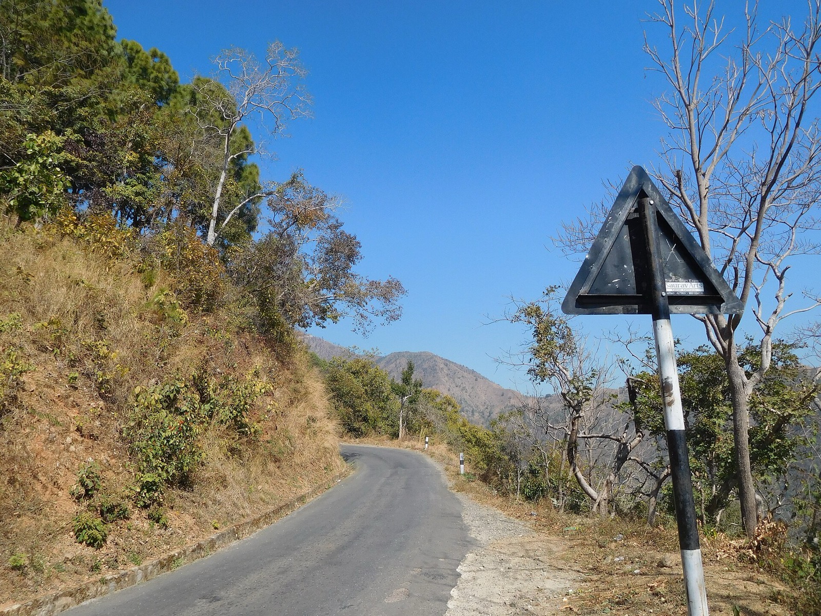
Dailekh is a hilly district of Karnali Province with the Pancha Koshi shrines, the Bhurti stone temple complex and Dullu, the winter capital of the ancient Sinja rulers1,3. This page covers the district; the neighbouring ones are in the districts hub, and the road north has a page of its own at Karnali Highway.
Where it is
The name Dailekh is supposed to derive from Dadhi Lekh: Dadhichi was an ancient sage and lekh means hill, so the name refers to the mountain where he meditated8. A second tale makes it a former abode of the Devatas, called Daibalok and later changed to Dailekh8.
Dailekh is a hilly district in Karnali Province, in mid-western Nepal1. Dailekh is its district headquarters, and the district covers 1,502 km22. It had 225,201 people in 2001 and 252,313 at the 2021 census2. The lowest elevation is 544 m and the highest 4,168 m2.
Gandaki, Karnali and Bhairavi are the major rivers that flow through the district1. Many precious medicinal herbs grow here in abundance, alongside forests filled with rhododendron trees1.
Dailekh was part of the Khasa kingdom during the 12th to 14th century, and its principality was one of the 22 Baise principalities2. The archaeological remains and inscriptions found in the district reveal its connection with the ancient Khasa (Malla) kingdom1.
How to reach Dailekh
The nearest airport is at Surkhet, and a bus from Surkhet reaches Dailekh in about five and a half hours1. The distance is given differently by three sources: the Nepal Tourism Board gives 130.2 km1, Buddha Air 65 km3 and Wikipedia about 70 km2. This page uses the Nepal Tourism Board’s figure. Flights from Kathmandu to Surkhet take around 70 minutes3; see Surkhet for the airport and town.
By road, Dailekh road (F-48) connects Dailekh with Birendranagar, the capital of Karnali Province2. Another road links Dailekh to the Karnali Highway via Dullu2. Kathmandu is 647.41 km from Dailekh by road2; Buddha Air gives 650 km3.
Guranse Bazaar, 20 km west of Surkhet, is a common stop for travellers heading from Surkhet towards Rara3. It has standard hotels on both sides of the highway3, and its cool climate draws visitors from Surkhet and Nepalgunj in summer3.
Restricted-area trekking in Nepal needs a permit from the Department of Immigration in Kathmandu, as set out on the Nepal Tourism Board permit page7.
What to see
Pancha Koshi
The popular Pancha Koshi pilgrimage site is one of the Shakti Peeth shrines1. Shristhan, Navisthan, Paduka and Dharaleshwar fall under it1. A road system links all of the Panchakoshi temples, and jeeps and motorcycles make it possible to see them in a single day3. There are general shops around the temple areas, but food and accommodation are not available3.
Hop Nepal lists paragliding, rafting on the Karnali River, hill climbing and rock climbing among the district’s main attractions8. According to Buddha Air’s July 2023 blog, two of the Pancha Koshi temples have natural gas flames burning from underground, three at Shristan and two at Navisthan3. Buddha Air names the five pilgrimages as Shirasthan, Navisthan, Padukasthan, Dhuleshwar and Kotilasthan3.
Bhurti
The Bhurti complex is a collection of 22 temple monuments built in dry stone masonry, a style unique to the region, according to the Nepal Tourism Board1. The complex lies three kilometres north of Narayan, the district headquarters6. Its 22 shikhara temples were built between the 13th and 15th centuries6. Researchers at Heidelberg University’s South Asia Institute read the temples as memorials rather than as tied to one religion6. The complex entered UNESCO’s World Heritage Tentative List in 20086. It is part of Nepal’s tentative UNESCO World Heritage list1. The 22 stone columns are clustered together and carved with artistic detail3.
Dullu
Ancient Sinja rulers established their summer capital in the Sinja Valley and their winter capital in Dullu, Dailekh3. The fortress of the once-famous Dullu Durbar stands in the heart of Dullu market, and the Dhuleshwar temple and the Jain Tirthankara Mahabir of Paduka temple are both from the 18th century, according to Hop Nepal8. Hop Nepal links the site to castle ruins, stone sculptures, pillars and Nepal’s earliest writing8.
Naumule
Naumule is home to the Dolti hydroelectric powerhouse8.
Mahabu
A 1-hour walk from Bhanjyang leads to the main temple of Mahabu, at 4,100 m3. The same post said a jeep could reach Bhanjyang from Dailekh, with nowhere to eat or sleep there3. On a clear day the hilltop looks out to Kanjirowa and Apishaipal3. Hop Nepal adds that paragliding runs from Mahabu to Gitachaur, and lists the Chamgaat River, Musekhola Waterfall, Taulekhar Cave and Shivalaya Temple among other sights8. On Buddha Air’s account the rhododendrons on the hill turn scarlet in March, and in the monsoon ground flowers bloom while fog covers the hill3. In July 2023 a Buddha Air blog reported that the 44 km road between Dailekh Bazar and Mahabu Bhanjyang was open for visitors, and that the 88 km route from Dailekh to Nagma, towards Kalikot and Jumla, was under construction3.
Chamunda and Bindrasaini
Chamunda is surrounded by forests, hills and farmland, and Hop Nepal lists the Chamundadevi, Bhairav, Purnamala and Debathi temples among its historic monuments, with Jal Cave a popular stop8. On Hop Nepal’s list, Guranshe is known for pure air in summer and snow in winter, with a rhododendron forest and a viewpoint8. Of Bindrasaini, Hop Nepal singles out the Dholak dance performed by local people, and a temple, waterfall and rivers on the way8.
Where to stay
Moderate inns and homestays are available in Dailekh1. On the highway from Surkhet, Buddha Air’s July 2023 blog listed standard hotels at Guranse3. The Panchakoshi temple areas have no food or accommodation3. Guranse is 20 km west of Surkhet and takes its name from the nearby Laliguras forest3. On a clear day Kanjirowa and Apishaipal are visible from it, and the Karnali government funded a viewing tower there3. Travellers going towards Rara from Surkhet make a pit stop there3. Its climate is cool, and young people from Surkhet and Nepalgunj come in summer3.
Dated road reports and safety
The Karnali Highway passes through Dailekh.
| Date | Report | Place |
|---|---|---|
| 17 August 2025 | Landslides blocked the highway; road access to Dailekh was cut off4 | Khidki Jyula, Dailekh4 |
| March 2010 | A crash killed 42 people5 | Kitu, Dailekh5 |
| May 2022 | A Mugu to Nepalgunj bus crashed along the highway, 3 dead and 33 injured5 | Sisnedanda, Aathabis Municipality-2, Dailekh5 |
In July 2026 police identified the stretch between Dahikhola in Dailekh and Galjebazaar in Kalikot as the most dangerous section of the highway5. The highest-risk locations include Dahikhola and Kitubhir in Dailekh5. In the week before the July 2026 report, a passenger minibus from Surkhet to Raskot plunged into the Karnali river at Sangetada in Dailekh5.
For the section beyond Dailekh, see Kalikot and, for the rains, monsoon road closures.
Read next
Surkhet: Birendranagar, gateway to Karnali
Surkhet district guide: Birendranagar, Bulbule Lake, Kankrebihar, the airport, the Ratna and Karnali highways and dated road reports for onward travel.
District guidesKalikot: Manma, the Karnali Highway and its risks
Kalikot district guide: Manma, the Karnali Highway through Kalikot, the dangerous Dahikhola to Galjebazaar stretch and dated road reports from 2025 and 2026.
Getting thereKarnali Highway: route, dated closure reports and safety record
Karnali Highway (NH58) from Banke to Hilsa: the route, how it opened, dated landslide and collapse reports from 2025 and the July 2026 accident figures.
Questions travellers ask
What is Dailekh famous for?
Dailekh is famous for its leather goods, the leather shoes in particular1. Its popular attractions include the Pancha Koshi pilgrimage site, one of the Shakti Peeth shrines, and the Bhurti complex of 22 temple monuments1.
How do I get to Dailekh?
The nearest airport is at Surkhet, and a bus from there reaches Dailekh in about five and a half hours1. Dailekh road (F-48) connects Dailekh with Birendranagar, and the Kathmandu distance is 647.41 km2.
How far is Surkhet airport from Dailekh?
Sources differ: the Nepal Tourism Board gives 130.2 km1, Buddha Air gives 65 km3 and Wikipedia about 70 km2. This page uses the Nepal Tourism Board's 130.2 km1.
What is the Bhurti temple complex in Dailekh?
Bhurti is a group of 22 shikhara temples built between the 13th and 15th centuries, three kilometres north of the district headquarters6. The temples were memorials rather than tied to one religion, and the complex joined UNESCO's World Heritage Tentative List in 20086.
Sources
- Dailekh | Culture, History and Nature · Nepal Tourism Board · ntb.gov.np · checked 19 October 2026
- Dailekh District · Wikipedia · en.wikipedia.org · checked 19 October 2026
- Dailekh: An Open Museum, Rich In Cultural Heritage · Buddha Air · buddhaair.com · checked 19 October 2026
- Landslides block Karnali Highway · The Kathmandu Post · kathmandupost.com · checked 19 October 2026
- Karnali Highway remains province's deadliest road despite millions spent on repairs · The Kathmandu Post · kathmandupost.com · checked 19 October 2026
- Heritage Focus Area: Bhurti Complex · Heidelberg University, South Asia Institute (DANAM) · danam.cats.uni-heidelberg.de · checked 19 October 2026
- Trekking Permit in Nepal · Nepal Tourism Board · ntb.gov.np · checked 19 October 2026
- Dailekh District - Karnali Province · Hop Nepal · hopnepal.com · checked 19 October 2026
Photos (1)
- Janak Poudel, CC BY-SA 4.0

Fees, fares and road conditions change: each note shows the date it was checked. How we check facts · Report an error.