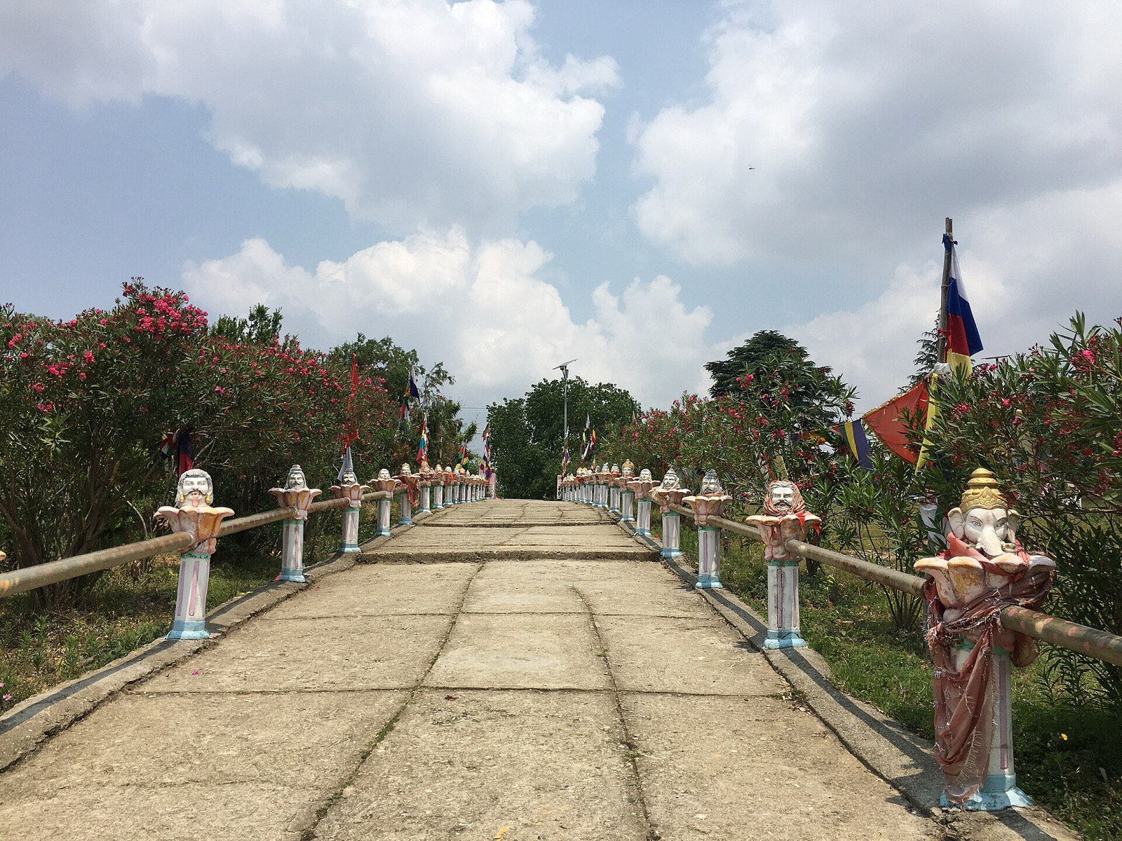
Dadeldhura is a hill district of the far west with its headquarters at Amargadhi, once joined to Doti by the Seti Highway3 and to the other hill districts of the province by the Bhimdatta Highway2. This page covers the whole district; its neighbours are in the districts hub, starting with Doti.
Where it is
Dadeldhura is a part of Sudurpashchim Province and one of Nepal’s 77 districts1. With Dadeldhura as its district headquarters it covers 1,538 km21. The 2021 census recorded 139,602 people, against 142,094 in 20111. It has a literacy rate of 78.19% and a sex ratio of 1119 females per 1000 males1.
The spoken language is Doteli (Dotyali) and the majority of inhabitants are Hindu1: the 2021 census gave Hinduism 98.18% and Buddhism 1.35%1. Dadeldhura is one of the most developed of the hilly districts in the far western region1, and it is the hometown of former prime minister Sher Bahadur Deuba1.
The district consists of seven municipalities, two urban (Amargadhi and Parshuram) and five rural (Aalitaal, Bhageshwar, Navadurga, Ajaymeru and Ganyapadhura)1. In 2021, 42.79% of residents lived in municipalities1.
Amargadhi
Amargadhi is a municipality and the district headquarters of Dadeldhura District in Sudurpashchim Province in western Nepal4. It was named after the Gorkha general Amar Singh Thapa, who fought in the Gurkha War between 1814 and 18164. At the 2011 census it had 21,245 people living in 4,778 households4.
Altitude and climate
Climate data for Dadeldhura is recorded at an elevation of 1,879 m (6,165 ft)1. The highest temperature ever recorded there was 34.3 °C on 20 June 2012, and the lowest was -5.0 °C in January 20081.
| Zone | Elevation | Share of area |
|---|---|---|
| Upper tropical | 300 to 1,000 m | 34.7%1 |
| Subtropical | 1,000 to 2,000 m | 55.8%1 |
| Temperate | 2,000 to 3,000 m | 8.9%1 |
Getting there
The Seti Highway (H15) linked Amargadhi, the district headquarters of Dadeldhura, and Dipayal Silgadhi, the headquarters of Doti3. It was a 66 km road3. In 2021 the Seti Highway merged with NH03, the Pushpalal Highway3. Doti covers the Dipayal Silgadhi end of the road.
The Seti Highway branches off the Mahakali Highway at Amargadhi towards Dipayal Silgadhi4. The Mahakali Highway links Amargadhi to the Terai and to Api Municipality in the Lesser Himalayas4.
In March 2020 the Bhimdatta Highway linked the hill districts of Sudurpashchim Province to Dadeldhura2. The Road Monitoring and Evaluation Office had allocated Rs100 million for expanding it between Syaule and Old Pokhara bazaar, and invited a tender for the 3-km stretch from Syaule to Bagbazaar in Amargadhi Municipality2. Hundreds of permanent houses and huts had been built on land near the highway, and small markets and settlements had grown along the 10-12 km stretch between Syaule and Old Pokhara bazaar2. Traffic jams and road accidents had become more frequent there since the roadside markets were established2.
The Mahakali Highway
The Mahakali Highway (NH66) is 364.93 km long5. It was formerly a 325 km road, numbered H14, from Dhangadhi in Kailali District to Mahakali Municipality in Darchula5. The section from Syaule in Dadeldhura to Satbanj in Darchula was built with US assistance between 1967 and 19855. In October 2026, 234.93 km of the highway had been paved, and around 92 km of dirt track, 31 km of it in Dadeldhura, was yet to be opened5. In October 2026 the extension from Dattu to Tinkar was listed as being built under the Mahakali Corridor Project5.
| Item | Detail | Date |
|---|---|---|
| Road expansion budget, Syaule to Old Pokhara bazaar | Rs100 million | March 20202 |
| Tendered stretch, Syaule to Bagbazaar | 3 km | March 20202 |
What to see
The region has a mountainous landscape that contains many religious temples1.
Ugratara Temple
The temple is dedicated to Goddess Ugratara, another form of Goddess Parvati6. It is considered one of the nine Bhagwati temples in Far West Nepal6. It stands on a hilltop, surrounded by dense forest on three sides, with a grassland in front6.
Ugratara lies about 4 km west of Dadeldhura, in Amargadhi Municipality ward 76. The trip is a 20-25 minute walk, or 8-10 minutes by local vehicle (seen October 2026)6.
A man of the Saud family discovered the idol while ploughing his fields6. The temple was later renovated by Naga Malla, King of Doti, and King Birendra also assisted in a later renovation6. According to locals, Goddess Ugratara is the goddess of fertility and wealth6.
For how the rainy months affect roads across the region, see monsoon road closures.
Read next
Doti: Dipayal Silgadhi, the Seti Highway and the road to Khaptad
Doti district guide: Dipayal Silgadhi headquarters, the Seti Highway from Amargadhi, Doti Airport, Khaptad park fees and the Doti Kingdom's history.
District guidesAchham: Mangalsen, Sanfebagar and the roads into the district
Achham district guide: Mangalsen headquarters, the paved road from Dhangadhi, the Mid-Hill Highway, Khaptad and what to know before you go.
District guidesBajhang: Chainpur, Saipal and Surma Sarobar
Bajhang district guide: Chainpur headquarters, the Saipal permit, flights and roads in, Surma Sarobar, Saipal Himal and climate by elevation.
Questions travellers ask
What is the altitude of Dadeldhura?
The climate data for Dadeldhura is recorded at an elevation of 1,879 m (6,165 ft)1. About 55.8% of the district lies between 1,000 and 2,000 m, and 8.9% between 2,000 and 3,000 m1.
Where is Dadeldhura district situated?
Dadeldhura is a part of Sudurpashchim Province and one of Nepal's 77 districts1. The Seti Highway linked its headquarters, Amargadhi, with Dipayal Silgadhi, the headquarters of Doti3.
What is Dadeldhura famous for?
The region has a mountainous landscape with many religious temples, and it is the hometown of former prime minister Sher Bahadur Deuba1. Ugratara Temple stands about 4 km west of Dadeldhura6.
Sources
- Dadeldhura District - Wikipedia · Wikipedia · en.wikipedia.org · checked 19 October 2026
- Road authorities to clear encroached land along Bhimdatta Highway · Kathmandu Post · kathmandupost.com · checked 19 October 2026
- Seti Highway - Wikipedia · Wikipedia · en.wikipedia.org · checked 19 October 2026
- Amargadhi - Wikipedia · Wikipedia · en.wikipedia.org · checked 20 October 2026
- Mahakali Highway - Wikipedia · Wikipedia · en.wikipedia.org · checked 20 October 2026
- Ugratara Temple: The heart of Dadeldhura · Nepal Traveller · nepaltraveller.com · checked 20 October 2026
Image credits (1)
- Gunjan Raj Giri / Wikimedia Commons · CC BY-SA 4.0 · source

Fees, fares and road conditions change: each note shows the date it was checked. How we check facts · Report an error.