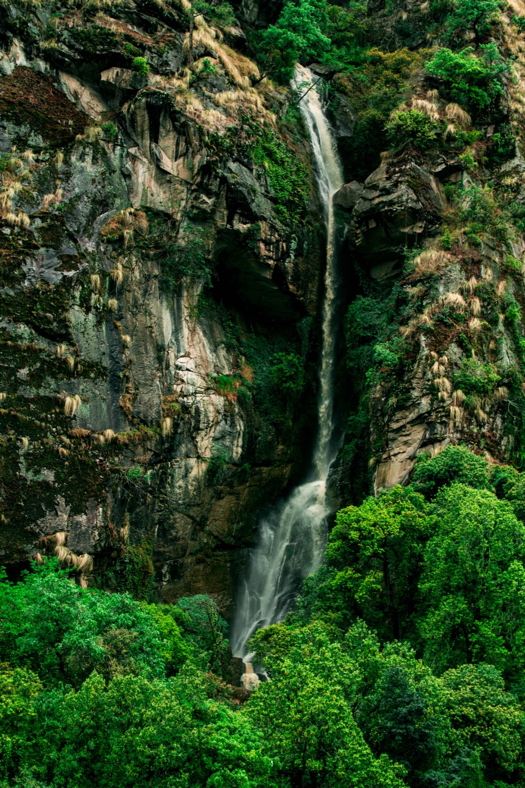
The Karnali Highway connects Kalikot with Surkhet, Jumla and Mugu4. This page covers the district and its dated road reports; the neighbouring districts are in the districts hub, and the whole road has its own Karnali Highway page.
Where it is
Kalikot, a part of Karnali Province, is one of the 77 districts of Nepal1. Its headquarters are at Manma, today part of Khandachakra Municipality, and the district covers 1,741 km21. The district had 105,580 people in 2001 and 136,948 in 2011, and 145,292 at the 2021 census1. The district’s literacy rate is 72.72% and its sex ratio 1,011 females per 1,000 males1. The District Coordination Committee has its office at Manma, Kalikot, Karnali Province5.
Hinduism is practised by 99.79% of the population1. In 2021, 73.24% of people spoke Nepali as their first language and 26.17% Khash, the dialect of Nepali spoken in Karnali Province1.
The district has 9 municipalities, 3 urban and 6 rural1. The urban ones are Khandachakra, Raskot and Tilagufa; the rural ones are Pachaljharana, Sanni Triveni, Narharinath, Shubha Kalika, Mahawai and Palata1.
Raskot and the highway
Raskot is an urban municipality in Kalikot District of Karnali Province6. It covers 59.73 square kilometres, had 16,272 people at the 2011 census and is divided into 9 wards6. It was established on 10 March 2017, when the government announced 744 local-level units, by joining the former Sipkhana, Siuna and Phukot village development committees; its headquarters are at Siuna6.
Manma, the district headquarters, is among the major intersections of the Karnali Highway7.
Getting there
The Karnali Highway directly connects Surkhet, Dailekh, Kalikot, Jumla and Mugu4. The Department of Roads places Kalikot and Jumla straight along the Karnali Corridor8. It is the way into Kalikot from Surkhet, and the way on to Jumla and Mugu. Start points and the Dailekh section are covered under Surkhet and Dailekh.
The road was blacktopped using Otta Seal technology in fiscal year 2019-204. By July 2026 around 80 percent of that blacktopping had peeled away4. Under engineering standards the 232 km journey from Jumla should take about six hours; in July 2026 travellers were often forced to spend up to 24 hours on the road4.
History of the highway
The Karnali Highway (NH58), also called the Karnali Corridor, stretches 505 km from Jamunaha in Banke District to Hilsa in Humla District7. The foundation for the highway was laid in 1992 and the passage was opened only in 20077. Of the 232 km length of the highway linking Jumla with Birendranagar, 17 km were blacktopped in 20107. Heavy monsoon rains in 2010 closed the highway because of landslides, and it reopened on 3 October, three months later7. On 6 July 2025 a Bailey bridge over the Chuwakhola river was inaugurated, connecting Simikot, Humla’s headquarters, to the national road network7. The northern end is covered in the Humla page.
Dated road reports
| Date | Report | Place |
|---|---|---|
| Reported 17 August 2025 | Landslides triggered by rainfall blocked the highway2 | Gaganekhola and Bihani in Kalikot, and near Nagma on the Kalikot-Jumla border2 |
| Reported 17 August 2025 | Flooding in the Phugad river along the Karnali Corridor obstructed traffic2 | Between Raskot and Pachhal Jharana2 |
| Reported 27 August 2025 | A road collapse brought the Surkhet-Jumla section to a standstill3 | Kalikhola, Kalikot3 |
In the 17 August 2025 report, motorcycles and small vehicles could not cross the flood between Raskot and Pachhal Jharana, and vehicles heading to Surkhet via Kalikot were stranded at several locations2. After the collapse reported on 27 August 2025, equipment and manpower were deployed for repairs3. Authorities urged travellers, including tourists heading toward Jumla and the Karnali region, to use alternative routes until the repair work was completed3.
In July 2026 landslides threatened the whole highway and most of the maintenance budget went on dealing with them, with nearly Rs670 million spent on maintenance over the past three fiscal years4. For the monsoon context see monsoon road closures.
Safety
In July 2026 the Karnali Highway accounted for nearly 56 percent of all road accidents recorded across Karnali Province, and 917 people had died in accidents on it since the 2014-15 fiscal year4.
In July 2026 police identified the stretch between Dahikhola in Dailekh and Galjebazaar in Kalikot as the most dangerous section: over the past three years, 98 accidents occurred along it, killing 35 people4. The highest-risk locations included Dahikhola and Kitubhir in Dailekh, and Serabada, Timure, Tadibhir, Bihani and Hulmajite in Kalikot4. In early July 2026 a passenger minibus travelling from Surkhet to Raskot plunged into the Karnali river from the highway at Sangetada in Dailekh4. A bus crash at Bittamod in Serabada, Kalikot, on 7 December 2011 claimed 28 lives4.
In July 2026 police had banned vehicles from operating on the highway at night4. Wider guidance is in landslides and road safety.
Read next
Jumla: Chandannath, the airport and the Karnali Highway
Jumla district guide: Chandannath, Jumla Airport, the Karnali Highway from Surkhet, the history of the Khas kingdom and dated road reports for travellers.
District guidesDailekh: Panchakoshi, Dullu and the road from Surkhet
Dailekh district guide: Pancha Koshi shrines, the Bhurti temple complex, Dullu, Mahabu, how to reach it from Surkhet and dated reports on the Karnali Highway.
Getting thereKarnali Highway: route, dated closure reports and safety record
Karnali Highway (NH58) from Banke to Hilsa: the route, how it opened, dated landslide and collapse reports from 2025 and the July 2026 accident figures.
Questions travellers ask
Which province is Kalikot District located in?
Kalikot is a part of Karnali Province and one of the 77 districts of Nepal1.
What is the capital city of Kalikot District?
Manma is the district headquarters, and is today part of Khandachakra Municipality1. The district covers 1,741 km21.
Is the Karnali Highway safe through Kalikot?
In July 2026 police identified the Dahikhola to Galjebazaar stretch, in Dailekh and Kalikot, as the most dangerous section of the highway, with 98 accidents and 35 deaths over three years4. The highest-risk Kalikot locations include Serabada, Timure, Tadibhir, Bihani and Hulmajite4.
How long does the road from Jumla take?
Under engineering standards the 232 km journey from Jumla should take about six hours, but in July 2026 travellers were often spending up to 24 hours on the road4.
Sources
- Kalikot District · Wikipedia · en.wikipedia.org · checked 19 October 2026
- Landslides block Karnali Highway · The Kathmandu Post · kathmandupost.com · checked 19 October 2026
- Karnali Highway blocked after road collapse in Kalikot · The Himalayan Times · thehimalayantimes.com · checked 19 October 2026
- Karnali Highway remains province's deadliest road despite millions spent on repairs · The Kathmandu Post · kathmandupost.com · checked 19 October 2026
- District Coordination Committee Kalikot (home) · District Coordination Committee Kalikot · dcckalikot.gov.np · checked 20 October 2026
- Raskot - Wikipedia · Wikipedia · en.wikipedia.org · checked 20 October 2026
- Karnali Highway - Wikipedia · Wikipedia · en.wikipedia.org · checked 20 October 2026
- Department of Roads (home page) · Department of Roads · dor.gov.np · checked 19 October 2026
Image credits (1)
- Pradishpaudel / Wikimedia Commons · CC BY-SA 4.0 · source

Fees, fares and road conditions change: each note shows the date it was checked. How we check facts · Report an error.