Contents
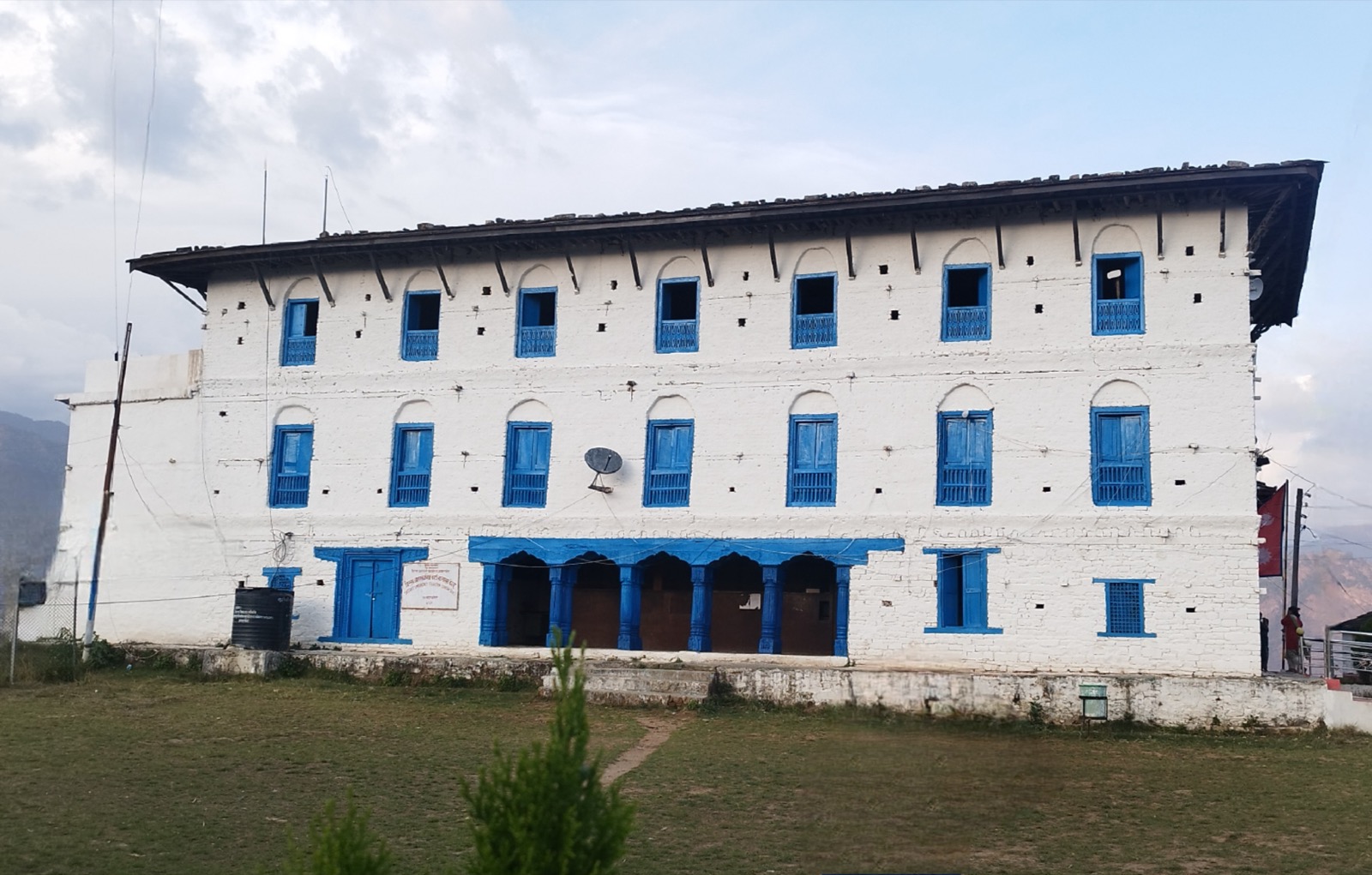
Jajarkot sits in the Bheri River valley, and its travel story is the road: a 118 km link to Dolpa that was still being finished in 20188. Khalanga is the administrative and market centre. The sections below cover where the district is, how to reach it, what to see and what to expect. For the wider region see the districts hub.
Where Jajarkot is
Jajarkot is one of the districts of Karnali Province1. Khalanga is its headquarters1, and the district covers 2,230 km21. It has 3 municipalities and 4 rural municipalities1.
Khalanga sits above the Bheri River valley and serves as the main administrative and market centre for the surrounding hills5. It was incorporated into Bheri Municipality in 20152. At the 1991 census Khalanga had 8140 people living in 1533 households2.
The district had 171,304 people in the 2011 census1. The 2021 census counted 189,360 people, and the CBS Karnali report is the source13. The neighbouring district that holds Chaurjahari Airport is covered in the Western Rukum guide.
Getting there
By air
Chaurjahari Airport (RUK) is a domestic airport serving Western Rukum District, not Jajarkot itself4. It has one runway of 600 metres4. No scheduled services run to and from it now; Nepal Airlines resumed services there in 2018 after several years without4.
The older route into Jajarkot ran through that airport. In 2010 the easier option to the road was a flight from Kathmandu to Nepalganj and then a flight to Chaurjhari7. Jajarkot Bajar was then about three hours’ trek from Chaurjhari7. Treat that as a 2010 route, not a current one.
By road
Road access is limited, and Jajarkot is mainly connected to the outside world through Khalanga and the Bheri River valley5. The Jajarkot-Dunai road links Jajarkot, Rukum and Dolpa districts8.
| Date | Reported status | Source |
|---|---|---|
| January 2018 | Only a 4.2-km section of the 118 km road remained to be finished, cut from hard rock | 8 |
| January 2018 | Only one bridge, Rimna, had been built where six are needed | 8 |
| January 2018 | Vehicles could not easily pass over the road | 8 |
| 15 July 2026 | The Bheri Corridor Project Office invited bids for bridges at 13 locations on the 118 km Jajarkot-Dolpa section | 9 |
The road effort began earlier. In November 2010 the World Bank financed work to connect the district headquarters of Darchula, Bajhang, Kalikot, Jumla, Jajarkot and Rukum to the strategic road network10. The Dolpa page covers the far end of the road, and Surkhet is the regional hub to the south-west.
When to go
HSJ Travel, an operator, lists March, April, October and November as the best time to visit Jajarkot, as seen on 20 October 20265.
What Jajarkot is known for
Jajarkot Durbar is a 250-year-old palace and the district’s major heritage landmark5. Jajarkot also has a palace from the Baise Rajya era that compares to the Malla palaces in Kathmandu (Nepali Times, 2010)7. The Department of Archaeology records the district’s monuments, and its list includes the Jajarkot Palace (NP-JJ-09), a Shiva Temple (NP-JJ-02), the Kalika Temple (NP-JJ-07) and the Jajarkot Darbar Vestiges (NP-JJ-04)3.
Outside the town, a Shiva temple stands in a cave three hours’ walk from Jajarkot bajar7. A cave-associated Shiva temple with a bat population lies several hours from Khalanga6. Ragda Waterfall is a scenic waterfall in the district5. The Bheri River’s turquoise waters cut through steep valleys and suit photography and sightseeing6. Chhedagad Valley offers some of the district’s most picturesque trekking opportunities6.
Permits and fees
The Department of Immigration’s trekking route and permit fee table, seen on 20 October 2026, lists 15 regions, and Jajarkot is not one of them11.
The table ends at Darchula, at USD 90 per person per week11.
Where to stay and health
In 2010, facilities for room and board in Jajarkot were a little rudimentary7.
A 2009 outbreak of diarrhoeal disease in Jajarkot was investigated, and the investigation was published in the Journal of Nepal Health Research Council in October 200912.
Read next
Salyan: Khalanga, Kupinde Lake and the roads from Nepalgunj
Salyan district guide: Khalanga, the bus from Nepalgunj, Kupinde Lake, Chattreswori temple, the best months, population and park-entry rules.
District guidesSurkhet: Birendranagar, gateway to Karnali
Surkhet district guide: Birendranagar, Bulbule Lake, Kankrebihar, the airport, the Ratna and Karnali highways and dated road reports for onward travel.
District guidesDolpa: Dunai, Juphal airport and Phoksundo Lake
Dolpa district guide: Dunai, Juphal airport, the road to Rukum and Jajarkot, Shey Phoksundo National Park, and the Lower and Upper Dolpa permit fees.
Questions travellers ask
What is Jajarkot famous for?
Jajarkot Durbar, a 250-year-old palace and the district's major heritage landmark5. The Department of Archaeology's monuments list also records the Jajarkot Palace (NP-JJ-09), a Kalika Temple (NP-JJ-07) and a Shiva Temple (NP-JJ-02)3.
How far is Jajarkot from Kathmandu?
In 2010 the route was a flight from Kathmandu to Nepalganj, then a flight to Chaurjahari, then about three hours' trek to Jajarkot bajar7. Chaurjahari Airport now has no scheduled services, though Nepal Airlines resumed flights there in 20184.
When is the best time to visit Jajarkot?
March, April, October and November, according to HSJ Travel, an operator, seen on 20 October 20265.
Do you need a trekking permit for Jajarkot?
Jajarkot is not one of the 15 regions in the Department of Immigration's trekking permit table, seen on 20 October 2026; the last row is Darchula at USD 90 per person per week11.
Sources
- Jajarkot District - Wikipedia · Wikipedia · en.wikipedia.org · checked 20 October 2026
- Khalanga, Jajarkot - Wikipedia · Wikipedia · en.wikipedia.org · checked 20 October 2026
- List of monuments in Jajarkot, Nepal - Wikipedia · Wikipedia · en.wikipedia.org · checked 20 October 2026
- Rukum Chaurjahari Airport - Wikipedia · Wikipedia · en.wikipedia.org · checked 20 October 2026
- Jajarkot Nepal - Khalanga, Bheri River Valley · HSJ Travel · hsj.sg · checked 20 October 2026
- Things to Do in Jajarkot · Nepal Traveller · nepaltraveller.com · checked 20 October 2026
- Welcome to Jajarkot (Nepali Times, 2010) · Nepali Times · nepalitimes.com · checked 20 October 2026
- Jajarkot-Dunai road nears completion (Kathmandu Post, 17 Jan 2018) · The Kathmandu Post · kathmandupost.com · checked 20 October 2026
- Tenders invited for construction of 13 concrete bridges in Bheri Corridor (Ekantipur, 15 Jul 2026) · Ekantipur · ekantipur.com · checked 20 October 2026
- World Bank approves additional financing for remote district roads (23 Nov 2010) · World Bank · worldbank.org · checked 20 October 2026
- Trekking Route and Permit Fee · Department of Immigration, Nepal · immigration.gov.np · checked 20 October 2026
- Outbreak Investigation of Diarrheal Disease in jajarkot (Journal of Nepal Health Research Council, Oct 2009) · Nepal Health Research Council · elibrary.nhrc.gov.np · checked 20 October 2026
- Karnali Province census report, National Population and Housing Census 2021 · Central Bureau of Statistics, Nepal · censusnepal.cbs.gov.np · checked 20 October 2026
Image credits (1)
- AviAmt / Wikimedia Commons · CC0 · source

Fees, fares and road conditions change: each note shows the date it was checked. How we check facts · Report an error.