Contents
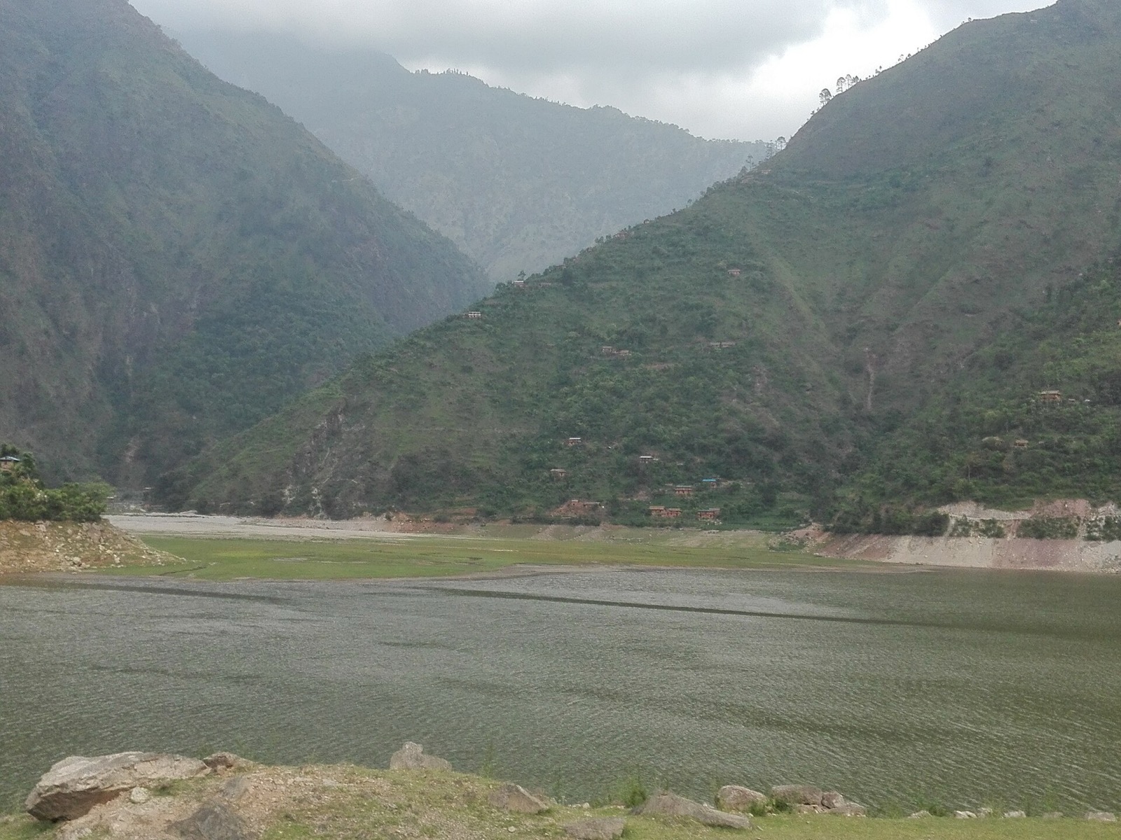
Western Rukum is a hill district with many valleys, and its best-known sight is a lake at 1372 m4. Musikot is the base1. For the wider region see the districts hub.
Where Western Rukum is
Western Rukum is a part of Karnali Province and one of the seventy-seven districts of Nepal1. Musikot is the headquarters1, and the district’s coordination committee names Musikot Bazaar as the seat5. The district sits in the western hill region and is a hill district with many valleys1.
It is bordered by Eastern Rukum and Rolpa to the east, Salyan to the south, Jajarkot to the west and Dolpa to the north1. See Salyan, Jajarkot and Dolpa for those neighbours.
Western Rukum was part of Rukum District before the district divided into Western Rukum and Eastern Rukum1. It covers 1,213.49 km21. It is divided into 3 urban and 3 rural municipalities1: the urban ones are Musikot, Chaurjahari and Aathbiskot, and the rural ones include Banphikot, Triveni and Sani Bheri1.
The district had 154,272 people at the 2011 census1. The 2021 census counted 166,74010.
Getting there
By road
The bus from Dang Tulsipur to Musikot takes about four hours on the Rapti Highway1. From Kathmandu it takes up to 24 hours1. Both times are from Wikipedia, seen in 2026. Western Rukum is considered a remote district, but transport has expanded rapidly, and bus and jeep services link it to the plains and Kathmandu1.
The Rapti Highway was under construction as of 2010 to connect Musikot to Salyan Khalanga1. The district page also lists the Mid-Hill Highway as under construction, without a date1. In November 2010 the World Bank approved financing to connect the district headquarters of Darchula, Bajhang, Kalikot, Jumla, Jajarkot and Rukum to the strategic road network7.
By air
Two airports offer safe but rudimentary facilities for passenger flights, mainly from Nepalganj and Kathmandu1. The flight from Kathmandu to Rukum Salle airport takes about 90 minutes, and from Nepalganj about 20 minutes1.
Chaurjahari Airport (RUK) is a domestic airport serving Western Rukum2. It started operations on 24 September 1973 and has one runway of 600 metres2. Nepal Airlines resumed services from it in 20182. No scheduled services run to and from Chaurjahari now; the date of that change is not given2. Older text on the district page records the airport as accessible by footpaths and horse trails only1.
Syarpu Lake
Syarpu Lake is in Rukum district of western Nepal at an altitude of 1372 m4. It drains to the Bheri River4. The Nepal Army built an observation tower there to promote tourism, at a cost of NPR 500,0004. The lake is used for high-altitude fish farming4.
Rising Nepal called Syarpu Lake a main tourist destination of Rukum (West) on 27 July 20248. The lake fills a green fold of the Rukum hills at about 1,370 metres9.
| Item | Figure | Source |
|---|---|---|
| Altitude | 1372 m (Wikipedia); about 1,370 metres (AroundTrail) | 4,9 |
| Road from Musikot | A 20-kilometre motorable road (Rising Nepal, 27 July 2024) | 8 |
| Road distance from Musikot | About 35 kilometres by road (AroundTrail) | 9 |
| On foot from Musikot | About three hours (Rising Nepal, 27 July 2024) | 8 |
The two road figures differ: 20 kilometres (Rising Nepal, 27 July 2024) against about 35 (AroundTrail, undated)8,9.
In town, the district coordination committee lists the Digre Shaikumari temple, a famous temple in Musikot Municipality ward 55.
When to go
The lake is full from July to October and slowly decreases in winter (Rising Nepal, 27 July 2024)8. Its shape is different in the rainy and winter seasons, and it is filled with blue waters in the rainy season8. AroundTrail names autumn the best season9.
Rara Lake is not in Rukum West
Rara Lake is the largest freshwater lake in the Nepalese Himalayas, at a surface elevation of 2,990 m, and a Ramsar wetland designated on 23 September 20073. It is the main feature of Rara National Park, located in Jumla and Mugu districts of Karnali Province3. For the lake, read Mugu and Rara Lake by road.
Permits
The Department of Immigration’s trekking route and permit fee table, seen on 20 October 2026, lists 15 regions, and Western Rukum is not one of them6.
Read next
Salyan: Khalanga, Kupinde Lake and the roads from Nepalgunj
Salyan district guide: Khalanga, the bus from Nepalgunj, Kupinde Lake, Chattreswori temple, the best months, population and park-entry rules.
District guidesSurkhet: Birendranagar, gateway to Karnali
Surkhet district guide: Birendranagar, Bulbule Lake, Kankrebihar, the airport, the Ratna and Karnali highways and dated road reports for onward travel.
District guidesDolpa: Dunai, Juphal airport and Phoksundo Lake
Dolpa district guide: Dunai, Juphal airport, the road to Rukum and Jajarkot, Shey Phoksundo National Park, and the Lower and Upper Dolpa permit fees.
Questions travellers ask
What is Rukum West famous for?
Syarpu Lake, which Rising Nepal called a main tourist destination of Rukum (West) on 27 July 20248. The lake lies at 1372 m and drains to the Bheri River4. The district's DCC also lists the Digre Shaikumari temple in Musikot ward 55.
Which zone is Rukum West?
Western Rukum is part of Karnali Province and one of the seventy-seven districts of Nepal1. It was part of Rukum District before that district divided into Western Rukum and Eastern Rukum1.
Where is Rukum located?
Western Rukum lies in the western hill region of Nepal, in Karnali Province1. Eastern Rukum and Rolpa border it to the east, Salyan to the south, Jajarkot to the west and Dolpa to the north1.
Sources
- Western Rukum District - Wikipedia · Wikipedia · en.wikipedia.org · checked 20 October 2026
- Rukum Chaurjahari Airport - Wikipedia · Wikipedia · en.wikipedia.org · checked 20 October 2026
- Rara Lake - Wikipedia · Wikipedia · en.wikipedia.org · checked 20 October 2026
- Syarpu lake - Wikipedia · Wikipedia · en.wikipedia.org · checked 20 October 2026
- DCC Rukum (West) - homepage (Nepali) · District Coordination Committee, Rukum West · dccrukumwest.gov.np · checked 20 October 2026
- Trekking Route and Permit Fee · Department of Immigration, Nepal · immigration.gov.np · checked 20 October 2026
- World Bank approves additional financing for remote district roads (23 Nov 2010) · World Bank · worldbank.org · checked 20 October 2026
- Syarpu Lake waiting for its gazers (Rising Nepal, 27 Jul 2024) · Rising Nepal · risingnepaldaily.com · checked 20 October 2026
- Syarpu Lake, Nepal - AroundTrail · AroundTrail · aroundtrail.com · checked 20 October 2026
- Karnali Province census report, National Population and Housing Census 2021 · Central Bureau of Statistics, Nepal · censusnepal.cbs.gov.np · checked 20 October 2026
Image credits (1)
- Gokarna Prasad Joshi / Wikimedia Commons · CC BY-SA 4.0 · source

Fees, fares and road conditions change: each note shows the date it was checked. How we check facts · Report an error.