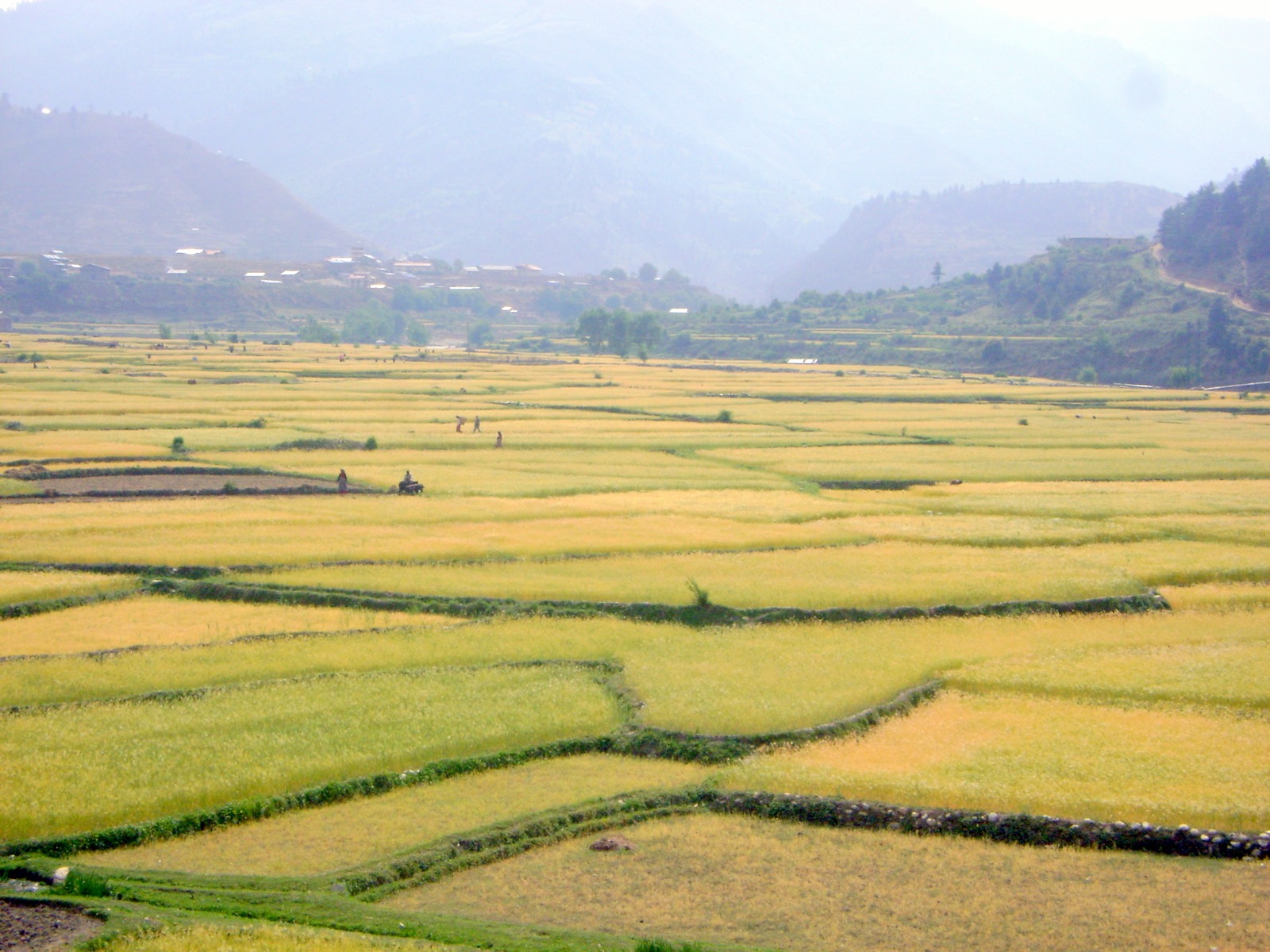
Jumla is the district where Nepali as a language began. It is reached by air or by the Karnali Highway from Surkhet. This page covers the district; the neighbouring ones are in the districts hub, and the walk to the lake is on the Jumla to Rara trek page.
Where it is
Jumla is one of the ten districts of Karnali Province and one of the seventy-seven districts of Nepal1. Its headquarters are in Chandannath municipality, and it covers 2,531 km21. In 2021 the district had 118,349 inhabitants1, up from 108,921 in 20111.
The terrain is Himalayan and mountainous, with elevations from 915 m to 4,679 m1. The Higher Himalayan Region consists of the Patarasi and Kanjirowa ranges, and the major rivers are the Hima, the Tila and the Jawa1.
Jumla is divided into 1 urban municipality, Chandannath, and 7 rural municipalities: Kankasundari, Sinja, Hima, Tila, Guthichaur, Tatopani and Patarasi1. The 2021 census found Chhetris to be a majority at 60% of the population, and 97.30% of people Hindu, 1.45% Buddhist and 1.16% Christian1.
History
The Nepali language, then known as Khas, originated in the Sinja Valley, and Sinja was the capital of the Khas Kingdom1. Jumla was part of the Khasa kingdom from the 11th to the 13th century1.
After the 13th century the kingdom divided into the 22 Baise principalities of the Karnali-Bheri region, and the Kingdom of Jumla was one of them1. It was founded around 1404 and became one of the most powerful kingdoms in western Nepal1. It took the kingdom of Mustang in 17601. Kaji Shiva Narayan Khatri led the Gorkhali troops that annexed Jumla for the Gorkha kings in 17891.
Sinja Valley
The Sinja Valley, in Jumla District, was the ancient capital city of the Khasa Kingdom and is considered a historically significant place5. Excavations led by the Department of Archaeology at Cambridge University uncovered palaces, temples and the remains of a settlement5. Major finds include a large network of underground pipes that formed a complex water delivery system and a ring of massive monolithic stone columns circumscribing the settlement5.
On the cliffs at the valley edge were found some of the earliest written examples of the Nepali language, and the earliest examples of the Devanagari script, from the 13th century, were found on the cliffs and in nearby Dullu5. Across the Hima River there are caves with ancient votive Buddhist chaityas and cliff inscriptions, and the rites of the Masto (shamans) are still practised in many of the stone dewals, or temples5. The valley was added to the UNESCO World Heritage Tentative List on 30 January 2008, in the Cultural category5.
Chandannath Temple
Chandannath Temple (चन्दननाथ मन्दिर) is a Hindu temple in Khalanga Bazar of Chandannath Municipality, at an elevation of 2,514 m6. It was built during the Kallala Dynasty; few written documents on the dynasty or the temple survive, and the events and lore have been passed on orally for generations6.
People believe that Chandannath, a man from Kashmir, brought the statue of Dattatreya (Trimurti) and kept it where the temple stands6. He is also believed to have first introduced brown rice to Jumla6. Some local people tell another story: a cow that gave its owner no milk let milk drop from its teats when it stood above the place where the temple now stands, and the villagers took the spot as sacred and built the temple there6.
Local people change the temple’s lingo every year6. The lingo is a timber of approximately more than 52 feet, coloured brick red with a huge cloth stitched around it, so that it looks like a triangular flag6. The replacement ceremony is held during Ghatasthapana, the first day of Dashain, when the temple is crowded with devotees; large crowds also come for Krishna Janmashtami and Maha Shivaratri6.
Getting there
By air
Jumla Airport (IATA JUM, ICAO VNJL) is a domestic airport serving the district2. It stands at 7,700 ft (2,347 m) above sea level and has one asphalt runway measuring 670 by 25 m2. In October 2026 Nepal Airlines, Sita Air, Summit Air and Tara Air were listed flying to Jumla from Nepalgunj, and Summit Air also from Birendranagar2. Operators and routes are covered in flights to Jumla.
On 18 January 1999 a Necon Air Cessna 208 Caravan stalled and crashed after take-off, and 4 passengers and 1 crew member of the 10 passengers and 2 crew died2.
By road
The Karnali Highway has a Surkhet to Jumla section4. Two dated road reports from August 2025 follow.
| Date | Report | Place |
|---|---|---|
| Reported 17 August 2025 | Landslides triggered by continuous rainfall blocked the highway3 | Gaganekhola and Bihani in Kalikot, Khidki Jyula in Dailekh, near Nagma on the Kalikot-Jumla border3 |
| Reported 27 August 2025 | A road collapse brought the Surkhet-Jumla section to a standstill4 | Kalikhola, Kalikot4 |
After the blockages reported on 17 August 2025 earthmovers were deployed to clear the landslides, and vehicles heading to Surkhet via Kalikot were stranded at several points3. After the collapse reported on 27 August 2025 equipment and manpower were deployed for repair, and authorities urged travellers, including tourists heading toward Jumla and the Karnali region, to use alternative routes until repairs were completed4.
More on the highway is in the Karnali Highway page, on the rains in monsoon road closures, and on the Surkhet end in Surkhet. The section through Kalikot is where both 2025 reports place the blockages3,4.
Onward to Mugu
In August 2025 the road near Nagma, on the Kalikot-Jumla border, was the road to Mugu3. For Rara Lake and the district beyond, see Mugu.
Safety
By 17 August 2025 landslides had blocked the Karnali Highway, and by 27 August 2025 a road collapse had stopped its Surkhet to Jumla section3,4.
The airport is at 2,347 m2 and the district climbs to 4,679 m1.
Read next
Flights to Jumla: Nepalgunj and Surkhet schedules and airport facts
Flights to Jumla from Nepalgunj and Surkhet: the Nepal Airlines October 2026 timetable, other operators, Jumla Airport facts and past incidents.
TreksJumla to Rara trek: days, route, season, permits and cost
Jumla to Rara Lake on foot: how many days it takes, a stage table from an operator itinerary, the season, park and permit fees and what trips cost.
Getting thereKarnali Highway: route, dated closure reports and safety record
Karnali Highway (NH58) from Banke to Hilsa: the route, how it opened, dated landslide and collapse reports from 2025 and the July 2026 accident figures.
Questions travellers ask
What is Jumla famous for?
Jumla is where the Nepali language, then known as Khas, originated in the Sinja Valley1. It was also the seat of the Jumla Kingdom, founded around 1404 and one of the most powerful in western Nepal1.
How do I get to Jumla?
Jumla Airport serves the district, and Nepal Airlines, Sita Air, Summit Air and Tara Air are listed as flying from Nepalgunj, with Summit Air also from Birendranagar2. By road the Karnali Highway has a Surkhet to Jumla section4; vehicles heading to Surkhet go via Kalikot3.
Sources
- Jumla District · Wikipedia · en.wikipedia.org · checked 19 October 2026
- Jumla Airport · Wikipedia · en.wikipedia.org · checked 19 October 2026
- Landslides block Karnali Highway · The Kathmandu Post · kathmandupost.com · checked 19 October 2026
- Karnali Highway blocked after road collapse in Kalikot · The Himalayan Times · thehimalayantimes.com · checked 19 October 2026
- Sinja Valley - Wikipedia · Wikipedia · en.wikipedia.org · checked 20 October 2026
- Chandannath Temple - Wikipedia · Wikipedia · en.wikipedia.org · checked 20 October 2026
Image credits (1)
- Prashant Shahi / Wikimedia Commons · CC BY-SA 4.0 · source

Fees, fares and road conditions change: each note shows the date it was checked. How we check facts · Report an error.